Popular
-

 Kestrel 5400 Heat Stress Trackers
 -

 Iridium 9555 Rp0 + PPN 11%
 -
 HOBO Optic USB Base Station
 -
 Topcon Dual Charger CDC77 Rp0 + PPN 11%
 -
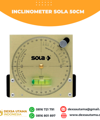 Inclinometer Sola 50cm


SatLab Eyr GNSS
Equipped with dual cameras, the Eyr features image measurement and visual stakeout, which not only provide a wide range of contact-free measurement solutions but also make stakeout operations intuitive and simple. The design of the RTK is aesthetic but practical, and the pocket-sized and lightweight body makes it portable and versatile.
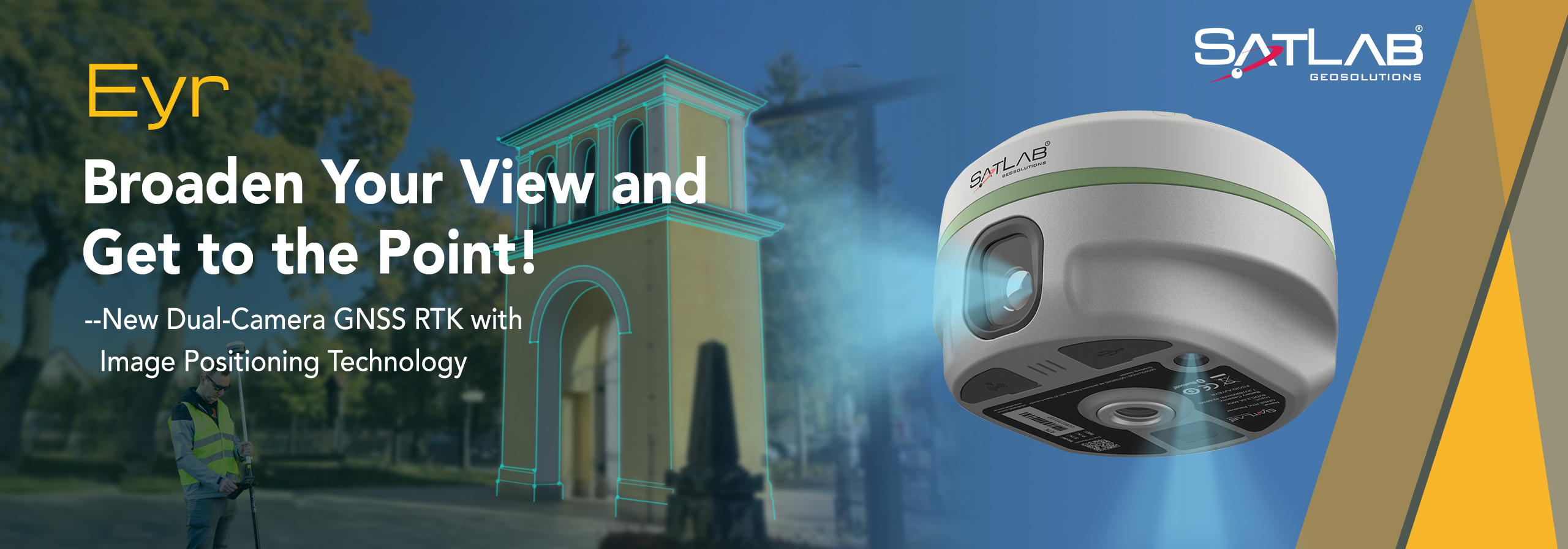
Stronger Tracking Satellites and Greater Anti-jamming Capability
The Eyr is equipped with SatLab’s unique product design and self-developed antenna for more stable and efficient operation. Meanwhile, a highly integrated motherboard chip with low power consumption, which supports up to 1408/1760 channels and an advanced SoC platform, is also the core feature of Eyr.
The excellent hardware configuration efficiently suppresses the interference signals and obtains higher quality observation data from satellite constellations are the advantages of the chip.
Multi-protocol Transceiver Built-in Radio
The built-in multi-protocol radio transmits and receives differential data that is compatible with multiple brands of RTK radio data links.
The self-developed radio module enables the Eyr to not only perform well in a typical operating range of 7km outdoors but even better in ideal working conditions.
HD Dual-camera for Easy Visualizing Building Elevation Survey and Quick Stakeout
Based on the high-performance image processing technology on the Android system, the 5-megapixel rearview camera, combined with the controller, captures precise coordinates in real time, in a range of 2-15 metres and with an accuracy of 2-4 cm.
The 2MP camera beneath enables AR live-view stakeout with an accuracy of 2cm, saving time and effort in reaching the stakeout point. Undoubtedly, the new image survey function enables non-contact measurements, greatly improving the usable range of GNSS for efficient and safe operation.
Software Support
The SatLab Satsurv is the best companion for the Eyr GNSS receiver. The professional field surveying software is functional and easy to use, thus promoting the performance of the Eyr further.
SGS is a versatile desktop software for the post-processing of measurement data, satisfying users’ needs in addressing a wide range of data post-processing.
Moreover, the image data results type obtained with Eyr is compatible with mainstream third-party 3D modelling softwares like ContextCapture, DPSmart, and Pix4D.
The 3D modelling feature makes Eyr a perfect partner for collaborative UAV operations.
Brosure
Hanya pelanggan yang sudah login dan telah membeli produk ini yang dapat memberikan ulasan.
Produk Terkait

GPS Geodetik RTK Comnav Sino Jupiter Laser
Baca selengkapnyaChannel 1668 Satellites tracking GPS: L1C/A, L1C, L2P, L2C, L5 BDS: B1l, B2l, B3l, B1C, B2a, B2b GLONASS: L1, L2, L3 Galileo: E1, E5a, E5b, E6c, E5 AItBOC QZSS: L1C/A, L2C, L5, L1C IRNSS: L5 SBAS: L1C/A PPP: B2b & HAS L-Band Signal Re-acquisition ≤1s Cold Start ≤30s Hot start ≤10s RTK Initialization Time <5s(Baseline≤10km) …

GPS SINGULAR XYZ X1
Baca selengkapnyaThe SingularXYZ X1 GNSS Receiver is a lightweight, ultra-compact RTK receiver designed for demanding field conditions. Offering full satellite tracking, tilt compensation, and a long-lasting battery, it delivers consistent high-precision results in any environment.


Produk
-
 Rite in the Rain 295
 -
 Tribrach With Adafter Optical Plummet Topcon Rp0 + PPN 11%
 -
 Sokkia Single Prisma/ Prisma Detils. Rp0 + PPN 11%
 -
 TERSUS OSCAR TREX GNSS Rp0 + PPN 11%
 -
 Leica GMP104 Mini Prisma Rp0 + PPN 11%
 -
 Water Level Body Besi B/150
 -
 Topcon OTS102N Rp0 + PPN 11%
Ulasan
Belum ada ulasan.