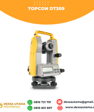
Category
- Uncategorized
- Accessories GPS Geodetik
- Accessories Lain
- Accessories Survey
- Alat Curah Hujan
- Anemometer
- Anemometer Kestrel
- Automatic Digital Level
- Automatic Level
- Borescope Endoscope
- Bushnell H2O
- Bushnell Lainnya
- Bushnell Powerview
- Bushnell Powerview 2
- Detektor Petir
- Digipas Digital Level
- Drone
- Dulang
- Echo Sounder
- Global Water
- GPS Furuno
- GPS Garmin
- GPS Geodetik
- GPS Trimble
- Hammer Test & Profometer
- Hardness Tester
- Humidity / Temp
- Kabel Locator
- Kaca Pembesar / Loupe
- Kamera Trap
- Kompas & Altimeter
- Laser level / Crossline Laser
- Leica Disto Meter
- LiDAR Laser Scanner
- Meteran
- Nikon Action EX
- Nikon Aculon
- Nikon Monarch
- Palu Geologi
- Photometer
- Planimeter
- Radar Gun
- Rangefinder
- Rite in the Rain
- Rotating Laser level
- Sampel Bags Kain Plastik
- Software
- Spotting Scopes
- Tachometer
- Telepon Satelit
- Tension Meter
- Teropong Malam/Night Vision
- Teropong Marine
- Theodolite & Laser Plummet
- Total Station
- Total Station Robotic
- USV
- Water Level Meters
- Weather Station

Versatile Performance
Better things in smaller packages!
The HiPer VR* is compact, light and packed with the most advanced GNSS technology in a design built to withstand the harshest field environments. Using Topcon’s advanced GNSS chipset with Universal Tracking Channels Technology, the HiPer VR automatically tracks every satellite signal above – now and into the future.
All signals, all satellites and all constellations — in a compact, rugged design, with an integrated IMU and eCompass.
The HiPer VR is a complete solution and versatile in many ways. It can be used for static or kinematic GNSS post-processed surveys, as a network RTK rover with the FC-5000’s internal 4G/LTE cellular modem, as a UHF/FH/Longlink jobsite RTK rover, and also in Topcon’s patented Hybrid Positioning workflow.
Top features include:
- Universal tracking technology for all satellites and constellations (GPS, GLONASS, Galileo, Beidou, IRNSS, QZSS, SBAS) covering all modernized signals
- Field tested, field ready IP67 design
- Compact form factor ideal for Millimeter GPS and Hybrid Positioning
- Revolutionary 9-axis IMU and ultra-compact 3-axis eCompass
- Integrated 400 MHz UHF Tx/Rx Radio Modem
- Integrated License free 900 MHz Radio Modem, FH915 protocol
| Berat | 40 kg |
|---|
Specifications
L1 C/A, L1C* L2C, L2P(Y), L5
L1 C/A, L1P, L2C/A, L2P, L3C*
E1/E5a/E5b/Alt-BOC
B1, B2
L5
WAAS, EGNOS, MSAS, GAGAN (L1/L5§)
TopNET Global D & C Corrections services
L1 C/A, L1C, L1-SAIF, L2C, L5
V: 5 mm + 0.5 ppm
V: 10 mm + 0.8 ppm
Tilt ≤ 10°
H: 1.8 mm/°Tilt;
Tilt > 10°
TX mode 1W – 6hr
Max Transmit Power: 1W
Range: 5-7 km typical; 15 km
(w x h x d)
Brosur
Kelengkapan
1x Base
1x Rover
2x OAF, GLONASS L1 L2 Tracking
2x Antenna UHF 425-470 Male BNC
2x Hard Carry Case
1x Bipod
1x Data Kontroller FC-500
1x Bracket for Data Kontroller –
1x Pole Carbon
1x Software Post Procces
1x Tribrach with Adapter –
1x Tripod
Hanya pelanggan yang sudah login dan telah membeli produk ini yang dapat memberikan ulasan.
Produk Terkait
ESurvey E800
Baca selengkapnyaHigh-performance RTK Receiver
The E800 is a high-performance GNSS receiver that provides an easy-to-use solution for survey professionals who need to collect highly accurate data in a wide range of applications. The durable IP67 design makes it possible to work in extreme environments. The colorful touchscreen is convenient for quick configurations.
GPS CHCNAV i89
Baca selengkapnyaThe i89 is a compact yet powerful surveying tool with a 1408-channel GNSS module that enhances RTK performance in challenging conditions. Its advanced ionospheric modeling ensures reliable RTK fixes, even during high solar activity. With 16.5 hours of battery life and a lightweight 750 g design, the i89 delivers efficiency and ease for daily surveying tasks.
GPS Emlid Reach RX
Baca selengkapnyaReach RX adalah rover RTK yang dirancang untuk bekerja dengan layanan NTRIP atau basis tunggal.
- Mudah digunakan
- Kompak, ringan dan kokoh
- Baterai yang andal hingga 16 jam kerja
- Menghasilkan data yang akurat
- Pilihan optimal untuk survei di area cakupan sel dan NTRIP yang baik
GPS GINTEC G40
Baca selengkapnyaWith 1408 channels, the G40 enhances fixed performance by an outstanding 20% even in obstructed environments. Upgraded with our GINTEC 5 satellites + 21 frequencies solution engine, the chip’s computational power is boosted by 40%, enabling precise calculations using a wider range of satellite frequencies.
Controller Alpha GEO S60III Android
Baca selengkapnyaController Alpha GEO S60III : Solusi Handheld Tangguh untuk Surveyor Profesional Dalam dunia pengukuran dan pemetaan, keandalan perangkat adalah kunci utama untuk mendapatkan hasil yang presisi. S60III hadir sebagai data collector terbaru yang dirancang khusus untuk memenuhi kebutuhan surveyor dan profesional pemetaan. Dengan prosesor industri terbaru dari Qualcomm dan berbagai fitur unggulan, S60III siap memberikan …
GPS SINGULAR XYZ X1
Baca selengkapnyaThe SingularXYZ X1 GNSS Receiver is a lightweight, ultra-compact RTK receiver designed for demanding field conditions. Offering full satellite tracking, tilt compensation, and a long-lasting battery, it delivers consistent high-precision results in any environment.
SatLab SL900 GNSS
Baca selengkapnyaThe SatLab GNSS receiver is a high-precision that performs even under the most demanding conditions. With this GNSS receiver, it is capable of delivering highly accurate GPS data in real-time to any device via a Bluetooth connection. Satellite correction service, compact and lightweight, this rtk GNSS is one of the most flexible solutions that promise positioning reliability.
CHCNAV DL8 Radio External
Baca selengkapnyaThe DL8 UHF radio modem provides reliable base-to-rover GNSS RTK corrections over long distances. Designed for harsh environments, it supports up to 28 W of adjustable output power, ensuring robust communication even in challenging conditions. With customizable frequency channels and a rugged IP67-rated enclosure, the DL8 is an essential tool for surveyors requiring dependable and high-performance data links.
GPS GINTEC G40+
Baca selengkapnyaG40Plus is the latest masterpiece of the Gintec team in 2024, a super RTK (Real-Time Kinematic) system that focuses on high-performance radio communication. G40Plus not only inherits all the advantages of the G40 base unit but also expands the power and range of the radio communication. It can cover a maximum distance of 20km, and in urban areas, it has been tested to reach nearly 14km. It boasts an exceptional battery life, with a continuous working time of up to 8-10 hours in the 5W power base station mode. It features an upgraded night vision starlight camera that can operate effectively in low-light conditions…
There are more features waiting for you to explore!GPS EFIX C8
Baca selengkapnyaThe EFIX C8 is a groundbreaking surveying RTK that seamlessly combines state-of-the-art vision, GNSS and IMU technologies. By integrating a powerful vision system, the C8 revolutionizes surveying workflows, streamlining operations, and delivering superior results in every surveying project. This integration empowers surveyors to tackle complex surveying tasks with unprecedented accuracy and ease. The real-time visual feedback provided by the vision system enables accurate stakeout, eliminating the need for complicated offset methods. Surveyors can efficiently measure previously inaccessible points and streamline their surveying workflow, increasing overall productivity. With the EFIX C8, surveyors can enhance their surveying capabilities and achieve superior results on every project they undertake.
SatLab Eyr GNSS
Baca selengkapnyaEquipped with dual cameras, the Eyr features image measurement and visual stakeout, which not only provide a wide range of contact-free measurement solutions but also make stakeout operations intuitive and simple. The design of the RTK is aesthetic but practical, and the pocket-sized and lightweight body makes it portable and versatile.
CHCNAV HCE600
Baca selengkapnyaThe HCE600 is a lightweight, professional Android data collector designed for field surveying and mapping. With a 5.5-inch DragonTrail™ display, it offers exceptional durability and clear visibility in sunlight. Packed with Bluetooth 5.0, dual-band Wi-Fi, and a 4G modem, it ensures seamless connectivity with GNSS receivers and RTK networks. Certified to IP67 and MIL-STD-810H standards, the HCE600 is built to withstand harsh environments, making it the ideal handheld controller for reliable data collection in any conditions
GPS Geodetik RTK Comnav Sino T300
Baca selengkapnyaSince its debut in 2013, the T300 has not only maintained its iconic design, but has also consistently evolved to stay at the forefront of GNSS technology.- GPS L1/L2/L5, BeiDou B1/B2/B3/B1C/B2a/B2b, GLONASS L1/L2/L3, Galileo E1/E5a/E5b/E6/AltBOC, QZSS L1/L2/L5, Navic L5, SBAS
- Compact Design
- Hot Swap Battery
- User-friendly Interface
- Support WIFI/UHF/4G
- Web server for easy configuration
GPS Sanding T9
Baca selengkapnyaMore information Distinguishable features MDS Internal radio adopts TRIMTALK protocol which enables T9 to work with other receives with same protocol. Power Operating power: min. [V] 7.4 Operating power: max. [V] 7.4 Typical consumption [W] 2 Internal power supply Removable 7.4V, 2500mAh Li-on battery External power supply 12-15V DC Operating time with internal power supply …
GPS TOKNAV T10 PRO
Rp0 + PPN 11%Tambah ke keranjangCharacteristic Linux Intelligent System Qualcomm Cortex-A7 + Linux, the intelligent system platform, brings efficient computing and unlimited expansion of product functions to users. Multi Constellation With its 1408 channels, T10Pro provides an excellent on board real time navigation solution with high accuracy. All GNSS signals (GPS, GLONASS, BDS, GALILEO, QZSS, SBAS and IRNSS) are included. …
GPS EFIX C5
Baca selengkapnyaC5 GNSS Receiver
100% MORE EFFICIENT TO DO SURVEYING AND STAKING-OUT1608 channels, full support of all GNSS constellations.Advanced Full Star technology, to maximize the use of all the satellite signals.4D IMU.RTK keeping technology, maintain fixed positioning when real-time corrections arelost.
Smaller body design
Support cloud serviceTOKNAV DL8635 RADIO EXTERNAL
Rp0 + PPN 11%Tambah ke keranjangDL8635 External Data Transmission Radio The DL8635 is an external high-power transceiver designed for the surveying market. It offers features such as long communication distance, low power consumption, intelligent and user-friendly design. It comes with a high-definition OLED display, supports menu operations, intelligent recognition of serial port baud rates, intelligent recognition of power-on status, interference …
GPS GNSS Alpha Geo L300
Baca selengkapnyaGNSS Alpha Geo L300 : Inovasi Teknologi untuk Pengukuran Presisi Dalam dunia pengukuran lahan dan konstruksi, keakuratan data sangatlah krusial. GNSS Alpha Geo L300 hadir sebagai solusi mutakhir bagi para surveyor dan kontraktor yang membutuhkan alat ukur dengan presisi tinggi, kemudahan operasional, dan fleksibilitas dalam berbagai kondisi kerja. Keunggulan GNSS Receiver Alpha Geo L300 1. …
Controller Alpha GEO S50III Android
Baca selengkapnyaController Alpha GEO S60III : Solusi Handheld Tangguh untuk Surveyor Profesional Dalam dunia pengukuran dan pemetaan, keandalan perangkat adalah kunci utama untuk mendapatkan hasil yang presisi. S60III hadir sebagai data collector terbaru yang dirancang khusus untuk memenuhi kebutuhan surveyor dan profesional pemetaan. Dengan prosesor industri terbaru dari Qualcomm dan berbagai fitur unggulan, S60III siap memberikan …
ESurvey E600
Baca selengkapnyaThe new e-survey E600 GNSS Receiver is coming to change the scene in the high-end GNSS receiver market. With up to 800 true channels and surprising performance, it is destined to be the perfect ally of the topographer – and not only – in the pursuit of perfection. E600 supports all the new technologies (Tilt …
GPS Sanding T7
Rp0 + PPN 11%Tambah ke keranjangGPS Geodetic Sanding T7 GNSS Receiver dapat melacak sinyal dari semua konstelasi, termasuk sinyal B3 dari satelit BDS. Sanding T7 dilengkapi teknologi pengukuran inersia, yang memungkinkan pengguna melakukan survei kemiringan dengan sudut kemiringan maksimum 60°. Centering tidak wajib, sehingga surveyor dapat berada pada posisi yang aman saat melakukan pengukuran di jalan raya dan tidak perlu …
GPS GNSS Alpha Geo Matrix VI
Baca selengkapnyaGNSS Alpha Geo Matrix VI dengan Teknologi Visual, AR, dan Laser untuk Pengukuran yang Lebih Presisi Mengukur Seakurat Mata Sendiri GNSS Alpha Geo Matrix VI adalah receiver GNSS kelas survey yang menggabungkan teknologi Visual Positioning, algoritma fotogrametri, serta fitur AR dan laser untuk meningkatkan produktivitas surveyor—baik profesional maupun pemula. Dengan perangkat ini, titik-titik yang sebelumnya …
Kontroler Hitarget iHand55
Baca selengkapnyaThe iHand55 Handheld Controller is a professional field controller with a big vision. Adopting a full-keyboard design, iHand55 supports the fast charge. The updated screen is readable in direct sunlight. More features of the latest Hi-Survey Road Software contribute to achieving high intelligence. Keeping robust and reliable in fieldwork under any conditions, iHand55 is a perfect choice for your survey work
Invoice & Faktur Pajak

Dexsa Utama akan menerbitkan Kwitansi, Invoice, Faktur Pajak , Surat Jalan dan dikirimkan bersama Barang Pesanan.
Transaksi 100% Aman

Dexsa Utama menghadirkan pilihan metode pembayaran yang aman dan nyaman Melalui Rekening Perusahaan
Garansi & Jaminan Keaslian

Dexsa Utama menjamin produk yang kami jual 100% original berkualitas & Bergaransi


Ulasan
Belum ada ulasan.