



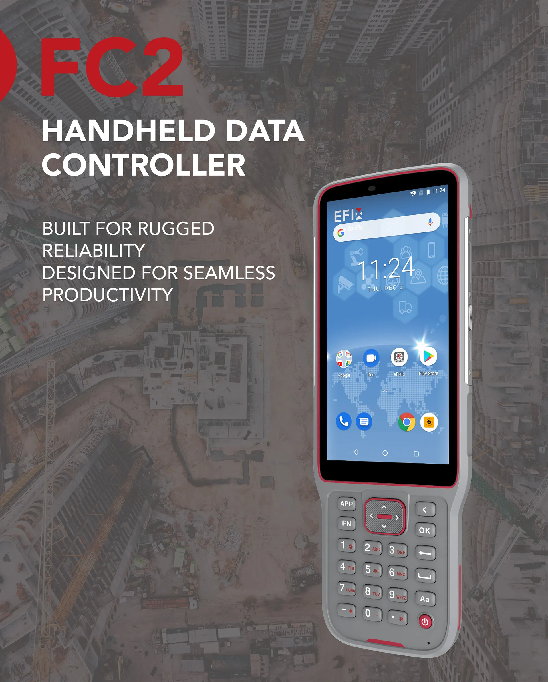
EFIX FC2 Controler
Designed for reliability and productivity
High visibility display
Fast and powerful processor
Robust industrial design
Intergrated versatile features
Robust industrial design
Brosure
Hanya pelanggan yang sudah login dan telah membeli produk ini yang dapat memberikan ulasan.
Produk Terkait


GPS Topcon HiPer SR
Baca selengkapnyaSIMPLE AND SOPHISTICATED Daily setup routines are made easy through the HiPer SR’s LongLink intelligence feature. More than just a wireless Bluetooth connection, LongLink serves to automatically connect multiple HiPer SR rovers to your mobile base. Just power them on and let the system do the rest. Combine your Topcon HiPer SR receiver with a …

ESurvey E600
Baca selengkapnyaThe new e-survey E600 GNSS Receiver is coming to change the scene in the high-end GNSS receiver market. With up to 800 true channels and surprising performance, it is destined to be the perfect ally of the topographer – and not only – in the pursuit of perfection. E600 supports all the new technologies (Tilt …

GPS Hitarget V30 Plus Rover
Baca selengkapnyaHi-Target V30 Plus adalah
sistem Global Navigation Satellite System (GNSS) RTK (Real-Time Kinematic) geodetik, yang dirancang untuk survei dan pemetaan dengan presisi tinggi. Perangkat ini memiliki desain kokoh berkelas industri yang ringkas, dengan mesin GNSS multi-konstelasi untuk pemosisian yang stabil dan akurat bahkan di lingkungan yang sulit.
GPS GNSS Alpha Geo Matrix II AR + Laser
Baca selengkapnyaGNSS Alpha GEO Matrix II AR + Smart Laser Teknologi Canggih untuk Pengukuran yang Lebih Akurat dan Efisien AR – Stakeout Jadi Lebih Mudah dan Akurat GNSS Alpha Geo Matrix II Dengan fitur Augmented Reality (AR), Matrix II memungkinkan surveyor menandai titik langsung di lapangan tanpa perlu menggeser pole berulang kali. Cukup ikuti arah panah …






Ulasan
Belum ada ulasan.