


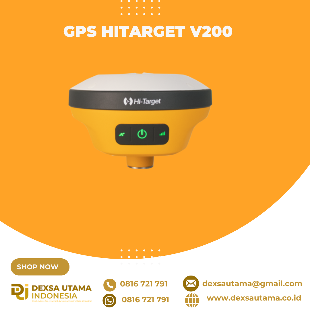
GPS Hitarget V200
penerima GNSS RTK (Global Navigation Satellite System Real-Time Kinematic) geodetik yang ringkas dan ringan, dirancang untuk survei dan pemetaan dengan akurasi tinggi. Dengan menggabungkan teknologi multi-konstelasi dan fitur kompensasi kemiringan, perangkat ini menawarkan solusi efisien dan portabel untuk pekerjaan lapangan di berbagai kondisi lingkungan
igher Accuracy and Precision
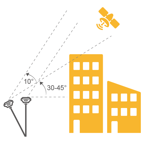
Equipped with the High-Performance Patch Antenna, enhances the low elevation angle tracking capabilities and keeps it maintaining a high gain for higher elevation satellites while tracking low-elevation satellites.
Spesifikasi
GNSS SIGNAL
- Channels: 1408
- GPS: L1 / L2 / L5 / L2C
- BDS: B1 / B2 / B3 / B1C / B2a
- GLONASS: L1/L2/L3
- Galileo: E1 / E5 / AltBOC / E5a / E5b / E6
- SBAS: L1 / L5
- QZSS: L1 / L2 / L5 / L6
- IRNSS: L5
POSITIONING PERFORMANCE
- High Precision static GNSS Surveying
- Horizontal : 2.5mm + 0.1ppm RMS
- Vertical: 3.5mm + 0.4ppm RMS
- Static and Fast Static
- Horizontal: 2.5mm + 0.5ppm RMS
- Vertical: 5mm + 0.5ppm RMS
- Post Processing Kinematic (PPK / Stop & Go)
- Horizontal: 8mm + 1ppm RMS
- Vertical: 15mm + 1ppm RMS
- Initialization time: Typically 10 min for base and 5 min for rover
- Initialization reliability: Typically > 99.9%
- Code Differential GNSS Positioning
- Horizontal: ±0.25m + 1ppm RMS
- Vertical: ±0.5m + 1 ppm RMS
- SBAS: 0.5m (H), 0.85m (V)
- Real Time Kinematic (RTK)
- Horizontal: 8mm+1ppm RMS
- Vertical: 15mm+1ppm RMS
- Initialization time: Typically <10s
- Initialization reliability: Typically > 99.9%
- Time to First Fix
- Cold Start: <45 s
- Hot Start: <30 s
- Signal re-acquisition: <2 s
- Hi-Fix
- Horizontal: RTK+10mm / minute RMS
- Vertical: RTK+20mm / minute RMS
- Tilt Survey Performance
- Additional horizontal pole-tilt uncertainty typically less than 8mm +0.7mm / °tilt (2.5cm accuracy in the inclination of 30°)
- High Precision static GNSS Surveying
COMMUNICATION
- Communication
- Bluetooth: 4.2 / 2.1+EDR, 2.4GHz
- WiFi: Frequency 2.4GHz, Supports 802.11a/b/g/n
- Internal UHF Radio
- Frequency: 410-470MHz
- Channel: 116 (16 scalable)
- Transmitting power: 0.5W/ 1W / 2W adjustable
- Support multi-communication protocols:
- Hi-Target
- TRIMTALK450S
- TRIMMARK III
- TRANSEOT
- SATEL-3AS
- etc.
- Communication
PHYSICAL
- Internal Battery
- Internal 7.4V / 6800mAh lithium-ion rechargeable battery
- RTK Rover (network) for 12 hours
- Static: up to 15 hours
- External Power
- Power Consumption: 4.2W
- Dimension (W x H): 132mm x 67mm
- Charging: using standard smartphone chargers or external power banks
- Weight: ≤0.8kg (include battery)
- Data Storage: 8GB ROM internal storage
- Internal Battery
CONTROL PANEL
- LED Lamp:
- Satellite
- Signal
- Power
- Physical button: 1
- LED Lamp:
ENVIRONMENT
- Water / Dustproof: IP67
- Shock and vibration: Designed to survive a 2m natural fall onto concrete
- Humidity: 100%, condensing
- Operation Temperature: -30°C~+70°C
- Storage Temperature: -40°C~+80°C
I/O INTERFACE
- 1x USB port, type C
- 1x SMA antenna connector
DATA FORMATS
- Output rate: 1Hz-20Hz.
- Static data format: GNS, Rinex
- Network model: VRS, FKP, MAC; supports NTRIP protocol
- CMR& RTCM: CMR, RTCM 2.x, RTCM 3.0, RTCM 3.2
- Navigation outputs ASCII: NMEA-0183
Brosure
Video
Hanya pelanggan yang sudah login dan telah membeli produk ini yang dapat memberikan ulasan.
Produk Terkait


ESurvey E800
Baca selengkapnyaHigh-performance RTK Receiver
The E800 is a high-performance GNSS receiver that provides an easy-to-use solution for survey professionals who need to collect highly accurate data in a wide range of applications. The durable IP67 design makes it possible to work in extreme environments. The colorful touchscreen is convenient for quick configurations.

ESurvey E600
Baca selengkapnyaThe new e-survey E600 GNSS Receiver is coming to change the scene in the high-end GNSS receiver market. With up to 800 true channels and surprising performance, it is destined to be the perfect ally of the topographer – and not only – in the pursuit of perfection. E600 supports all the new technologies (Tilt …
eSurvey eRTK25
Baca selengkapnyaLaser + CAD AR Dual-Tech Integration AR Stakeout: Overlay CAD designs onto real-world environments via AR, boosting on-site efficiency by 40%. Laser Precision: Achieve centimeter-level accuracy with non-contact measurements, ideal for extreme temperatures or tight spaces. High performance and stability: The eSurvey eRTK25 integrates laser ranging technology and AR vision stakeout, enabling robust centimeter-level positioning …

 0816 721 791
 dexsautama@gmail.com






Ulasan
Belum ada ulasan.