


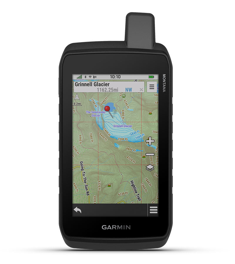
GPS Garmin Montana 710
STAY ON TRACK THROUGH ALL KINDS OF ADVENTURES
With routable mapping for roads and trails, the Montana 710 handheld brings advanced outdoor features into a sturdy 5-inch format that’s ideal for navigation on foot, bike, kayak, ATV and more.
![]()
![]()
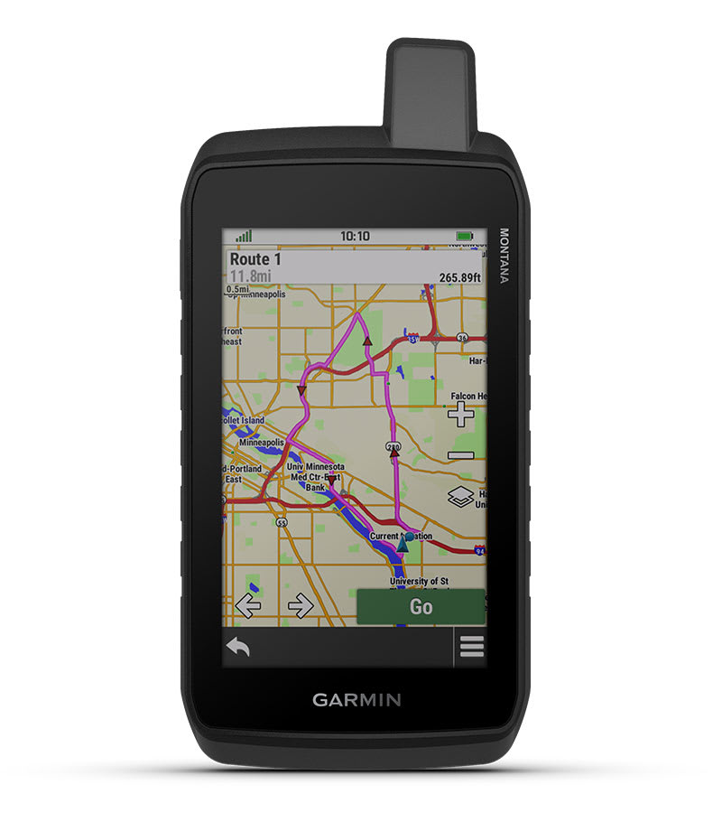
LARGE 5-INCH GLOVE-FRIENDLY TOUCHSCREEN
![]()
![]()
PRELOADED TOPOGRAPHIC MAPS WITH LANDMARKS
![]()
![]()
MEETS MIL-STD 810 FOR THERMAL, SHOCK, WATER AND VIBRATION
![]()
![]()
SATELLITE IMAGERY SHOWS VIVID OVERHEAD VIEWS OF YOUR ROUTE
![]()
![]()
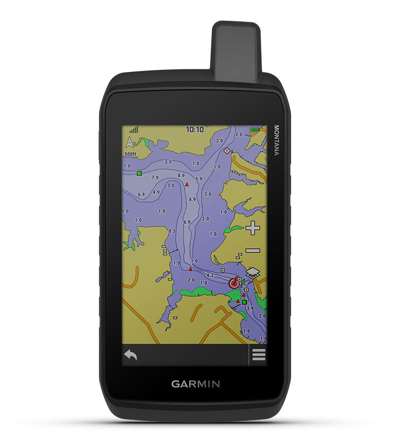
SUPPORTS OUTDOOR MAPS+ FOR PREMIUM MAPPING (SOLD SEPARATELY)
![]()
![]()
PLAN AND REVIEW TRIPS WITH THE GARMIN EXPLORE™ SMARTPHONE APP
WHAT YOU’LL LOVE
RUGGED BY DESIGN
This durable, water-resistant handheld is tested to meet MIL-STD 810 for thermal, shock, water and vibration. It features a glove-friendly 5-inch touchscreen and is compatible with a variety of robust mounting solutions (sold separately) to best suit your activities.
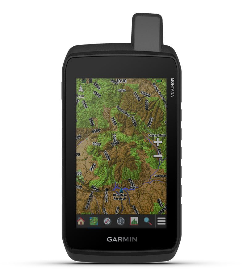
TOPOACTIVE MAPS
To navigate your adventures, use preloaded worldwide topographical maps. View terrain contours, elevations, coastlines, rivers, landmarks and more.
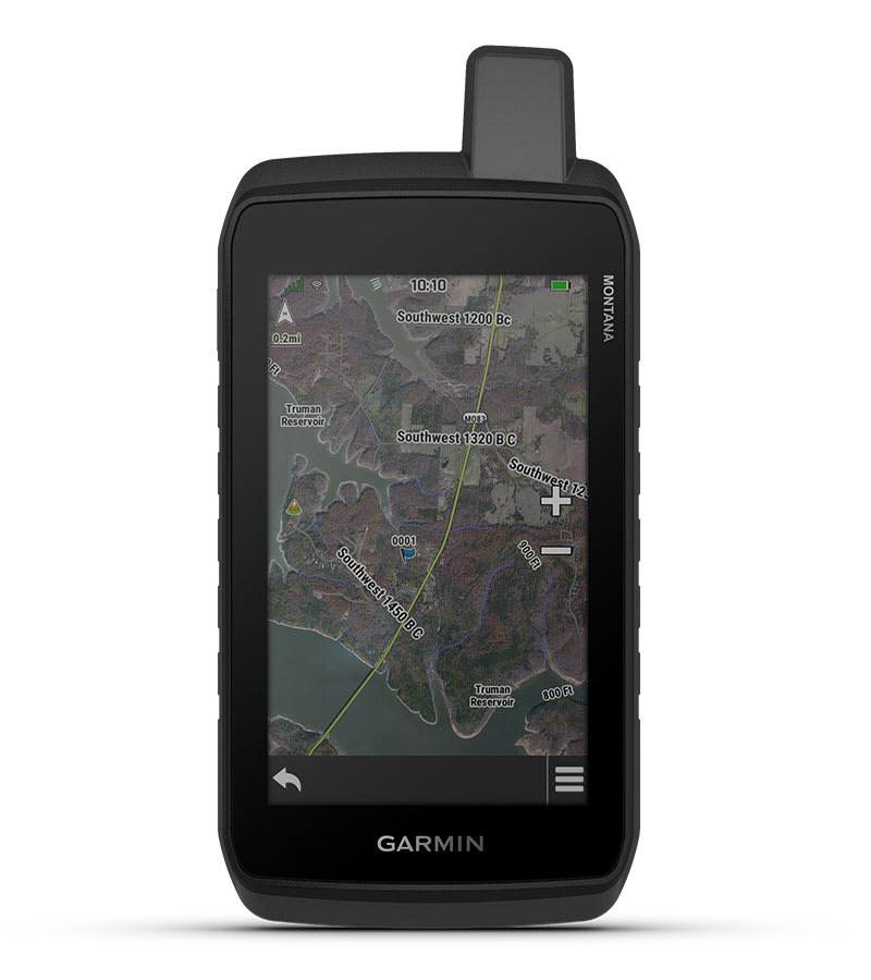
SATELLITE VIEWS
Access subscription-free, high-resolution satellite imagery with direct-to-device downloads over Wi-Fi® connectivity. See photorealistic overhead views of routes and surrounding terrain, and easily create waypoints based on landmarks.
ADDITIONAL MAPS
With 32 GB of onboard memory, you can download even more maps, such as City Navigator® maps for your drive or BlueChart® g3 charts for the water (sold separately).
OUTDOOR MAPS+
With a subscription to Outdoor Maps+ (sold separately), get ongoing access to a wide variety of premium mapping content and regular updates sent right to your Garmin device via Wi-Fi technology.
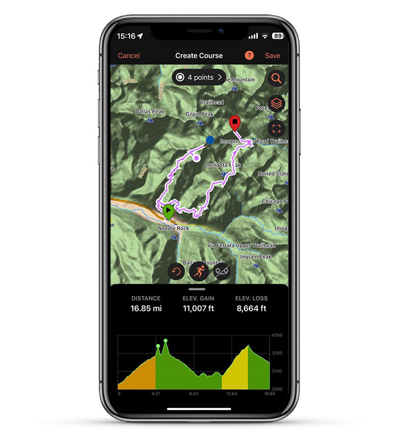
GARMIN EXPLORE APP
Pair with the Garmin Explore app to plan and review trip data, plus manage your waypoints, courses and activities.
Hanya pelanggan yang sudah login dan telah membeli produk ini yang dapat memberikan ulasan.
Produk Terkait


Garmin GT20-TM
Baca selengkapnyaFor the shallow water anglers who wants traditional and CHIRP ClearVü scanning sonar, this transom or trolling motor mounted transducer consistently displays fish arches as well as clear pictures of objects, structure and fish that pass below your boat. The 20 ft transducer cable with built-in fast response temperature sensor has a power rating of …

GPS Garmin Montana 700
Baca selengkapnyaEXPLORE YOUR WORLD WITH NAVIGATION YOU TRUST With routable mapping for roads and trails, the Montana 700 handheld brings advanced outdoor features into a sturdy 5” format that’s ideal for navigation on foot, bike, kayak, ATV and more. Expect big things. A large touchscreen puts them all at your fingertips. Routable topographic maps? Check. Now …

Garmin Reactor 40 Hydraulic Autopilot
Baca selengkapnyaSETIAP KAPTEN MEMBUTUHKAN CO-PILOT Dirancang untuk powerboat, pilot otomatis hidraulis Reactor 40 ini memberi Anda bantuan yang dibutuhkan, sehingga Anda dapat menjelajah tanpa khawatir. Corepack hidraulis Reactor 40 ini adalah pendamping yang sempurna untuk sistem kemudi hidraulis Anda. Ya, ada fitur solid-state 9-axis AHRS. Dan ya, itu berarti Anda dapat memasangnya di mana saja. Bahkan …

GPS Garmin 73
Baca selengkapnyaPerangkat Genggam GPS Navigator yang Mudah Digunakan Penanda GPS dengan sensitivitas tinggi yang dapat menyimpan 1000 waypoints dan 100 tracks Tandai lokasi favorit anda untuk kemudahan navigasi Garmin SailAssist??untuk GPS 73 dilengkapi dengan virtual starting line, heading line, timer countdown timers dan tack assist Fitur matahari terbit/matahari terbenam, perkiraan waktu tiba, dan kalkulasi data lain, …


Ulasan
Belum ada ulasan.