


Tag: CHCNAV AlphaAir 450
Menampilkan semua 3 hasilDiurutkan menurut yang terbaru


LiDAR CHCNAV AlphaAir 15
Baca selengkapnyaThe AlphaAir 15 (AA15) is a lightweight, high-performance airborne LiDAR system designed for large-scale operations where high-density data capture is crucial. With a range of up to 1800 meters and the ability to produce 2 million pulses per second, the AA15 is ideal for mapping and geospatial applications, including corridor mapping, urban planning, and vegetation analysis. Its compact design allows for easy integration with UAVs, small aircraft, and helicopters.

LiDAR CHCNAV AlphaAir 10
Baca selengkapnyaThe AlphaAir 10 is a professional airborne LiDAR+RGB system designed to meet the demanding requirements of UAV LiDAR mapping and drone photogrammetry. This advanced solution integrates superior LiDAR technology with accurate GNSS positioning, IMU orientation, and a professional full frame orthophoto camera. Together with CHCNAV’s point cloud and image fusion modeling software, the AA10 delivers survey-grade accuracy, efficiency, and cost-effectiveness in 3D data acquisition and processing

LiDAR CHCNAV AlphaAir 450
Baca selengkapnyaThe AlphaAir 450 is designed for simplicity and precision, making advanced geospatial reality capture accessible to non-professional users and those new to the technology. At an affordable price, the AA450 combines ease-of-use with high-precision capabilities. This lightweight, durable solution integrates a high-performance laser scanner, a professional-grade 26 MP industrial camera, and a high-precision inertial navigation system to ensure superior data collection quality.
Produk
-
 Sokkia IM103 Rp0 + PPN 11%
 -
 Bracket Controller Rp0 + PPN 11%
 -
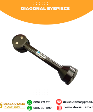 Diagonal Eyepiece Sokkia CX
 -
 CHCNAV CTS-A100 Total Station
 -
 Sokkia LX32
 -
 Nikon AS-2
 -
 Digipas DWL-90Pro