



GPS Geodetik RTK Comnav Sino T300
- GPS L1/L2/L5, BeiDou B1/B2/B3/B1C/B2a/B2b, GLONASS L1/L2/L3, Galileo E1/E5a/E5b/E6/AltBOC, QZSS L1/L2/L5, Navic L5, SBAS
- Compact Design
- Hot Swap Battery
- User-friendly Interface
- Support WIFI/UHF/4G
- Web server for easy configuration
| Channel | 965 |
| Satellites tracking | GPS: L1C/A, L2C, L2P, L5 BeiDou:B1I, B2I, B3I, B1C, B2a, B2b GLONASS:L1, L2, L3 Galileo: E1, E5a, E5b, E6, AltBOC QZSS:L1C/A, L1C, L2C, L5 Navic: L5 SBAS: WAAS, EGNOS, MSAS, GAGAN, SDCM,BDSBAS |
| Signal Re-acquisition | <1.5 s |
| Cold Start | <50 s |
| Warm start | <30 s |
| Hot start | <15 s |
| RTK Initialization Time | <10s |
| Initialization reliability | >99.9% |
| Static and Fast Static | Horizontal 2.5 mm + 0.5 ppm RMS Vertical 5 mm + 0.5 ppm RMS |
| Real Time Kinematic | Horizontal 8mm + 1ppm RMS Vertical 15mm + 1ppm RMS |
| Long Observation Static | 3 mm + 0.1 ppm Horizontal 3.5 mm + 0.4 ppm Vertical |
| DGPS | <0.4m RMS |
| SBAS | 1 m 3D RMS |
| Standalone | 1.5m 3D RMS |
Hanya pelanggan yang sudah login dan telah membeli produk ini yang dapat memberikan ulasan.
Produk Terkait
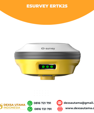

eSurvey eRTK25
Baca selengkapnyaLaser + CAD AR Dual-Tech Integration AR Stakeout: Overlay CAD designs onto real-world environments via AR, boosting on-site efficiency by 40%. Laser Precision: Achieve centimeter-level accuracy with non-contact measurements, ideal for extreme temperatures or tight spaces. High performance and stability: The eSurvey eRTK25 integrates laser ranging technology and AR vision stakeout, enabling robust centimeter-level positioning …

GPS Hitarget V30 Plus Rover
Baca selengkapnyaHi-Target V30 Plus adalah
sistem Global Navigation Satellite System (GNSS) RTK (Real-Time Kinematic) geodetik, yang dirancang untuk survei dan pemetaan dengan presisi tinggi. Perangkat ini memiliki desain kokoh berkelas industri yang ringkas, dengan mesin GNSS multi-konstelasi untuk pemosisian yang stabil dan akurat bahkan di lingkungan yang sulit.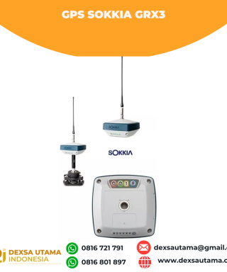
GPS Sokkia GRX3
Baca selengkapnyaNumber of Universal Tracking Channels 226 UTC technology Tracked Signals GPS L1 C/A, L1C, L2P(Y), L2C, L5 GLONASS L1 C/A, L1P, L2 C/A, L2P, L3C BeiDou B1, B2 Galileo E1,E5a, E5b, Alt-BOC SBAS L1 C/A, L5 WAAS/MSAS/EGNOS/GAGAN QZSS L1 C/A, L1C, L1-SAIF, L2C, L5 Static/Fast Static H: 3 mm + 0.4 ppm V: 5 mm …
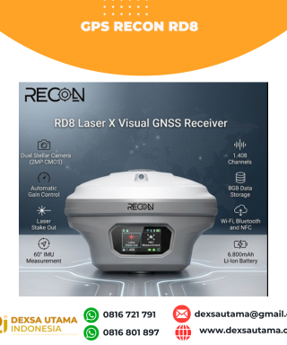
GPS Recon RD8
Baca selengkapnyaRECON RD8 Laser This tool is designed to increase the efficiency and accuracy of measurements in the field, especially in difficult conditions such as closed areas, tall objects, or locations that cannot be reached directly. With a combination of visual and laser technology, the RD8 enables non-contact measurements (without touching the object) and real-time target …





Ulasan
Belum ada ulasan.