



GPS Comnav Sino Mars Pro Laser
- 1668 channels and 60+ satellites tracking capabilities
- Tracking all running and planned constellations, including GPS, BDS-2, BDS-3, GLONASS, Galileo, QZSS, IRNSS, and SBAS
- Up to 120° tilt with 2.5 cm accuracy
- IP67 dust- and waterproof for harsh environments
- Up to 20 hrs non-stop use
- Enabling broader use through extensive protocol support, including Transparent/TT450S/SATEL/Trimtakl3/CHC/South
- Channel1668
- Satellites trackingGPS: L1C/A, L1, L2, L2C, L5
BDS: B1, B2, B3, B1C, B2a, B2b
GLONASS: L1,L2P,L2C,L3, G1, G2, G3
Galileo: E1, E5a, E5b, E5a+b, E6c, E5 AItBOC
QZSS: L1C/A, L2C, L5, L1C, L1, SAIF, L1S3, LEX/L6
L-band: Satelite signals
SBAS: L1C/A, WAAS, EGNOS, GAGAN, MSAS - Signal Re-acquisition≤1s
- Cold Start≤45s
- Hot start≤15 s
- RTK Initialization Time<10s>
- Initialization reliability≥99.9%
- Data Update Rate1Hz, 2Hz, 5Hz, 10Hz, 20Hz
- Static and Fast StaticHorizontal 2.5 mm + 0.5 ppm RMS
Vertical 5 mm + 0.5 ppm RMS - Long Observations StaticHorizontal 3.0 mm + 0.1 ppm RMS
Vertical 3.5 mm + 0.4 ppm RMS - Single Baseline RTKHorizontal 8mm + 1ppm RMS
Vertical 15mm + 1ppm RMS - DGPS<0.4m RMS
- SBASHorizontal 0.5m RMS
Vertical 0.8m RMS - Standalone1.5m 3D RMS
- Laser Tilt Measurement≤5.5cm (5m range, ≤60°Tilt in laser mode)
Hanya pelanggan yang sudah login dan telah membeli produk ini yang dapat memberikan ulasan.
Produk Terkait
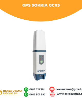

GPS Sokkia GCX3
Baca selengkapnyaGet centimeter-level results without being weighed down by your equipment. This compact receiver delivers full-featured, high-precision performance. The GCX3 is the ideal local job site base/rover RTK (Real Time Kinematic) system or network RTK rover – and like all of our solutions, you can customize it to meet your needs and create your own workflows. …
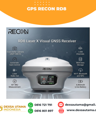
GPS Recon RD8
Baca selengkapnyaRECON RD8 Laser This tool is designed to increase the efficiency and accuracy of measurements in the field, especially in difficult conditions such as closed areas, tall objects, or locations that cannot be reached directly. With a combination of visual and laser technology, the RD8 enables non-contact measurements (without touching the object) and real-time target …

ESurvey E800
Baca selengkapnyaHigh-performance RTK Receiver
The E800 is a high-performance GNSS receiver that provides an easy-to-use solution for survey professionals who need to collect highly accurate data in a wide range of applications. The durable IP67 design makes it possible to work in extreme environments. The colorful touchscreen is convenient for quick configurations.

 0816 721 791
 dexsautama@gmail.com







Ulasan
Belum ada ulasan.