


GPS GNSS Alpha Geo Matrix VI
GNSS Alpha Geo Matrix VI dengan Teknologi Visual, AR, dan Laser untuk Pengukuran yang Lebih Presisi
Mengukur Seakurat Mata Sendiri
GNSS Alpha Geo Matrix VI adalah receiver GNSS kelas survey yang menggabungkan teknologi Visual Positioning, algoritma fotogrametri, serta fitur AR dan laser untuk meningkatkan produktivitas surveyor—baik profesional maupun pemula. Dengan perangkat ini, titik-titik yang sebelumnya sulit diukur menggunakan GNSS RTK biasa kini dapat diukur dengan lebih mudah dan cepat.
Surveyor bisa menangkap kondisi lapangan dengan serangkaian gambar atau video, lalu melakukan pengukuran titik koordinat dari gambar tersebut, baik langsung di lapangan maupun nanti di kantor.
Kamera Samping: Membantu Pengukuran Laser dengan Lebih Akurat
Kamera samping Matrix VI tidak hanya digunakan untuk fotogrametri, tetapi juga sebagai asisten dalam pengukuran laser. Dalam kondisi cahaya yang kuat, titik laser sering kali sulit terlihat di titik yang diukur. Dengan kamera ini, surveyor dapat melihat tampilan real-time untuk memastikan apakah laser sudah mengarah ke titik yang benar.
Real-Scene Stakeout dengan AR: Langsung ke Titik yang Tepat
Fitur Augmented Reality (AR) dalam Matrix VI memungkinkan stakeout menjadi lebih cepat dan akurat. Surveyor dapat langsung melihat titik stakeout di peta real-time dengan panduan panah, sehingga tidak perlu bolak-balik menggerakkan pole untuk menemukan titik yang tepat. Ini membuat pekerjaan stakeout lebih efisien dan presisi.
Mode Pengukuran Laser: Akurasi Sentimeter dalam Sekejap
Teknologi laser yang dipatenkan memungkinkan pengukuran koordinat dengan cepat dan akurat hingga level sentimeter. Kamera dalam perangkat ini juga mengatasi kesulitan dalam membidik titik di bawah sinar matahari, sehingga pekerjaan pengukuran di lapangan menjadi lebih cepat dan efisien.
Super IMU: Tidak Perlu Lagi Re-Initialize
Dengan sensor IMU yang cepat, bebas kalibrasi, dan tahan terhadap gangguan magnetik, Matrix VI memungkinkan surveyor menangkap titik koordinat dengan lebih fleksibel. Baik receiver dalam posisi tegak maupun miring hingga 120°, hasil pengukuran tetap akurat tanpa perlu repot melakukan inisialisasi ulang. Ini menghemat waktu dan membuat pekerjaan lebih efisien.
Pengukuran Lebih Aman dengan Laser
Matrix VI juga membantu surveyor menghindari risiko di lapangan. Saat bekerja di area berbahaya seperti jalan raya dengan lalu lintas padat, dekat menara tegangan tinggi, atau transformer, fitur laser memungkinkan pengukuran dari jarak aman tanpa harus berada langsung di lokasi berisiko tinggi.
Performa GNSS Alpha Geo Matrix VI yang Mumpuni
Ditenagai oleh mesin GNSS dengan 1408 kanal dan algoritma pelacakan sinyal yang kuat, Matrix VI mampu melacak semua konstelasi satelit yang sedang beroperasi. Hasilnya, solusi fixed bisa diperoleh dengan lebih cepat, bahkan di lingkungan yang menantang seperti hutan lebat atau di antara gedung-gedung tinggi. Teknologi mitigasi gangguan narrowband juga memastikan akurasi tetap terjaga dalam kondisi lingkungan yang sulit.
Penyimpanan Besar, Bebas Khawatir
Matrix VI memiliki memori internal 64GB yang cukup untuk menyimpan data lapangan dalam jangka waktu lama. Dengan fitur cyclic storage, perangkat akan otomatis menghapus data lama saat ruang penyimpanan hampir habis. Jika menggunakan interval sampling 5 detik, data bisa tersimpan hingga hampir 4 tahun! Desain chip memori tertanam juga memastikan keamanan data pengamatan.
Spesifikasi
| GNSS Performance | Signals tracking | GPS: L1C/A,L2C,L2P,L5 |
| GLONASS: L1,L2 | ||
| BDS: B1,B1C,B2,B2a,B2b,B3 | ||
| GALILEO: E1,E5a,E5b,E6 | ||
| QZSS: L1,L2,L5,L6 | ||
| SBAS: WAAS,EGNOS,MSAS,GAGAN,SDCM | ||
| Channels | 1408 | |
| Cold start | <60s | |
| Hot start | <15s | |
| Positioning output rate | 1Hz~50Hz | |
| Signal reacquisition | <1s | |
| RTK initialization time | <5s | |
| Initialization reliability | >99.99% | |
| Time accuracy | 20ns | |
| Positioning accuracy* | Code differential GNSS positioning | H: 0.25m+1ppm RMS |
| V: 0.50m+1ppm RMS | ||
| SBAS differential positioning accuracy* | Typically< 5m 3DRMS | |
| Static surveying | H: 2.5mm+0.5ppm RMS | |
| V: 5mm+0.5ppm RMS | ||
| RTK surveying(baseline<30km) | H: 8mm+1ppmRMS | |
| V: 15mm+1ppm RMS | ||
| Network RTK* | H: 8mm+0.5ppmRMS | |
| V: 15mm+0.5ppm RMS | ||
| Laser measurement | ±1cmm+5mm/m | |
| Sensor | IMU | Supported,4D lMU initialization in 3 seconds |
| Update rate | 400Hz | |
| Accuracy | <2.5cm within 120° | |
| Tilt compensation | 0~120° | |
| Camera | Visual camera | Global shutter with 2MP |
| AR camera | 5MP | |
| FOV | 84° | |
| Physical | Materials | Magnesium alloy |
| Dimensions | 129mmx129mmx99mm | |
| Weight | <0.8kg | |
| Operating temperature | -40℃~+75°C | |
| Storage temperature | -55℃~+85℃ | |
| Waterproof/Dustproof | IP67 standard, protected from 30min immersion to depth of 1m | |
| Shock | Survive a 2m pole drop onto concrete | |
| Vibration | MIL-STD-810G | |
| Humidity | 100% non-condensing | |
| Eletrical | Power supply | 9~24V DC external power inputto 5-pin LEMO port Supports Type-C fast charging |
| Battery | Built-in 7000mAh-7.4V Li-ion battery | |
| Battery life | Rover mode: 12hours | |
| Base mode: 7hours | ||
| Static mode: 15hours | ||
| Communications | l/O interface | 1*5-pin LEMO port, power supply, RS232, external radio communication port |
| 1*USB Type-C port, charging, data download | ||
| 1*SlM card slot, Nano SlM | ||
| 1*UHF antenna interface | ||
| Internal UHF | 1.5W receiver and transmitter | |
| Frequency band | 410MHZ~470MHz, supports frequency modification | |
| Protocols | Trimtalk450S, Alphatalk15, South,Satel, PCC-EOT | |
| Cellular network | Full frequency multi-band 4Gmodem, supports TDD-LTE/FDD-LTE/WCDMA/CDMA2000 | |
| WiFi | 802.11 b/g standard, access point & client mode, supports accessing to hotspot for correction transmission | |
| Bluetooth | Bluetooth 5.2 classical/BLE proprietary dual-mode | |
| Differential data format | RTCM2x, RTCM3x, CMR&CMR+, sCMRX | |
| GPS output data format | RINEX, NMEA-0183 | |
| Data storage | Memory | 64GB, supports cyclic storage, with ability to collect almost 4 years raw observation based on 5s interval |
| User interaction | Operating system | Linux OS |
| Buttons | Power key | |
| Indicators | 1*Power indicator | |
| 1*Bluetooth indicator | ||
| 1*Satellite | ||
| Voice | indicator1*Data link indicator Intelligent voice prompts | |
| Web Ul | Supports Web Ul configration |
Brosure
Hanya pelanggan yang sudah login dan telah membeli produk ini yang dapat memberikan ulasan.
Produk Terkait


GPS Topcon HiPer SR
Baca selengkapnyaSIMPLE AND SOPHISTICATED Daily setup routines are made easy through the HiPer SR’s LongLink intelligence feature. More than just a wireless Bluetooth connection, LongLink serves to automatically connect multiple HiPer SR rovers to your mobile base. Just power them on and let the system do the rest. Combine your Topcon HiPer SR receiver with a …

CHCNAV HCE600
Baca selengkapnyaThe HCE600 is a lightweight, professional Android data collector designed for field surveying and mapping. With a 5.5-inch DragonTrail™ display, it offers exceptional durability and clear visibility in sunlight. Packed with Bluetooth 5.0, dual-band Wi-Fi, and a 4G modem, it ensures seamless connectivity with GNSS receivers and RTK networks. Certified to IP67 and MIL-STD-810H standards, the HCE600 is built to withstand harsh environments, making it the ideal handheld controller for reliable data collection in any conditions

ESurvey E800
Baca selengkapnyaHigh-performance RTK Receiver
The E800 is a high-performance GNSS receiver that provides an easy-to-use solution for survey professionals who need to collect highly accurate data in a wide range of applications. The durable IP67 design makes it possible to work in extreme environments. The colorful touchscreen is convenient for quick configurations.
GPS Recon RD8
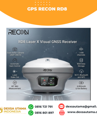
Baca selengkapnyaRECON RD8 Laser This tool is designed to increase the efficiency and accuracy of measurements in the field, especially in difficult conditions such as closed areas, tall objects, or locations that cannot be reached directly. With a combination of visual and laser technology, the RD8 enables non-contact measurements (without touching the object) and real-time target …





Ulasan
Belum ada ulasan.