


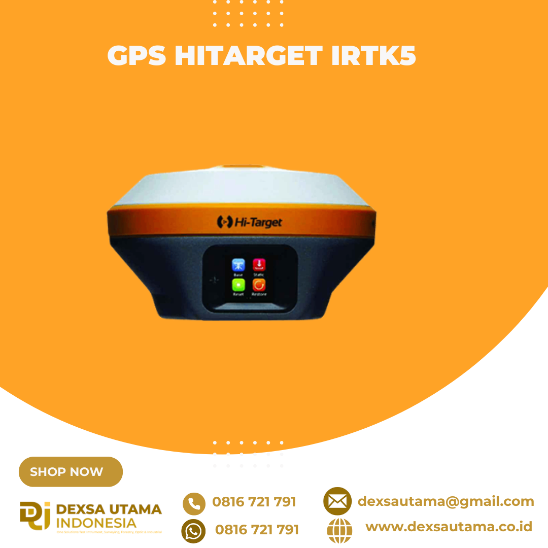
GPS Hitarget iRTK5
GPS geodetik berteknologi tinggi yang menawarkan solusi survei GNSS RTK (Global Navigation Satellite System Real-Time Kinematic) untuk kebutuhan pemetaan dan konstruksi. Alat ini didesain dengan mesin GNSS generasi terbaru dan teknologi komunikasi nirkabel untuk memberikan akurasi posisi tingkat sentimeter
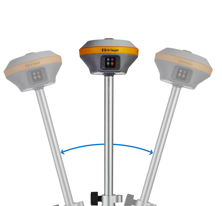
Revolutionary Tilt Survey with Built-in IMU
Customers benefit from calibration-free for tilt surveys without centering. Once you reach the surveying points, immediately start the operation. Compared with bubble leveling, boost working efficiency by 20%.
Spesifikasi
Satellite Signals Tracked Simultaneously
- Channels: 1760
- GPS: L1C/A, L1C, L2P(Y), L2C, L5
- BDS: B1l, B2l, B3l, B1C, B2a, B2b
- GLONASS: L1, L2, L3
- Galileo: E1, E5a, E5b, E6
- QZSS: L1, L2, L5, L6*
- NavlC: L5
- SBAS: L1, L2, L5
- PPP: B2b-PPP, Galileo E6-HAS
POSITIONING PERFORMANCE
- High-Precision Static
- Horizontal: 2.5 mm + 0.1 ppm RMS
- Vertical: 3.5 mm + 0.4 ppm RMS
- Static and Fast Static
- Horizontal: 2.5 mm + 0.5 ppm RMS
- Vertical: 5 mm + 0.5 ppm RMS
- Post Processing Kinematic (PPK / Stop & Go)
- Horizontal: 8mm+1ppm RMS
- Vertical: 15mm+1ppm RMS
- Initialization time: Typically 10 min for base and 5 min for rover
- Initialization reliability: Typically > 99.9%
- Code Differential GNSS Positioning
- Horizontal: ±0.25m+1ppm RMS
- Vertical: ±0.5m+1ppm RMS
- SBAS: 0.5m(H), 0.85m(V)
- PPP: 10cm(H), 20cm(V)
- High-Precision Static
Real Time Kinematic (RTK)
- Single Baseline
- Horizontal: 8mm+1ppm RMS
- Vertical: 15mm+1ppm RMS
- Network RTK(VRS,FKP,MAC)
- Horizontal: 8mm+0.5ppm RMS
- Vertical: 15mm+0.5ppm RMS
- Positioning rate: 1 Hz, 5 Hz and 10 Hz
- Initialization time: Typically 2-10s
- Initialization reliability: Typically>99.99%
- Hi-Fix
- Horizontal: RTK + 10 mm/minute RMS
- Vertical: RTK + 20 mm/minute RMS
- Tilt Survey Performance
- Additional horizontal pole-tilt uncertainty typically less than 8 mm +0.7 mm / °tilt (0° ~ 60°)
- Single Baseline
HARDWARE
- Physical
- Dimensions (W x H): 158mm x 98mm (6.22inch x 3.86inch)
- Weight: lighter than 1.3kg (2.65lb) within internal battery
- Operation temperature: -40°C~+75°C(-40°F~+167°F)
- Storage temperature: -50°C~+85°C(-58°F~+185°F)
- Temperature control: Auto-adjust the working power to maintain the temperature
- Humidity: 100%, condensing
- Water/dustproof: IP67 dustproof, protected from temporary immersion to depth of 1m (3.28ft)
- Shock and vibration: MIL-STD-810G, 514.6
- Anti-salt spray: MIL-STD-810G, 509.4, 96h
- Free fall: MIL-STD-810G, 516.6, designed to survive a 2m(6.56ft) natural fall onto concrete
- Electrical
- 6V to 28V DC external power input(5-pin port), with over-discharge protection power consumption 4.4W Automatic switching between internal power and external power
- Control Panel
- Physical button: 1
- Display: 1.3″ OLED Touch Screen
- LED Lights: Satellite, Signal, Power
- Battery
- 2 V, 6900 mAh lithium-ion rechargeable and removable battery.
- RTK rover(UHF/Cellular) for 24 hours.
- Power indicator embedded.
- Quick charge within 3.5 hours.
- I/O Interface
- Bluetooth 4.0/2.1+ EDR, 2.4 GHz. USB 3.0 port , OTG function. 1 SMA antenna connector.
- 1 DC power input(5-pin),1 SIM card slot.
- Near Field Communication(NFC)
- Physical
Communication
- Network Communication
- Full band support for cellular mobile network(LTE, WCDMA, EDGE, GPRS, GSM). 2.4GHz Wi-Fi, supports the standard protocol 802.11 b/g/n. Network RTK(in CORS) range is 20-50km.
- Internal UHF Transceiver Radio
- Frequency: 403~473MHz
- Transmitting power: 1~5W Hi-Target Advanced Radio Supports protocols: HI-TARGET, TRIMTALK450S, TRIMMARK III, SATEL-3AS, TRANSEOT, etc.
- Working Range: Typically 3~5km, optimal 8~15km
- External UHF Radio
- Frequency: 403~473MHz
- Transmitting power: 10W / 35W
- Compatible with third party radio Working Range: Typically 8~10km, optimal 15~20km
- SYSTEM CONFIGURATION
- System Data storage: Circulating 16GB Internal storage Record GNS and RINEX format simultaneously
- Data Formats
- Output rate: 1Hz-20Hz
- Static data format: GNS, Rinex Dual Format Static Data
- Network model: VRS, FKP, MAC; supports NTRIP protocol
- CMR & RTCM: RTCM2.X, RTCM3.X, CMR
- Navigation outputs ASCI: NMEA-0183
- Network Communication
Brosure
Video
Video Drone DJI & GPS Hi-Target iRTK5
Hanya pelanggan yang sudah login dan telah membeli produk ini yang dapat memberikan ulasan.
Produk Terkait


ESurvey E600
Baca selengkapnyaThe new e-survey E600 GNSS Receiver is coming to change the scene in the high-end GNSS receiver market. With up to 800 true channels and surprising performance, it is destined to be the perfect ally of the topographer – and not only – in the pursuit of perfection. E600 supports all the new technologies (Tilt …

GPS Topcon HiPer SR
Baca selengkapnyaSIMPLE AND SOPHISTICATED Daily setup routines are made easy through the HiPer SR’s LongLink intelligence feature. More than just a wireless Bluetooth connection, LongLink serves to automatically connect multiple HiPer SR rovers to your mobile base. Just power them on and let the system do the rest. Combine your Topcon HiPer SR receiver with a …
GPS Sokkia GRX3
Baca selengkapnyaNumber of Universal Tracking Channels 226 UTC technology Tracked Signals GPS L1 C/A, L1C, L2P(Y), L2C, L5 GLONASS L1 C/A, L1P, L2 C/A, L2P, L3C BeiDou B1, B2 Galileo E1,E5a, E5b, Alt-BOC SBAS L1 C/A, L5 WAAS/MSAS/EGNOS/GAGAN QZSS L1 C/A, L1C, L1-SAIF, L2C, L5 Static/Fast Static H: 3 mm + 0.4 ppm V: 5 mm …

 0816 721 791
 dexsautama@gmail.com





Ulasan
Belum ada ulasan.