



Furuno GPS NAVIGATOR GP-39
Features
Newly designed GPS core delivers enhanced position fixing accuracy
4.2″ high-resolution color LCD
Storage for 3,000 track points, 10,000 waypoints and 100 routes
SBAS capable for better positioning calculations
Share and display position information on networked equipment such as a fish finder, sonar, radar, etc.
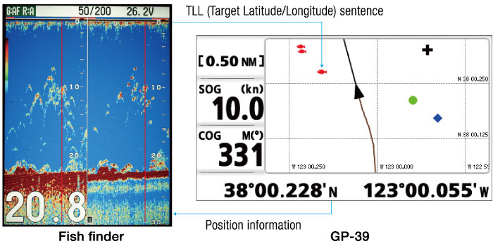

The GP-39 delivers the position information to an interfaced fi sh finder or sonar. Also, the GP-39 receives the TLL (Target Latitude/Longitude) sentence from networked fish fi nders or sonars and can display the received information. This allows you to mark fish school locations easily.
7 display modes available, including 2 user-customizable modes
Waypoint and route data can be exported/imported via a USB flash drive or signal converter
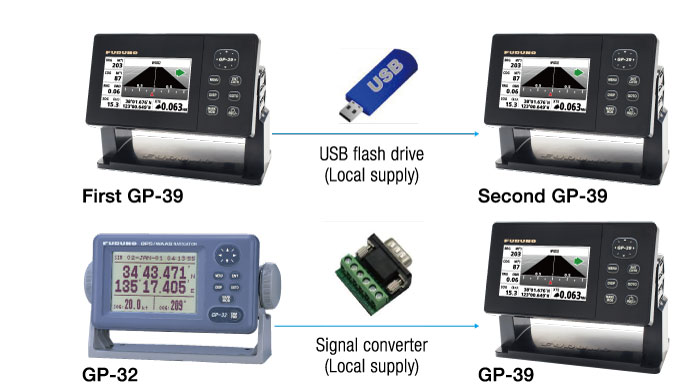
Waypoint, route data and setting information can be exported/imported via a USB ash drive between GP-39 units. The waypoint and route data in GP-32 can be transferred to GP-39 by means of signal converter. You can backup information, or share useful information between vessels.
Multi-language ready : English, French, Spanish, Chinese, Vietnamese, Malay, Indonesian and Thai
Easy to mount on/off the bracket
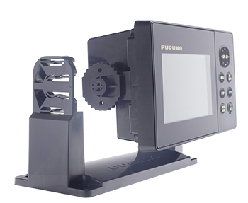
The improved hanger allows the display unit to be mounted or un-mounted easily. The display unit can be carried in the bag (standard supply).
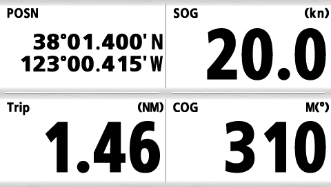
Screenshots
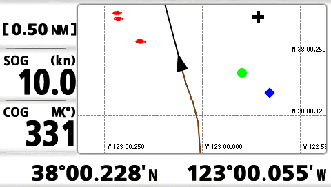
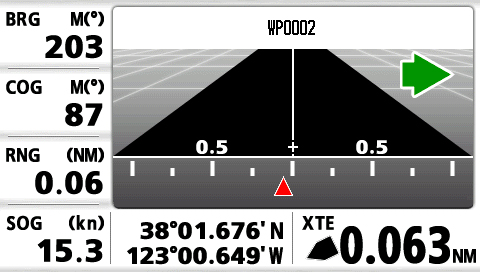
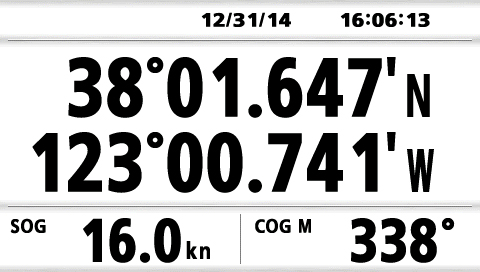
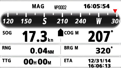
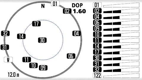
.jpg)
Specification
Display Unit
- Screen Type
- 4.2″ Color LCD
- Screen Resolution
- 480 (V) x 272 (H) pixels
- GPS Antenna
- External
- Display Modes
- Plotter, Highway, Steering, NAV Data, Satellite monitor, User Display (Digital, Speedometer, COG)
- Language
- English, French, Spanish, Chinese, Vietnamese, Malay, Indonesian, Thai
GPS / SBAS (WAAS/EGNOS/MSAS)
- Receiving Type
- GPS: 12 channels parallel, 12 satellites tracking, C/A code, all-in-view
SBAS: 2 channels - Receiving Frequency
- L1 (1575.42 MHz ± 1.023 MHz)
- Accuracy
- GPS: 10 m (95% of the time, HDOP≤4)
WAAS: 3 m (95% of the time, HDOP≤4)
MSAS: 7 m (95% of the time, HDOP≤4)
PLOTTER
- Memory Capacity
- 3,000 ship’s track points
10,000 waypoints with comments
100 routes with 30 waypoints/route
OTHERS
- Waterproofing
- Display unit: IP55
Antenna unit: IP56 - Power Supply
- 12-24 VDC : 0.7-0.3 A
- Weight
- 0.39 kg 0.86 lb (Bracket mount)
Package
Standard
- Display unit GP-39
- Antenna unit GPA-017 with cable 10 m
- Plastic bag
- Standard spare parts and installation materials
Brosure
Hanya pelanggan yang sudah login dan telah membeli produk ini yang dapat memberikan ulasan.
Produk Terkait


Furuno GPS/WAAS COLOR CHART PLOTTER with FISH FINDER GP-3700 F
Baca selengkapnyaUser customizable keys User customizable keys are designed to create short-cuts to menus. Customize menus before you leave the dock for faster, effortless and more intuitive operation on the sea. 12.1 inch large display The larger IPS LCD screen, which features a distinctively clear and wider viewing angle, gives you excellent readability in changing sea conditions. Huge …
Furuno GPS/WAAS COLOR CHART PLOTTER with FISH FINDER GP-3700 FRead More

Furuno GPS/WAAS COLOR CHART PLOTTER GP-3700
Baca selengkapnyaUser customizable keys User customizable keys allow you to create short-cuts to menus. Customize menus before you leave the dock for faster, effortless and more intuitive operation. 12.1 inch large display The larger IPS LCD screen, which features a distinctively clear and wider viewing angle, gives you excellent readability. Huge storage capacity The GP-3700 series …

Furuno Fishfinder FCV-295
Baca selengkapnya10.4″bonded color LCD provides clear view in any weather conditions Post-processing gain control applies to all existing returns on the display White Edge function trace the bottom contour with a thin white line FURUNO Digital Filter delivers crystal clear target presentation FURUNO Free Synthesizer transceiver allows adjustable operating frequency

Furuno Fishfinder FCV-628
Baca selengkapnyaDual-frequency fish finder equipped with revolutionary new RezBoost™ signal processing technology Improved clarity and resolution that was previously impossible with conventional narrowband transducers has been made possible thanks to the new RezBoost™ technology. *The enhanced mode of RezBoost™ requires a RezBoost™ capable thru-hull or transom mount transducer. ACCU-FISH™ – A unique fish size analyzer based on …







Ulasan
Belum ada ulasan.