



GPS Sanding T9
- More information
Distinguishable features
MDS Internal radio adopts TRIMTALK protocol which enables T9 to work with other receives with same protocol.
- Power
Operating power: min. [V]
7.4
Operating power: max. [V]
7.4
Typical consumption [W]
2
Internal power supply
Removable 7.4V, 2500mAh Li-on battery
External power supply
12-15V DC
Operating time with internal power supply [hr]
10
Certifications
CE
Rechargeable with (auto)battery
N/A
Direct car connection cable available
Available
- Performance
Max. simultaneous tracked channels
220
Tracked satellite signals
GPS: Simultaneous L1 C/A, L2E, L2C, L5; GlONASS: Simultaneous L1 C/A, L1P, L2 C/A (GLONASS M Only), L2 P; SBAS: Simultaneous L1 C/A, L5; GALILEO: Simultaneous L1 BOC, E5A, E5B, E5AltBOC; BEIDOU: B1, B2; QZSS: L1 C/A, L1 SAIF, L2C, L5
SBAS differential signals
GPS; GLONASS; GALILEO; BEIDOU
Type of measurements
C/A; P code; C code
Reacqisition time [s]
1
RTK Network Compatibility
Y
MRS functionality
Y
No. channels
220
- General
Year of initial introduction
2013
Height [m]
0.096
Depth [m]
0.184
Width [m]
0.184
Total Weight [kg]
1.2
Housing Material
Plastic
Type
- Horizontal uncertainty
code: DGNSS/RTC (constant part) [m]
0.25
code: DGNSS/RTC (variable part) [ppm]
1
phase: RTK rapid static (constant part) [m]
0.003
phase: RTK rapid static (variable part) [ppm]
0.5
phase: RTK kinematic (constant part) [m]
0.008
phase: RTK kinematic (variable part) [ppm]
1
phase: static post processing (constant part) [m]
0.003
phase: static post processing (variable part) [ppm]
0.5
phase: kinematic post processing (constant part) [m]
0.008
phase: kinematic post processing (variable part) [ppm]
1
Initialization time on the fly [s]
8
Range on the fly [km]
20
RTK network solution methods
NRS; VRS; FKP; RTCM3
- Communication: Protocols
RTCM standards for differential data
Version 2.1; 2.2; 2.3; 3.0; 3.1
CMR standards for differential data
CMR; CMR+
Other formats for differential data
SCMRX; RTD
NMEA output format
GGA; GSA; GST; GSV; ZDA
other output formats
N/A
L-Band Compatible
L1, L2
Configuration method
PC software; Controller
- Recording
Memory medium
Internal
Data capacity [MB]
4096
Type of data (on board recording)
Binary
Data input
Qwerty keyboard
- Communication: general
Communication ports
Standard USB2.0 port; RS-232 port
Simultaneous links
Y
PPS Out
N
Bluetooth
Y
- Environment
Operating temperature: min. [°C]
-40
Operating temperature: max. [°C]
75
Humidity resistance
100% condensing
Water sand and dust proof
IP67,immersion to depth of 1m (3.28ft)
Shock and vibration proof
IP67, 2m (6.6ft) pole drop
ROHS compliance
N
WEEE compliance
N
- Communication: links
Radio modems
Internal and External
GSM; UMTS phone modems
Internal
CDMA phone modems
Internal
Landline modems
None
Specifications
Brosure
Kelengkapan
( 1x Base, 1x Rover, 1x Kontroler 2x Tripod, 1x Pole carbon, 1x Radio External )
Hanya pelanggan yang sudah login dan telah membeli produk ini yang dapat memberikan ulasan.
Produk Terkait
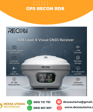

GPS Recon RD8
Baca selengkapnyaRECON RD8 Laser This tool is designed to increase the efficiency and accuracy of measurements in the field, especially in difficult conditions such as closed areas, tall objects, or locations that cannot be reached directly. With a combination of visual and laser technology, the RD8 enables non-contact measurements (without touching the object) and real-time target …

 0816 721 791
 dexsautama@gmail.com








Ulasan
Belum ada ulasan.