


GPS Geodetik RTK Topcon HiPer VR
Harga Belum termasuk PPN
Garansi 12 Bulan

Versatile Performance
Better things in smaller packages!
The HiPer VR* is compact, light and packed with the most advanced GNSS technology in a design built to withstand the harshest field environments. Using Topcon’s advanced GNSS chipset with Universal Tracking Channels Technology, the HiPer VR automatically tracks every satellite signal above – now and into the future.
All signals, all satellites and all constellations — in a compact, rugged design, with an integrated IMU and eCompass.
The HiPer VR is a complete solution and versatile in many ways. It can be used for static or kinematic GNSS post-processed surveys, as a network RTK rover with the FC-5000’s internal 4G/LTE cellular modem, as a UHF/FH/Longlink jobsite RTK rover, and also in Topcon’s patented Hybrid Positioning workflow.
Top features include:
- Universal tracking technology for all satellites and constellations (GPS, GLONASS, Galileo, Beidou, IRNSS, QZSS, SBAS) covering all modernized signals
- Field tested, field ready IP67 design
- Compact form factor ideal for Millimeter GPS and Hybrid Positioning
- Revolutionary 9-axis IMU and ultra-compact 3-axis eCompass
- Integrated 400 MHz UHF Tx/Rx Radio Modem
- Integrated License free 900 MHz Radio Modem, FH915 protocol
| Berat | 40 kg |
|---|
Specifications
L1 C/A, L1C* L2C, L2P(Y), L5
L1 C/A, L1P, L2C/A, L2P, L3C*
E1/E5a/E5b/Alt-BOC
B1, B2
L5
WAAS, EGNOS, MSAS, GAGAN (L1/L5§)
TopNET Global D & C Corrections services
L1 C/A, L1C, L1-SAIF, L2C, L5
V: 5 mm + 0.5 ppm
V: 10 mm + 0.8 ppm
Tilt ≤ 10°
H: 1.8 mm/°Tilt;
Tilt > 10°
TX mode 1W – 6hr
Max Transmit Power: 1W
Range: 5-7 km typical; 15 km
(w x h x d)
Brosur
Kelengkapan
1x Base
1x Rover
2x OAF, GLONASS L1 L2 Tracking
2x Antenna UHF 425-470 Male BNC
2x Hard Carry Case
1x Bipod
1x Data Kontroller FC-500
1x Bracket for Data Kontroller –
1x Pole Carbon
1x Software Post Procces
1x Tribrach with Adapter –
1x Tripod
Hanya pelanggan yang sudah login dan telah membeli produk ini yang dapat memberikan ulasan.
Produk Terkait


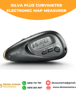
GPS SINGULAR XYZ X1
Baca selengkapnyaThe SingularXYZ X1 GNSS Receiver is a lightweight, ultra-compact RTK receiver designed for demanding field conditions. Offering full satellite tracking, tilt compensation, and a long-lasting battery, it delivers consistent high-precision results in any environment.

ESurvey E600
Baca selengkapnyaThe new e-survey E600 GNSS Receiver is coming to change the scene in the high-end GNSS receiver market. With up to 800 true channels and surprising performance, it is destined to be the perfect ally of the topographer – and not only – in the pursuit of perfection. E600 supports all the new technologies (Tilt …


Ulasan
Belum ada ulasan.