

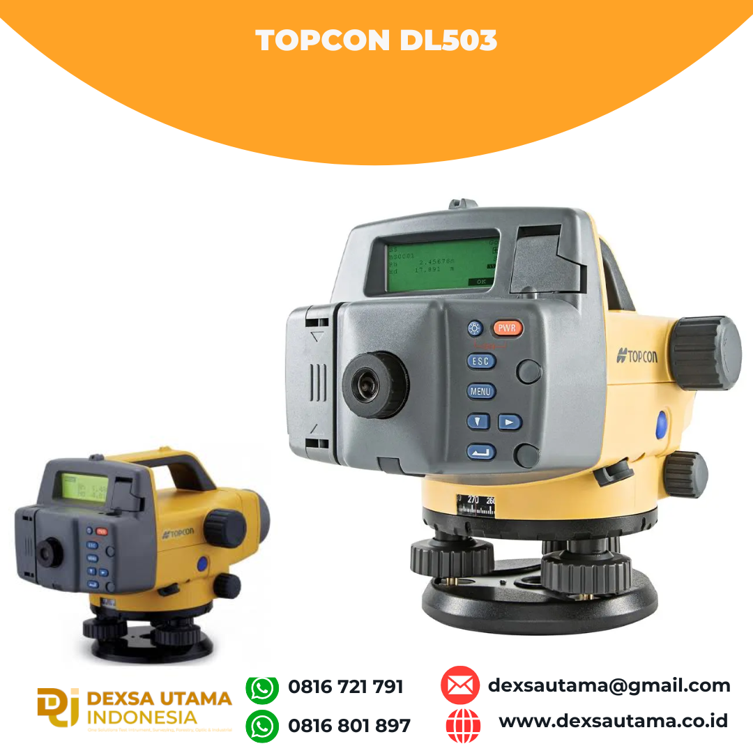
Topcon DL503
- World’s First “Wave-and-Read” TechnologyTopcon DL-500 series digital levels maximize work efficiency and minimize human error, providing consistent measurement precision and speed, regardless of operator skill.Incorporating cutting-edge Random-Bidirectional (RAB) coding technology, an optimized digital processing algorithm, the DL-500 provides exceptional measurement accuracy,
stability and speed, under a variety of environmental conditions. Even when the staff surface is partially shaded, or in dim lighting conditions as low as 20 lux, a single button triggers measurement and the DL-500 instantly provides reliable results.
The world’s first “Wave-and-Read” technology provides an additional survey style option that allows a rod operator to wave the staff forward and back, instead of keeping the staff plumb. This simpler method is faster, easier, minimizes the fatigue and is just as accurate.
Pre-installed measurement programs assist various leveling tasks and accompanied calculations. Internal memory stores field data, and can be directly transferred to your computer via serial cable, eliminating human error.


Elevation
Calculates elevation of foresight (FS) with reference to backsight (BS) elevation. Elevation of the turning point (TP) is used for a new backsight, allowing for consecutive leveling.
Cut and Fill
Cut and fill stakeout routines facilitate slope work. Measurement can be taken with 0.1mm or 1mm (0.001ft. or 0.01ft.) resolutions.
Height Difference
Automatically displays the height difference between backsight (BS) and foresight (FS) in 0.1mm or 1mm (0.001ft. or 0.01ft.) unit.
Ceiling Height
Two measurements provide a ceiling height; one with a staff placed on the ground, the other with an inverted staff put onto the ceiling. Ceiling elevation can also be calculated with reference to the benchmark elevation.
Specifications
| SPECIFICATIONS: | DL-502 | DL-503 |
| Magnification | 32 x | 28 x |
| Resolving Power | 3″ | 3.5″ |
| Minimum focus | 1.5 m | 1.5 m |
| Objective aperture | 45 mm | 36 mm |
| Field of view | 1°20′ | 1°20′ |
| Accuracy (electronic reading) Invar staff Fibreglass staff | 0.6 mm 1.0 mm | 0.8 mm 1.5 mm |
| Weight | 2.4 kg | 2.4 kg |
| Operating time | Approx 16 hrs | Approx 16 hrs |
Hanya pelanggan yang sudah login dan telah membeli produk ini yang dapat memberikan ulasan.
Produk Terkait


Topcon DL502
Baca selengkapnyaWorld’s First “Wave-and-Read” TechnologyTopcon DL-500 series digital levels maximize work efficiency and minimize human error, providing consistent measurement precision and speed, regardless of operator skill. Incorporating cutting-edge Random-Bidirectional (RAB) coding technology, an optimized digital processing algorithm, the DL-500 provides exceptional measurement accuracy, stability and speed, under a variety of environmental conditions. Even when the staff …

Digital Auto Level Alpha Geo AGL-32B
Baca selengkapnyaDigital Auto Level Alpha Geo AGL-32 : Alat Ukur Presisi untuk Surveyor Profesional Dalam dunia survei dan konstruksi, ketepatan dalam pengukuran beda tinggi lahan menjadi hal yang sangat krusial. Salah satu alat yang dapat membantu dalam pekerjaan ini adalah Alpha Geo AGL-32 Digital Auto Level, atau yang biasa disebut Waterpass Digital. Alat ini dirancang untuk …


Ulasan
Belum ada ulasan.