Popular
-

 Horizon HET55 Rp0 + PPN 11%
 -
 GPS Garmin AQUAMAP 1022xs
 -
 EFIX eSteer 10
 -
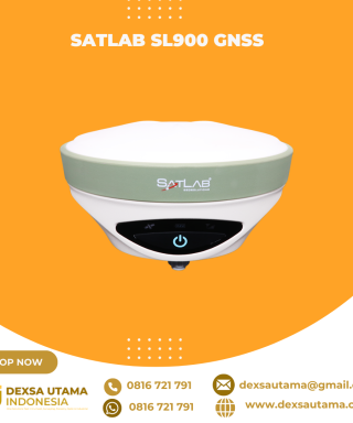 SatLab SL900 GNSS
 -
 South Baterai NB20A Rp0 + PPN 11%


GPS GNSS Alpha Geo L2
GNSS Alpha Geo L2 RTK Laser Handheld: Kecil, Ringan, dan Presisi Tinggi
Dalam dunia survei lahan, teknologi terus berkembang untuk memberikan kemudahan, kecepatan, dan akurasi yang lebih tinggi. Salah satu perangkat terbaru yang menarik perhatian adalah GNSS Alpha Geo L2 RTK Laser Handheld. Alat ini menawarkan keunggulan dalam desain, teknologi pengukuran laser, serta kemampuan menangkap sinyal di lingkungan yang kompleks. Berikut ulasan lengkapnya.
Desain Ultra-Kompak dan Ringan
Saat pertama kali melihat L2 Plus, perangkat ini langsung meninggalkan kesan mendalam. Dengan dimensi hanya 61(L) x 41(W) x 120(H)mm, perangkat ini seukuran genggaman tangan dan bahkan bisa dimasukkan ke dalam saku. Bobotnya hanya 170g, termasuk baterai internal, menjadikannya salah satu perangkat RTK paling ringan di pasaran. Hal ini memberikan kenyamanan ekstra saat digunakan dalam pekerjaan lapangan yang membutuhkan mobilitas tinggi.
Material bodi L2 Plus terbuat dari polymer engineering yang memiliki ketahanan tinggi terhadap suhu ekstrem, korosi, dan tekanan lingkungan yang kompleks. Ini menjadikannya pilihan ideal bagi surveyor yang sering bekerja di medan berat.
Teknologi Laser untuk Pengukuran Presisi
Salah satu fitur unggulan L2 Plus adalah teknologi pengukuran laser fusion yang memungkinkan kalibrasi cepat dan pengukuran dengan tingkat akurasi centimeter-level. Teknologi ini sangat membantu dalam mendapatkan koordinat titik yang sulit dijangkau secara langsung, misalnya:
- Menara tegangan tinggi
- Tutup manhole di jalan raya yang sibuk
- Titik-titik yang berisiko tinggi untuk didekati secara langsung
Dengan laser hijau yang lebih terang, titik target lebih mudah ditemukan, jarak tembak lebih jauh, dan akurasi tetap terjaga. Teknologi ini sangat cocok untuk pengukuran di lingkungan terbuka yang menuntut ketelitian tinggi.
Kemampuan Tangkap Sinyal yang Unggul
Ditenagai oleh mesin GNSS dengan 1408 channel, L2 Plus dapat menangkap sinyal dari semua konstelasi satelit yang beroperasi saat ini, termasuk GPS, GLONASS, BeiDou, dan Galileo. Teknologi ini memungkinkan:
- Penyelesaian fixed solution lebih cepat, bahkan di area dengan sinyal lemah
- Stabilitas pengukuran di lingkungan sulit, seperti di hutan lebat atau dekat bangunan tinggi
- Akurasi tetap terjaga meskipun berada di lokasi dengan hambatan sinyal
Kemampuan ini menjadikan L2 Plus sangat handal untuk pekerjaan survei di medan yang menantang tanpa perlu menunggu lama untuk mendapatkan solusi fixed.
Super Inertial Measurement Unit (IMU) untuk Pengukuran Fleksibel
Teknologi IMU generasi terbaru pada L2 Plus memberikan banyak keuntungan, seperti:
- Inisialisasi cepat dan kalibrasi otomatis, tanpa perlu pengaturan manual
- Tahan terhadap gangguan magnetik, sehingga lebih stabil saat digunakan
- Sudut kemiringan hingga 120°, memungkinkan pengukuran titik dengan posisi yang sulit dijangkau
Dengan fitur IMU ini, surveyor dapat mengumpulkan atau melakukan stakeout titik koordinat dengan lebih cepat dan mudah, tanpa harus menjaga posisi alat tetap tegak lurus seperti pada RTK konvensional.
Specifications
| GNSS Performance | Channels | 1408 |
| Data Format | RTCM2.X、RTCM3.X | |
| Signals tracking | GPS: L1C/A,L2C,L2P, L5 | |
| GLONASS: L1,L2 | ||
| BDS: B1,B1C, B2, B2a, B2b, B3 | ||
| GALILEO: E1, E5a, E5b, E6 | ||
| QZSS: L1, L2, L5, L6 | ||
| SBAS: WAAS, EGNOS, MSAS, GAGAN, SDCM | ||
| Cold start | <60s | |
| Hot start | <15s | |
| Positioning output rate | 1Hz~50HZ | |
| Signal reacquisition | <1s | |
| RTK initialization time | <5s | |
| Initialization reliability | >99.99% | |
| Time accuracy | 20ns | |
| Positioning accuracy* | Static GNSS surveying | H:±(2.5mm+0.5ppm) |
| V:±(5mm+0.5ppm) | ||
| RTK surveying | H:±(8mm+ 1ppm) | |
| V:±(15mm+1ppm) | ||
| Laser surveying | ±1cmm+5mm/m | |
| IMU | Sensor | Supported,4D lMU |
| initialization in 3 seconds | ||
| Update rate | 400Hz | |
| Accuracy | <2.5cm within 120° | |
| Tilt compensation | 0~120% | |
| Communications | l/O interface | Type-C |
| Bluetooth | Bluetooth V4.0 | |
| Electrical | Battery | Built-in Li-ion battery,supports external power supply |
| Capacity | 2000mAh | |
| Battery life | >12hrs | |
| Interface | Type-C 5V/2A | |
| Environmental | Operating temperature | -20°C~+75°C |
| Storage temperature | -40°C~+85°C | |
| Protection IP | IP67 | |
| Shockproof | Survive a 2m pole drop onto concrete | |
| Vibration | MIL-STD-810G | |
| Humidity | 100%Non-condensing | |
| Physical | Dimensions | 120mmx61mmx41mm |
| Weight | 170g | |
| Materials | Polymer engineering materials | |
| Keys | Power button | |
| Indicators | 1*Satellite indicator | |
| 1*Bluetooth indicator | ||
| 1*Data communication | ||
| 1*Power indicator |
Brosure
Hanya pelanggan yang sudah login dan telah membeli produk ini yang dapat memberikan ulasan.
Produk Terkait

ESurvey E800
Baca selengkapnyaHigh-performance RTK Receiver
The E800 is a high-performance GNSS receiver that provides an easy-to-use solution for survey professionals who need to collect highly accurate data in a wide range of applications. The durable IP67 design makes it possible to work in extreme environments. The colorful touchscreen is convenient for quick configurations.


Ulasan
Belum ada ulasan.