



GPS Geodetik RTK Comnav Sino T300
- GPS L1/L2/L5, BeiDou B1/B2/B3/B1C/B2a/B2b, GLONASS L1/L2/L3, Galileo E1/E5a/E5b/E6/AltBOC, QZSS L1/L2/L5, Navic L5, SBAS
- Compact Design
- Hot Swap Battery
- User-friendly Interface
- Support WIFI/UHF/4G
- Web server for easy configuration
| Channel | 965 |
| Satellites tracking | GPS: L1C/A, L2C, L2P, L5 BeiDou:B1I, B2I, B3I, B1C, B2a, B2b GLONASS:L1, L2, L3 Galileo: E1, E5a, E5b, E6, AltBOC QZSS:L1C/A, L1C, L2C, L5 Navic: L5 SBAS: WAAS, EGNOS, MSAS, GAGAN, SDCM,BDSBAS |
| Signal Re-acquisition | <1.5 s |
| Cold Start | <50 s |
| Warm start | <30 s |
| Hot start | <15 s |
| RTK Initialization Time | <10s |
| Initialization reliability | >99.9% |
| Static and Fast Static | Horizontal 2.5 mm + 0.5 ppm RMS Vertical 5 mm + 0.5 ppm RMS |
| Real Time Kinematic | Horizontal 8mm + 1ppm RMS Vertical 15mm + 1ppm RMS |
| Long Observation Static | 3 mm + 0.1 ppm Horizontal 3.5 mm + 0.4 ppm Vertical |
| DGPS | <0.4m RMS |
| SBAS | 1 m 3D RMS |
| Standalone | 1.5m 3D RMS |
Hanya pelanggan yang sudah login dan telah membeli produk ini yang dapat memberikan ulasan.
Produk Terkait


CHCNAV HCE600
Baca selengkapnyaThe HCE600 is a lightweight, professional Android data collector designed for field surveying and mapping. With a 5.5-inch DragonTrail™ display, it offers exceptional durability and clear visibility in sunlight. Packed with Bluetooth 5.0, dual-band Wi-Fi, and a 4G modem, it ensures seamless connectivity with GNSS receivers and RTK networks. Certified to IP67 and MIL-STD-810H standards, the HCE600 is built to withstand harsh environments, making it the ideal handheld controller for reliable data collection in any conditions
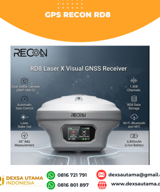
GPS Recon RD8
Baca selengkapnyaRECON RD8 Laser This tool is designed to increase the efficiency and accuracy of measurements in the field, especially in difficult conditions such as closed areas, tall objects, or locations that cannot be reached directly. With a combination of visual and laser technology, the RD8 enables non-contact measurements (without touching the object) and real-time target …

GPS Geodetik RTK Comnav Sino Jupiter Laser
Baca selengkapnyaChannel 1668 Satellites tracking GPS: L1C/A, L1C, L2P, L2C, L5 BDS: B1l, B2l, B3l, B1C, B2a, B2b GLONASS: L1, L2, L3 Galileo: E1, E5a, E5b, E6c, E5 AItBOC QZSS: L1C/A, L2C, L5, L1C IRNSS: L5 SBAS: L1C/A PPP: B2b & HAS L-Band Signal Re-acquisition ≤1s Cold Start ≤30s Hot start ≤10s RTK Initialization Time <5s(Baseline≤10km) …







Ulasan
Belum ada ulasan.