


GPS Geodetik RTK Comnav Sino N2
Slim-line design makes the N2 one of the most compact GNSS receiver: only 48mm and 0.67kg including battery. Compared with a typical GNSS receiver, it is more than 35% thinner and 40% lighter, can be carried, used and operated more easily without fatigue. Lighter, Thinner, and Stronger – N2 is specifically designed for land survey, marine, precision agriculture, machine control, and GIS.
- 1590 channels and 50+ satellites tracking capabilities
- Tracking all running and planned constellations, including GPS, BDS-2, BDS-3, GLONASS, Galileo, QZSS, IRNSS and SBAS
- Up to 15km work range with enhanced UHF
- Up to 120° tilt with 2.5 cm accuracy
- 20+ hrs continuous work with 10000mAh batteries
- Support NFC and Bluetooth connection
- IP67 dust- and waterproof for harsh environments
- Channel1590
- Satellites trackingGPS: L1C/A, L1C, L2P, L2C, L5
BDS: B1l, B2l, B3l, B1C, B2a, B2b
GLONASS: G1, G2, G3
Galileo: E1, E5a, E5b, E6c, E5 AItBOC
QZSS: L1C/A, L2C, L5, L1C
IRNSS: L5
SBAS: L1C/A - Signal Re-acquisition≤1s
- Cold Start≤45s
- Hot start≤15 s
- RTK Initialization Time<10s>
- Initialization reliability≥99.9%
- Internal Memory8GB
- Static and Fast StaticHorizontal 2.5 mm + 0.5 ppm RMS
Vertical 5 mm + 0.5 ppm RMS - Signal Baseline RTKHorizontal 8mm + 1ppm RMS
Vertical 15mm + 1ppm RMS - Long Observation Static3 mm + 0.1 ppm Horizontal
3.5 mm + 0.4 ppm Vertical - DGPS<0.4m RMS
- SBAS0.5m Horizontal
0.8m Vertical - Standalone1.5m 3D RMS
- Data Update Rate1Hz, 2Hz, 5Hz, 10Hz
- Tilt Surveyup to 120° tilt with 2.5cm accuracy
Brosur
Hanya pelanggan yang sudah login dan telah membeli produk ini yang dapat memberikan ulasan.
Produk Terkait


GPS SINGULAR XYZ X1
Baca selengkapnyaThe SingularXYZ X1 GNSS Receiver is a lightweight, ultra-compact RTK receiver designed for demanding field conditions. Offering full satellite tracking, tilt compensation, and a long-lasting battery, it delivers consistent high-precision results in any environment.

GPS Geodetik RTK Comnav Sino Jupiter Laser
Baca selengkapnyaChannel 1668 Satellites tracking GPS: L1C/A, L1C, L2P, L2C, L5 BDS: B1l, B2l, B3l, B1C, B2a, B2b GLONASS: L1, L2, L3 Galileo: E1, E5a, E5b, E6c, E5 AItBOC QZSS: L1C/A, L2C, L5, L1C IRNSS: L5 SBAS: L1C/A PPP: B2b & HAS L-Band Signal Re-acquisition ≤1s Cold Start ≤30s Hot start ≤10s RTK Initialization Time <5s(Baseline≤10km) …


Produk
-
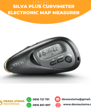 Silva Plus curvimeter Electronic Map measurer
 -
 Geomax Baterai ZBA302 Rp0 + PPN 11%
 -
 GPS GNSS Alpha Geo Matrix II Lite
 -
 Pengunci Horizontal Rp0 + PPN 11%
 -
 Trimble Charger GPS 54344 Rp0 + PPN 11%
 -
 Solinst 101 P7/LM3/150
 -
 Leica DISTO D5
Ulasan
Belum ada ulasan.