



GPS Geodetik RTK Comnav Sino N2
- 1590 channels and 50+ satellites tracking capabilities
- Tracking all running and planned constellations, including GPS, BDS-2, BDS-3, GLONASS, Galileo, QZSS, IRNSS and SBAS
- Up to 15km work range with enhanced UHF
- Up to 120° tilt with 2.5 cm accuracy
- 20+ hrs continuous work with 10000mAh batteries
- Support NFC and Bluetooth connection
- IP67 dust- and waterproof for harsh environments
- Channel1590
- Satellites trackingGPS: L1C/A, L1C, L2P, L2C, L5
BDS: B1l, B2l, B3l, B1C, B2a, B2b
GLONASS: G1, G2, G3
Galileo: E1, E5a, E5b, E6c, E5 AItBOC
QZSS: L1C/A, L2C, L5, L1C
IRNSS: L5
SBAS: L1C/A - Signal Re-acquisition≤1s
- Cold Start≤45s
- Hot start≤15 s
- RTK Initialization Time<10s>
- Initialization reliability≥99.9%
- Internal Memory8GB
- Static and Fast StaticHorizontal 2.5 mm + 0.5 ppm RMS
Vertical 5 mm + 0.5 ppm RMS - Signal Baseline RTKHorizontal 8mm + 1ppm RMS
Vertical 15mm + 1ppm RMS - Long Observation Static3 mm + 0.1 ppm Horizontal
3.5 mm + 0.4 ppm Vertical - DGPS<0.4m RMS
- SBAS0.5m Horizontal
0.8m Vertical - Standalone1.5m 3D RMS
- Data Update Rate1Hz, 2Hz, 5Hz, 10Hz
- Tilt Surveyup to 120° tilt with 2.5cm accuracy
Brosur
Hanya pelanggan yang sudah login dan telah membeli produk ini yang dapat memberikan ulasan.
Produk Terkait
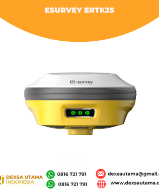

eSurvey eRTK25
Baca selengkapnyaLaser + CAD AR Dual-Tech Integration AR Stakeout: Overlay CAD designs onto real-world environments via AR, boosting on-site efficiency by 40%. Laser Precision: Achieve centimeter-level accuracy with non-contact measurements, ideal for extreme temperatures or tight spaces. High performance and stability: The eSurvey eRTK25 integrates laser ranging technology and AR vision stakeout, enabling robust centimeter-level positioning …
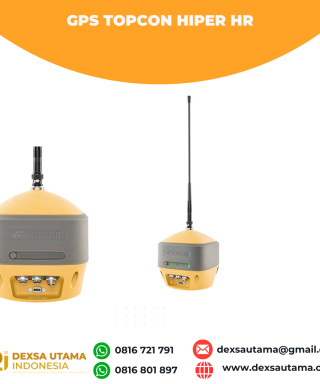
GPS Topcon Hiper HR
Baca selengkapnyaThe HiPer HR GNSS receiver overcomes field challenges with a unique blend of technologies. If you’re under tree cover, or can’t get the pole plumb, or need to range widely from your base, or you need superb accuracy, or work in wet conditions, or all of the above, you’ll be free to do your best work. …

ESurvey E600
Baca selengkapnyaThe new e-survey E600 GNSS Receiver is coming to change the scene in the high-end GNSS receiver market. With up to 800 true channels and surprising performance, it is destined to be the perfect ally of the topographer – and not only – in the pursuit of perfection. E600 supports all the new technologies (Tilt …








Ulasan
Belum ada ulasan.