



GPS Geodetik RTK Comnav Sino N2
- 1590 channels and 50+ satellites tracking capabilities
- Tracking all running and planned constellations, including GPS, BDS-2, BDS-3, GLONASS, Galileo, QZSS, IRNSS and SBAS
- Up to 15km work range with enhanced UHF
- Up to 120° tilt with 2.5 cm accuracy
- 20+ hrs continuous work with 10000mAh batteries
- Support NFC and Bluetooth connection
- IP67 dust- and waterproof for harsh environments
- Channel1590
- Satellites trackingGPS: L1C/A, L1C, L2P, L2C, L5
BDS: B1l, B2l, B3l, B1C, B2a, B2b
GLONASS: G1, G2, G3
Galileo: E1, E5a, E5b, E6c, E5 AItBOC
QZSS: L1C/A, L2C, L5, L1C
IRNSS: L5
SBAS: L1C/A - Signal Re-acquisition≤1s
- Cold Start≤45s
- Hot start≤15 s
- RTK Initialization Time<10s>
- Initialization reliability≥99.9%
- Internal Memory8GB
- Static and Fast StaticHorizontal 2.5 mm + 0.5 ppm RMS
Vertical 5 mm + 0.5 ppm RMS - Signal Baseline RTKHorizontal 8mm + 1ppm RMS
Vertical 15mm + 1ppm RMS - Long Observation Static3 mm + 0.1 ppm Horizontal
3.5 mm + 0.4 ppm Vertical - DGPS<0.4m RMS
- SBAS0.5m Horizontal
0.8m Vertical - Standalone1.5m 3D RMS
- Data Update Rate1Hz, 2Hz, 5Hz, 10Hz
- Tilt Surveyup to 120° tilt with 2.5cm accuracy
Brosur
Hanya pelanggan yang sudah login dan telah membeli produk ini yang dapat memberikan ulasan.
Produk Terkait
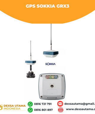

GPS Sokkia GRX3
Baca selengkapnyaNumber of Universal Tracking Channels 226 UTC technology Tracked Signals GPS L1 C/A, L1C, L2P(Y), L2C, L5 GLONASS L1 C/A, L1P, L2 C/A, L2P, L3C BeiDou B1, B2 Galileo E1,E5a, E5b, Alt-BOC SBAS L1 C/A, L5 WAAS/MSAS/EGNOS/GAGAN QZSS L1 C/A, L1C, L1-SAIF, L2C, L5 Static/Fast Static H: 3 mm + 0.4 ppm V: 5 mm …

ESurvey E800
Baca selengkapnyaHigh-performance RTK Receiver
The E800 is a high-performance GNSS receiver that provides an easy-to-use solution for survey professionals who need to collect highly accurate data in a wide range of applications. The durable IP67 design makes it possible to work in extreme environments. The colorful touchscreen is convenient for quick configurations.

GPS Hitarget V30 Plus Rover
Baca selengkapnyaHi-Target V30 Plus adalah
sistem Global Navigation Satellite System (GNSS) RTK (Real-Time Kinematic) geodetik, yang dirancang untuk survei dan pemetaan dengan presisi tinggi. Perangkat ini memiliki desain kokoh berkelas industri yang ringkas, dengan mesin GNSS multi-konstelasi untuk pemosisian yang stabil dan akurat bahkan di lingkungan yang sulit.







Ulasan
Belum ada ulasan.