

GPS RTK STEC SV1
Empowered by ZENITH Algorithm, SmartView is capable to track enormous signals of all constellations with stunningly fast fixing speed even under thick cover of trees or beside tall buildings. Coordinates will be examined twice to ensure an utmost accuracy.
GNSS Geodetik RTK STEC SV1 adalah penerima GNSS canggih yang menggabungkan ide dan teknologi terdepan di industri, menawarkan keseimbangan sempurna antara akurasi, kesederhanaan, dan efisiensi untuk pekerjaan survei di berbagai lingkungan yang menantang.
GNSS Geodetik RTK STEC SV1 Didukung oleh Algoritma ZENITH, SmartView mampu melacak sinyal besar dari semua konstelasi dengan fiksasi yang sangat cepat, bahkan di bawah naungan pohon lebat atau di samping gedung tinggi. Koordinat akan diperiksa dua kali untuk memastikan akurasi maksimum.
GNSS Geodetik RTK STEC SV1 Pada AR Stake Out mengoordinasikan kamera pada pengontrol dan penerima. Ketika Anda cukup jauh dari titik tersebut, pengontrol menunjukkan arah umum ke titik tersebut
Brosure
Hanya pelanggan yang sudah login dan telah membeli produk ini yang dapat memberikan ulasan.
Produk Terkait


ESurvey E800
Baca selengkapnyaHigh-performance RTK Receiver
The E800 is a high-performance GNSS receiver that provides an easy-to-use solution for survey professionals who need to collect highly accurate data in a wide range of applications. The durable IP67 design makes it possible to work in extreme environments. The colorful touchscreen is convenient for quick configurations.

ESurvey E600
Baca selengkapnyaThe new e-survey E600 GNSS Receiver is coming to change the scene in the high-end GNSS receiver market. With up to 800 true channels and surprising performance, it is destined to be the perfect ally of the topographer – and not only – in the pursuit of perfection. E600 supports all the new technologies (Tilt …
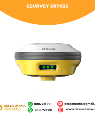
eSurvey eRTK25
Baca selengkapnyaLaser + CAD AR Dual-Tech Integration AR Stakeout: Overlay CAD designs onto real-world environments via AR, boosting on-site efficiency by 40%. Laser Precision: Achieve centimeter-level accuracy with non-contact measurements, ideal for extreme temperatures or tight spaces. High performance and stability: The eSurvey eRTK25 integrates laser ranging technology and AR vision stakeout, enabling robust centimeter-level positioning …







Ulasan
Belum ada ulasan.