


SatLab SL8 Laser GNSS
SatLab SL8 Laser RTK combines dual cameras, GNSS, IMU,and visible laser technology to make surveying faster and easier. With non-contact measurement, image-assisted targeting, CAD live-view stakeout, and a built-in LoRa radio,It ensures smooth, reliable work even in complex or GNSS-limited environments.
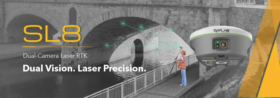
Laser Measurement — Wide Coverage for Typical Tasks
Achieve 2 cm accuracy within 10 m using Laser RTK, even in GNSS-denied environments.
Perfect for bridges, tunnels, riverbanks, and other complex sites where traditional GNSS cannot work.
Exclusive Image-assisted Targeting— Fast & Accurate Aiming
Laser points are directly overlaid on real-time images in SatSurv software, enabling users to instantly locate and aim at distant objects.
This visual workflow greatly improves on-site speed and confidence.
Automotive-grade IMU — Greatly Boosted Efficiency
The automotive-grade IMU requires no manual calibration or initialization—just power on and measure.
It delivers stable, precise results and boosts accuracy by up to 40%, even in GNSS-challenged areas.
Extended-Range LoRa Communication — Reliable Transmission Beyond 15 km
With a built-in multi-protocol LoRa transceiver, SL8 ensures stable communication over 15 km and seamless compatibility with various RTK brands.
Our self-developed LoRa algorithms maintain strong, reliable links across long distances.
CAD & Visual Stakeout— 50% Faster Layout
A high-performance CAD engine combined with real-scene imagery allows users to stake out directly from visual and CAD views.
See your target points on-site for a safer, faster, and more intuitive workflow—improving efficiency by up to 50%.
Video Player
Brosure
Hanya pelanggan yang sudah login dan telah membeli produk ini yang dapat memberikan ulasan.
Produk Terkait


CHCNAV DL8 Radio External
Baca selengkapnyaThe DL8 UHF radio modem provides reliable base-to-rover GNSS RTK corrections over long distances. Designed for harsh environments, it supports up to 28 W of adjustable output power, ensuring robust communication even in challenging conditions. With customizable frequency channels and a rugged IP67-rated enclosure, the DL8 is an essential tool for surveyors requiring dependable and high-performance data links.

CHCNAV HCE600
Baca selengkapnyaThe HCE600 is a lightweight, professional Android data collector designed for field surveying and mapping. With a 5.5-inch DragonTrail™ display, it offers exceptional durability and clear visibility in sunlight. Packed with Bluetooth 5.0, dual-band Wi-Fi, and a 4G modem, it ensures seamless connectivity with GNSS receivers and RTK networks. Certified to IP67 and MIL-STD-810H standards, the HCE600 is built to withstand harsh environments, making it the ideal handheld controller for reliable data collection in any conditions


Ulasan
Belum ada ulasan.