

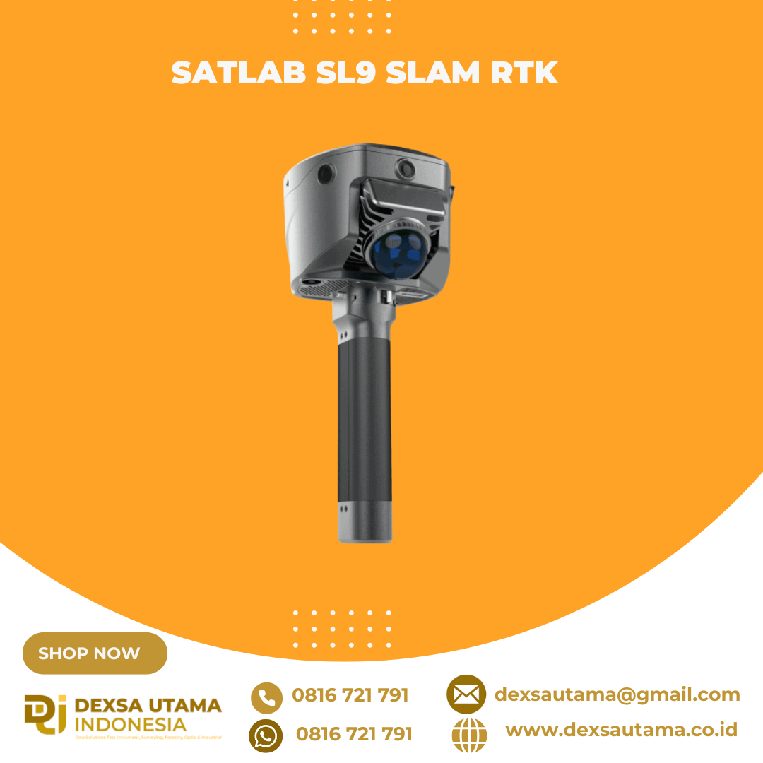
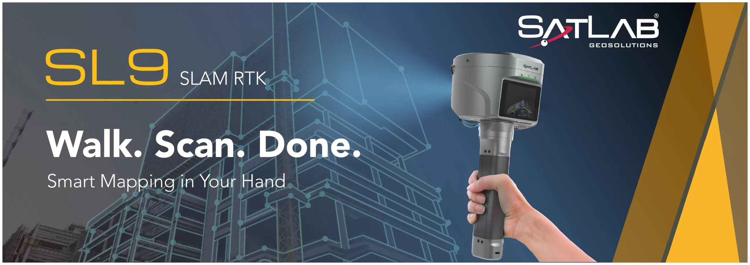
SatLab SL9 SLAM RTK
SatLab SL9 SLAM RTK combines high-precision GNSS positioning with cutting-edge SLAM technology, eliminating the spatial constraints of traditional RTK measurements. Whether in urban buildings, dense forests, or indoor environments, SL9 ensures reliable, precise measurements, redefining efficiency and versatility in fieldwork
1. New Image Measurement Experience
With three HD cameras and SLAM integration, the SL9 lets you measure in real-time—just select the target point in the image to get its 3D coordinates. Achieve 2–5 cm accuracy within 15 meters using the Satsurv app.
2. Boundaryless Surveying with SLAM-Fix Tech
SL9 smartly switches between RTK and SLAM. Get reliable coordinates even under bridges, eaves, or indoors—no signal, no problem.
3. Unified Coordinate System
No more stitching data. SL9 keeps your coordinates unified across environments—no control points, no loop closure, no hassle.
4. Fast & Easy Volume Calculation
Instantly generate 3D terrain and calculate volumes right on-site using the Android-based Satsurv app.
5. Reliable Signal, High-Quality Data
Track all major constellations with superior performance in tough environments, achieving centimeter-level accuracy.
6. Precision Post-Processing with Sat-LiDAR
Post-process your data with Sat-LiDAR for <2 cm thickness and <1 cm accuracy. The software supports tunnel excavation analysis, progress monitoring, and acceptance checks. It also aids renovation projects with cross-section, plan, and elevation outputs.
Video Player
Applications
- Semi-Open Environment Surveys
- 3D Facility Mapping
- Engineering Surveys

Brosure
Hanya pelanggan yang sudah login dan telah membeli produk ini yang dapat memberikan ulasan.
Produk Terkait


LiDAR CHCNAV AlphaAir 450
Baca selengkapnyaThe AlphaAir 450 is designed for simplicity and precision, making advanced geospatial reality capture accessible to non-professional users and those new to the technology. At an affordable price, the AA450 combines ease-of-use with high-precision capabilities. This lightweight, durable solution integrates a high-performance laser scanner, a professional-grade 26 MP industrial camera, and a high-precision inertial navigation system to ensure superior data collection quality.

Laser Scanner CHCNAV RS10
Baca selengkapnyaThe RS10 integrates GNSS RTK, laser scanning, and visual SLAM technologies into one single platform. This fusion increases the efficiency and accuracy of both indoor and outdoor 3D scanning and surveying tasks. It gives surveyors the ability to work in areas with weak GNSS signals, providing unparalleled flexibility. Designed for surveying, BIM, forestry, power line inspection, underground mapping, and more, the RS10 embodies versatility, making it an essential tool for professionals looking to expand their surveying capabilities.

Laser Scanner Lixel K1
Baca selengkapnyaLaser Scanner Lixel K1 – Scanner 3D Genggam yang Ringkas & Presisi Lixel K1 adalah perangkat pemindaian dan pemodelan 3D Lidar genggam yang ringkas, ringan, dan mudah digunakan. Dengan berat hanya 1 kg, alat ini dirancang untuk kemudahan mobilitas dan efisiensi kerja. Fitur Unggulan Laser Scanner Lixel K1 Ringkas & Mudah Dibawa – Material aluminium …
CHCNAV ViLi i100
Baca selengkapnyaThe ViLi i100 is CHCNAV’s flagship GNSS RTK receiver, combining advanced satellite filtering, enhanced SFix 2.0 positioning and innovative Vi-LiDAR technology. It provides reliable, centimetre-level accuracy even in challenging GNSS environments, allowing professionals to extend the boundaries of traditional GNSS surveying.


Ulasan
Belum ada ulasan.