

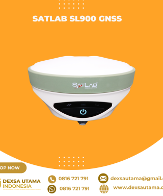


GPS Geodetik RTK South Galaxy G1 Plus
Harga Sudah termasuk PPN 10%
Features

• Behind every significant epoch-making change in human society, always accompanied by the birth of an important technology.
• Computer and electronics make surveying and mapping industry achieve a span from the analog age to the digital age.
• And the development of Internet technology further opens the prelude of surveying and mapping information age.
• In the form of the ubiquitous, internet is penetrating and fusion in all corners of the surveying technology, and setting off an unprecedented reconstruction and
transformation.
• In the dawn of a new era, south is walking in front of it to craft Galaxy 1plus which opening a ‘+’ era of high-precision positioning applications.
| Berat | 35 kg |
|---|
Specifications
| GNSS performance | Channels | 336, 555 (optional) |
| GPS | L1 C/A, L2E, L2C, L5 | |
| GLONASS | L1 C/A, L2 C/A, L3 | |
| BDS | B1, B2, B3 | |
| GALILEO | E1, E5A, E5B, E5AltBOC, E6 | |
| SBAS | L1 C/A, L5 QZSS, WAAS, MSAS, EGNOS, GAGAN | |
| L-Band | RTX Function | |
| Positioning output rate | 1Hz~50Hz | |
| Initialization time | <10s | |
| Initialization reliability | >99.99% | |
| Positioning precision | Static surveying | Horizontal: 2.5mm+0.5ppm; Vertical: 5mm+0.5ppm |
| Code differential positioning | Horizontal: 0.25m+1ppm; Vertical: 0.50m+1ppm | |
| Real-time kinematic surveying | Horizontal: 8mm+1ppm; Vertical: 15mm+1ppm | |
| RTX | Horizontal: 4-10cm (5-30min); Vertical: 8-20cm (5-30min) | |
| SBAS positioning | Typically<5m 3DRMS | |
| xFill | ||
| IMU tilt compensation | ||
| Single positioning | — | |
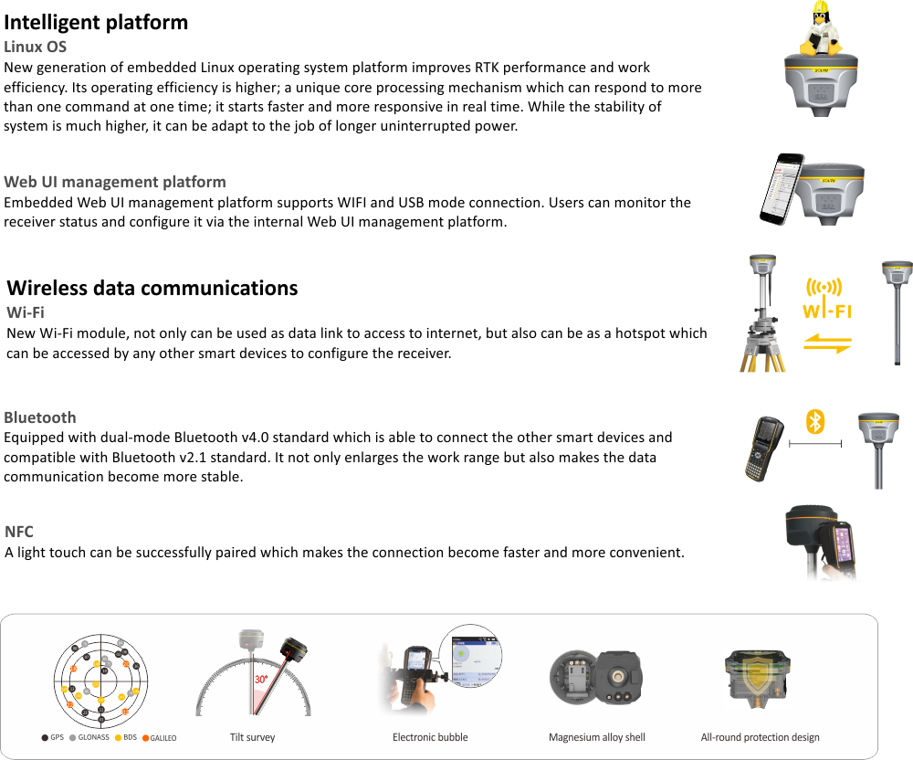
| User interaction | Operaing system | Linux |
| Buttons | 2 buttons operation | |
| LCD | — | |
| Indicators | 5 indicate lights | |
| Web UI | Freely to configure and monitor the receiver by accessing to the web server via Wi-Fi and USB | |
| Voice guide | iVoice intelligent voice technology provides status and voice guide, Supports Chinese, English, Korean, Russian, Portuguese, Spanish, Turkish and user define | |
| Secondary development | Providing secondary development package | |
| Data cloud service | — | |
| Hardware performance | Dimension | 135mm (Diameter) x 125mm (Height) |
| Weight | 1.29kg (with two batteries) | |
| Material | Magnesium aluminum alloy shell | |
| Operating temperature | -30°C ~ +65°C | |
| Storag temperature | -40°C ~ +80°C | |
| Humidity | 95% Non-condensing | |
| Waterproof/Dustproof | IP67 standard, protected from long time immersion to depth of 1m, and fully protected against blowing dust | |
| Shock and vibration | Withstand 2 meters drop onto the cement ground naturally | |
| Power Supply | 9-25V DC, overvoltage protection | |
| Battery | Rechargeable, removable Lithium-ion battery, 7.4V 3400mAh/per | |
| Battery solution | Supports one or two batteries installed; supports power pole connection (optional); 4 standard batteries power package (optional) | |
| Battery life | Single battery: >10h (static mode), >6h (internal UHF base mode), >8h (rover mode) | |
| Communications | I/O port | 5-PIN LEMO external power port + RS232, 7-PIN external USB(OTG)+Web accessing, 1 radio antenna interface, SIM card slot |
| Wireless modem | Built-in radio, 1W/2W/3W switchable, typically work range can be 8KM | |
| Frequency Range | 410-470MHz | |
| Communication Protocol | TrimTalk450s, SOUTH, SOUTH+, huace, ZHD, Satel | |
| Cellular Mobile Network | TDD-LTE, FDD-LTE 4G network modem | |
| Double Module Bluetooth | BLEBluetooth 4.0 standard, Bluetooth 2.1 + EDR standard | |
| NFC Communication | Realizing close range (shorter than 10cm) automatic pair between receiver and controller | |
| External Devices | Optional external GPRS/EDGE dual-mode communication module, switchable | |
| WIFI | Standard | 802.11 b/g standard |
| WIFI Hotspot | The WIFI hotspot allows any mobile terminal to connect and access to the internal webserver for the control and moditor receiver | |
| WIFI data link | To work as the datalink that receiver is able to broadcast and receive differential data via WIFI | |
| Data storage/ Transmission | Data Storage | 8GB SSD internal storage, supports external USB storage and automatical cycle storage, changeable record interval, up to 50Hz raw data collection |
| Data Transmission | USB data transmission, supporting FTP/HTTP data download | |
| Data Format | Static data format: STH, Rinex2.x and Rinex3.x etc Differential data format: CMR+, SCMRx, RTCM 2.1, RTCM 2.3, RTCM 3.0, RTCM 3.1, RTCM 3.2 GPS output data format: NMEA 0183, PJK plane coordinates, binary code, Trimble GSOF Network model support: VRS, FKP, MAC, supporting NTRIP protocol | |
| Inertial sensing system | Tilt survey | Built-in tilt compensator, correcting coordinates automatically according to the tilt direction and angle of the centering rod |
| Electronic bubble | Controller software display electronic bubble, checking leveling status of the centering rod real time | |
| Thermometer | Built-in thermometer sensors, adopting intelligent temperature control tech nology, monitoring and adjusting the receiver temperature in real time |
Note: all information above is subject to change without any prior notice.
Brosur
Hanya pelanggan yang sudah login dan telah membeli produk ini yang dapat memberikan ulasan.
Produk Terkait


ESurvey E800
Baca selengkapnyaHigh-performance RTK Receiver
The E800 is a high-performance GNSS receiver that provides an easy-to-use solution for survey professionals who need to collect highly accurate data in a wide range of applications. The durable IP67 design makes it possible to work in extreme environments. The colorful touchscreen is convenient for quick configurations.

CHCNAV HCE600
Baca selengkapnyaThe HCE600 is a lightweight, professional Android data collector designed for field surveying and mapping. With a 5.5-inch DragonTrail™ display, it offers exceptional durability and clear visibility in sunlight. Packed with Bluetooth 5.0, dual-band Wi-Fi, and a 4G modem, it ensures seamless connectivity with GNSS receivers and RTK networks. Certified to IP67 and MIL-STD-810H standards, the HCE600 is built to withstand harsh environments, making it the ideal handheld controller for reliable data collection in any conditions

ESurvey E600
Baca selengkapnyaThe new e-survey E600 GNSS Receiver is coming to change the scene in the high-end GNSS receiver market. With up to 800 true channels and surprising performance, it is destined to be the perfect ally of the topographer – and not only – in the pursuit of perfection. E600 supports all the new technologies (Tilt …

 0816 721 791
 dexsautama@gmail.com



Ulasan
Belum ada ulasan.