Popular
-

 GPS TOKNAV T10 PRO Rp0 + PPN 11%
 -
 LEICA GKL311 CHARGER Rp0 + PPN 11%
 -
 Trimble C5 HP 5" Rp0 + PPN 11%
 -
 Calico Sample Bags 50x50cm
 -
 Solinst 101 P7/LM3/400

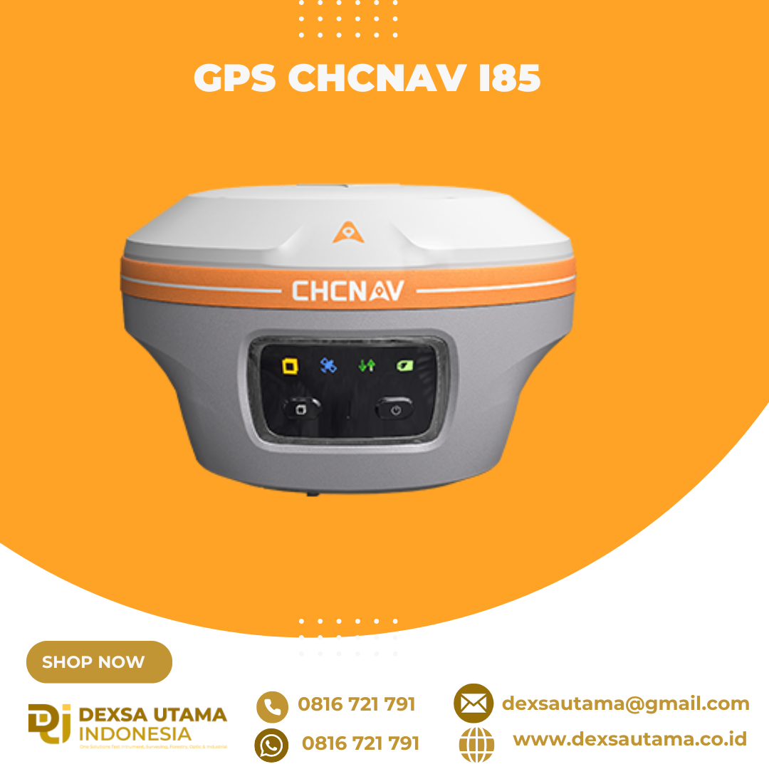
GPS CHCNAV i85
The CHCNAV i85 is a compact, high-performance GNSS solution for daily land surveying. Featuring a 1408-channel GNSS module, advanced IMU, integrated dual cameras, and laser rangefinder, it delivers reliable positioning in challenging environments, even under high solar activity. Weighing 800 g with an IP68 rating and 20-hour battery life, the i85 ensures efficient, dependable RTK performance in the field.
With its laser-based surveying capabilities and high-precision heading information, the i85 enables accurate measurements of points that are otherwise inaccessible, expanding your reach without sacrificing accuracy.
Powered by the iStar2.0 algorithm and ionospheric interference rejection, the i85 achieves a 96% fix reliability in low-latitude regions affected by solar activity. It ensures robust signal tracking in challenging environments.
A true 8-megapixel front-facing camera supported by edge computing provides adaptive 6x zoom and enhanced imagery. Low visibility and distant points can be identified and targeted with precision.
The i85’s AR-based navigation and stakeout tools simplify workflows and reduce operator effort by up to 50%. With accuracy up to 10 times greater than conventional gyroscope-based systems, it improves results even for less experienced users.
The 200Hz IMU supports automatic tilt compensation with no manual initialization required. The i85 maintains 3 cm accuracy within a 60° tilt range, delivering consistent results.
Built for demanding field use, the i85 combines all key components into a single compact 800 g unit. It is IP68-rated for water and dust resistance and can withstand a 2-meter pole drop.
Specifications
Brosure
Hanya pelanggan yang sudah login dan telah membeli produk ini yang dapat memberikan ulasan.
Produk Terkait

CHCNAV DL8 Radio External
Baca selengkapnyaThe DL8 UHF radio modem provides reliable base-to-rover GNSS RTK corrections over long distances. Designed for harsh environments, it supports up to 28 W of adjustable output power, ensuring robust communication even in challenging conditions. With customizable frequency channels and a rugged IP67-rated enclosure, the DL8 is an essential tool for surveyors requiring dependable and high-performance data links.


Ulasan
Belum ada ulasan.