


GPS Garmin Montana 710
STAY ON TRACK THROUGH ALL KINDS OF ADVENTURES
With routable mapping for roads and trails, the Montana 710 handheld brings advanced outdoor features into a sturdy 5-inch format that’s ideal for navigation on foot, bike, kayak, ATV and more.
![]()
![]()
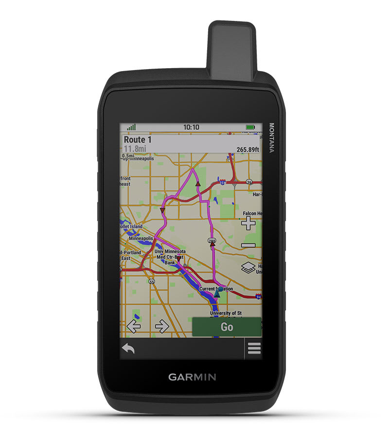
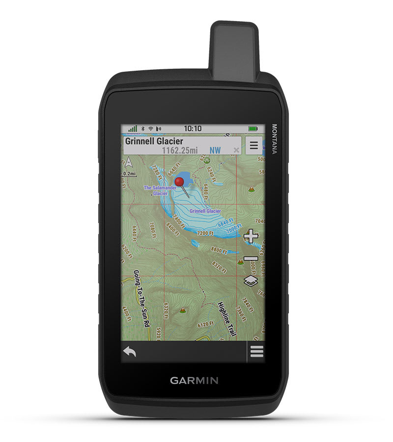
LARGE 5-INCH GLOVE-FRIENDLY TOUCHSCREEN
![]()
![]()
PRELOADED TOPOGRAPHIC MAPS WITH LANDMARKS
![]()
![]()
MEETS MIL-STD 810 FOR THERMAL, SHOCK, WATER AND VIBRATION
![]()
![]()
SATELLITE IMAGERY SHOWS VIVID OVERHEAD VIEWS OF YOUR ROUTE
![]()
![]()
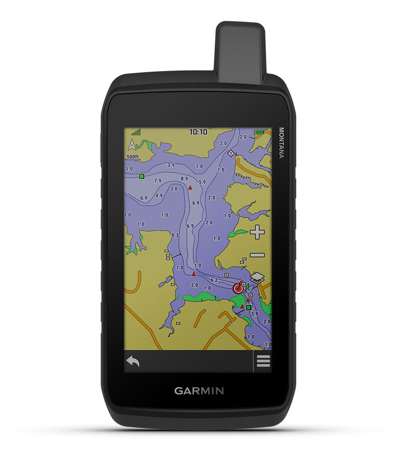
SUPPORTS OUTDOOR MAPS+ FOR PREMIUM MAPPING (SOLD SEPARATELY)
![]()
![]()
PLAN AND REVIEW TRIPS WITH THE GARMIN EXPLORE™ SMARTPHONE APP
WHAT YOU’LL LOVE
RUGGED BY DESIGN
This durable, water-resistant handheld is tested to meet MIL-STD 810 for thermal, shock, water and vibration. It features a glove-friendly 5-inch touchscreen and is compatible with a variety of robust mounting solutions (sold separately) to best suit your activities.
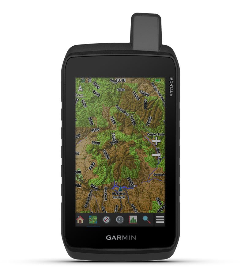
TOPOACTIVE MAPS
To navigate your adventures, use preloaded worldwide topographical maps. View terrain contours, elevations, coastlines, rivers, landmarks and more.
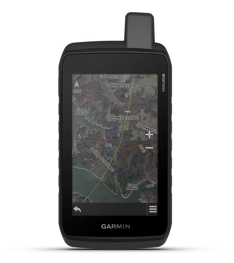
SATELLITE VIEWS
Access subscription-free, high-resolution satellite imagery with direct-to-device downloads over Wi-Fi® connectivity. See photorealistic overhead views of routes and surrounding terrain, and easily create waypoints based on landmarks.
ADDITIONAL MAPS
With 32 GB of onboard memory, you can download even more maps, such as City Navigator® maps for your drive or BlueChart® g3 charts for the water (sold separately).
OUTDOOR MAPS+
With a subscription to Outdoor Maps+ (sold separately), get ongoing access to a wide variety of premium mapping content and regular updates sent right to your Garmin device via Wi-Fi technology.
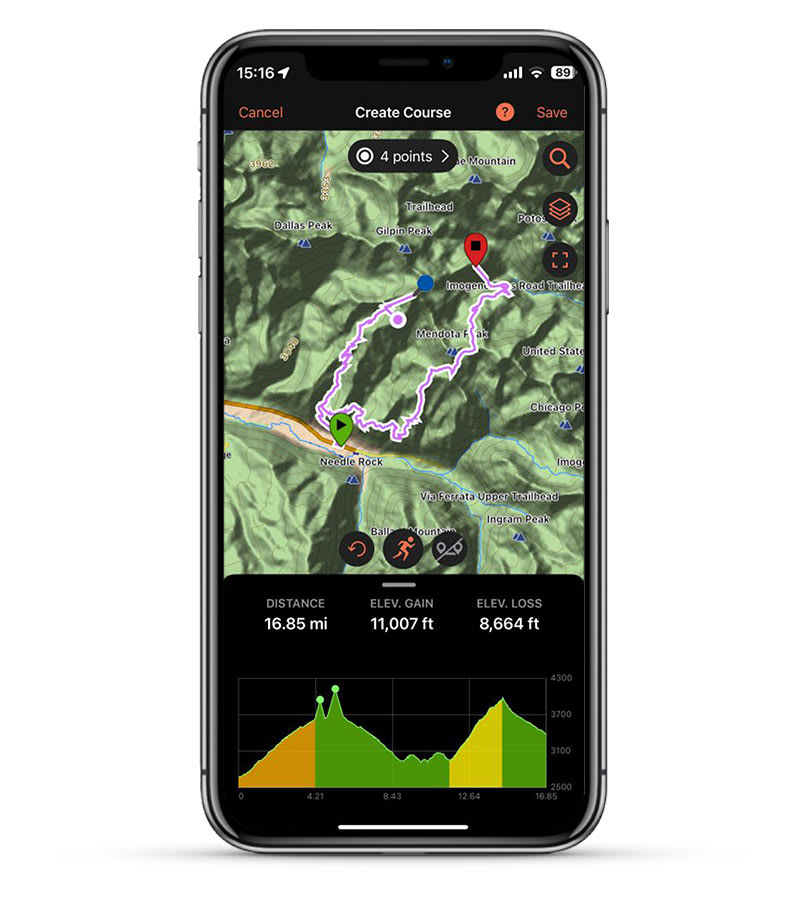
GARMIN EXPLORE APP
Pair with the Garmin Explore app to plan and review trip data, plus manage your waypoints, courses and activities.
Hanya pelanggan yang sudah login dan telah membeli produk ini yang dapat memberikan ulasan.
Produk Terkait


GPS Garmin GPSMAP 86s
Baca selengkapnyaDATA KAPAL Sinkronkan dengan chartplotter dan instrumen Garmin yang kompatibel untuk melihat data kapal waktu nyata yang ditampilkan langsung di perangkat genggam Anda. AUDIO FUSION-LINK Dapatkan pengoperasian jarak jauh yang nyaman untuk produk kelautan Fusion onboard tertentu. PELACAKAN AKURAT Saat Anda sedang dalam perjalanan, filter GPS yang dapat disesuaikan memperhalus kecepatan dan indikasi arah saat …

GPS Garmin GPSMAP 585 Plus
Baca selengkapnyaFind fishing spot, Catch fish with the Power of Garmin CHIRP Multi language support : English, Simplified Chinese, Traditional Chinese, Japanese, Korean, Indonesia Bahasa, Malaysia Bahasa, Vietnamese, Burmese, Thai. Available in 6-inch WVGA color, portrait mode display. Offers a keyed interface with dedicated buttons. CHIRP sonar sends a continuous sweep of frequencies ranging from low …

GPS Garmin GPSMAP 66i
Baca selengkapnyaMORE ADVENTURE. LESS WORRY. Precise navigation meets global communication in the rugged GPSMAP 66i button-operated GPS handheld and satellite communicator1 featuring Garmin TopoActive mapping and inReach® technology. Need assistance? Send interactive SOS alerts anytime, globally. No matter where you are, two-way messaging lets you connect to the ones who matter. Let loved ones know precisely …

Garmin GSD 25
Baca selengkapnyaPremium CHIRP and Scanning Sonar Module Premium remote network sonar solution Includes true dual-channel 1 kW CHIRP, plus CHIRP SideVü and ClearVü scanning sonar for the clearest images on the water (transducers sold separately) Provides serious sportsfishers outstanding fishfinding and bottom tracking capabilities Helps distinguish between small and closely spaced fish at key fishing depths …


Ulasan
Belum ada ulasan.