Category
- Uncategorized
- Abney Level
- Alat Curah Hujan
- Alat Survey
- Alat Survey Aksesoris
- Altimeter
- Anemometer
- Anemometer Kestrel
- Binocular Bushnell
- Binocular Nikon
- Borescope Endoscope
- Curvimeter
- Densiometer
- Detektor Petir
- Digipas Digital Level
- Disto Meter
- Drone
- Dulang
- Echo Sounder
- Global Water
- GPS
- GPS Aksesoris
- Hammer Test & Profometer
- Hand Lens
- Humidity / Temp
- Inclinometer
- Kabel Locator
- Kompas
- LiDAR Laser Scanner
- Meteran
- Notebooks
- Palu Geologi
- Photometer
- Pita Survey/Flagging Tape
- Pocket Microscope
- Protractor Ruler
- Radar Gun
- Sampel Bag
- Software
- Soil Tester
- Susceptibility Meter
- Tachometer
- Telepon Satelit
- Temperature & Data Logger
- Tension Meter
- USV
- Water Level Meters
- Weather Station


Versatile Performance
Better things in smaller packages!
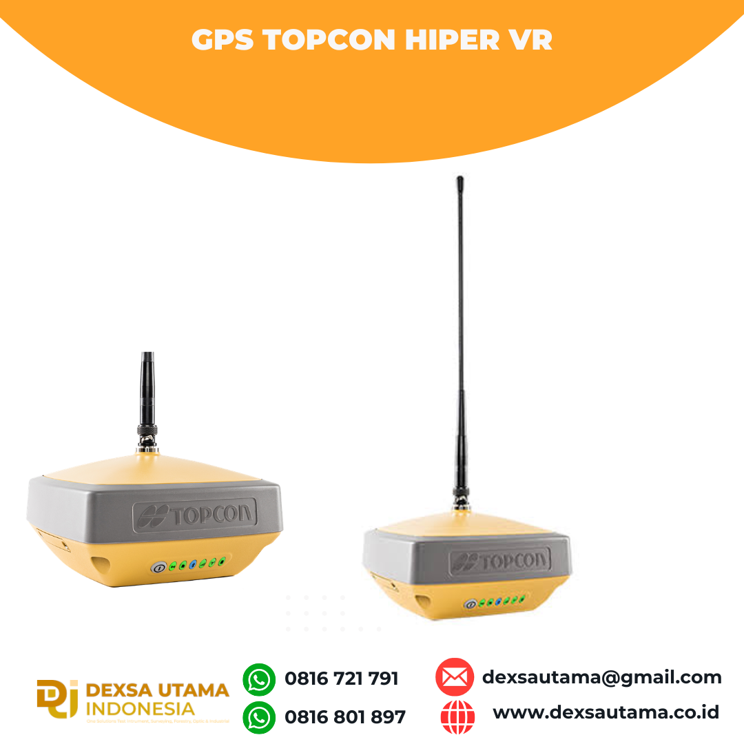
The HiPer VR* is compact, light and packed with the most advanced GNSS technology in a design built to withstand the harshest field environments. Using Topcon’s advanced GNSS chipset with Universal Tracking Channels Technology, the HiPer VR automatically tracks every satellite signal above – now and into the future.
All signals, all satellites and all constellations — in a compact, rugged design, with an integrated IMU and eCompass.
The HiPer VR is a complete solution and versatile in many ways. It can be used for static or kinematic GNSS post-processed surveys, as a network RTK rover with the FC-5000’s internal 4G/LTE cellular modem, as a UHF/FH/Longlink jobsite RTK rover, and also in Topcon’s patented Hybrid Positioning workflow.
Top features include:
- Universal tracking technology for all satellites and constellations (GPS, GLONASS, Galileo, Beidou, IRNSS, QZSS, SBAS) covering all modernized signals
- Field tested, field ready IP67 design
- Compact form factor ideal for Millimeter GPS and Hybrid Positioning
- Revolutionary 9-axis IMU and ultra-compact 3-axis eCompass
- Integrated 400 MHz UHF Tx/Rx Radio Modem
- Integrated License free 900 MHz Radio Modem, FH915 protocol
| Berat | 40 kg |
|---|
Specifications
L1 C/A, L1C* L2C, L2P(Y), L5
L1 C/A, L1P, L2C/A, L2P, L3C*
E1/E5a/E5b/Alt-BOC
B1, B2
L5
WAAS, EGNOS, MSAS, GAGAN (L1/L5§)
TopNET Global D & C Corrections services
L1 C/A, L1C, L1-SAIF, L2C, L5
V: 5 mm + 0.5 ppm
V: 10 mm + 0.8 ppm
Tilt ≤ 10°
H: 1.8 mm/°Tilt;
Tilt > 10°
TX mode 1W – 6hr
Max Transmit Power: 1W
Range: 5-7 km typical; 15 km
(w x h x d)
Brosur
Kelengkapan
1x Base
1x Rover
2x OAF, GLONASS L1 L2 Tracking
2x Antenna UHF 425-470 Male BNC
2x Hard Carry Case
1x Bipod
1x Data Kontroller FC-500
1x Bracket for Data Kontroller –
1x Pole Carbon
1x Software Post Procces
1x Tribrach with Adapter –
1x Tripod
Hanya pelanggan yang sudah login dan telah membeli produk ini yang dapat memberikan ulasan.
Produk Terkait
CHCNAV HCE600
Baca selengkapnyaThe HCE600 is a lightweight, professional Android data collector designed for field surveying and mapping. With a 5.5-inch DragonTrail™ display, it offers exceptional durability and clear visibility in sunlight. Packed with Bluetooth 5.0, dual-band Wi-Fi, and a 4G modem, it ensures seamless connectivity with GNSS receivers and RTK networks. Certified to IP67 and MIL-STD-810H standards, the HCE600 is built to withstand harsh environments, making it the ideal handheld controller for reliable data collection in any conditions
GPS Geodetik RTK Comnav Sino Jupiter Laser
Baca selengkapnyaChannel 1668 Satellites tracking GPS: L1C/A, L1C, L2P, L2C, L5 BDS: B1l, B2l, B3l, B1C, B2a, B2b GLONASS: L1, L2, L3 Galileo: E1, E5a, E5b, E6c, E5 AItBOC QZSS: L1C/A, L2C, L5, L1C IRNSS: L5 SBAS: L1C/A PPP: B2b & HAS L-Band Signal Re-acquisition ≤1s Cold Start ≤30s Hot start ≤10s RTK Initialization Time <5s(Baseline≤10km) …

- Kirim Seluruh Indonesia
- Layanan pengiriman menjangkau seluruh Indonesia dengan proses cepat dan andal.

- Produk Pilihan
- Setiap produk dicek untuk memastikan kualitas dan fungsi terbaik bagi kebutuhan Anda

- Pembayaran Aman
- Sistem pembayaran terjamin aman dengan berbagai metode yang praktis dan terpercaya.


Ulasan
Belum ada ulasan.