

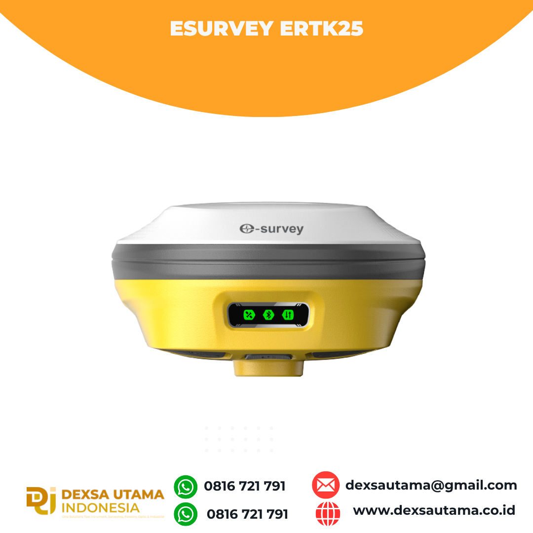
eSurvey eRTK25
Laser + CAD AR Dual-Tech
Integration
AR Stakeout:
Overlay CAD designs onto real-world
environments via AR, boosting on-site
efficiency by 40%.
Laser Precision:
Achieve centimeter-level accuracy
with non-contact measurements,
ideal for extreme temperatures
or tight spaces.
High performance and stability:
The eSurvey eRTK25 integrates laser
ranging technology and AR vision
stakeout, enabling robust
centimeter-level positioning even
in harsh or constrained settings.
Its multimodal sensor fusion ensures
operational adaptability across
diverse scenarios, including full
daylight visibility, narrow spaces,
and extreme temperature ranges
(-30°C to 70°C), making it ideal
for industrial, construction,
and geospatial applications requiring
precision in dynamic environments
Brosure
Hanya pelanggan yang sudah login dan telah membeli produk ini yang dapat memberikan ulasan.
Produk Terkait


CHCNAV DL8 Radio External
Baca selengkapnyaThe DL8 UHF radio modem provides reliable base-to-rover GNSS RTK corrections over long distances. Designed for harsh environments, it supports up to 28 W of adjustable output power, ensuring robust communication even in challenging conditions. With customizable frequency channels and a rugged IP67-rated enclosure, the DL8 is an essential tool for surveyors requiring dependable and high-performance data links.
GPS Topcon HiPer VR
Baca selengkapnyaVersatile Performance Better things in smaller packages! The HiPer VR* is compact, light and packed with the most advanced GNSS technology in a design built to withstand the harshest field environments. Using Topcon’s advanced GNSS chipset with Universal Tracking Channels Technology, the HiPer VR automatically tracks every satellite signal above – now and into the future. All …
GPS Sokkia GCX3
Baca selengkapnyaGet centimeter-level results without being weighed down by your equipment. This compact receiver delivers full-featured, high-precision performance. The GCX3 is the ideal local job site base/rover RTK (Real Time Kinematic) system or network RTK rover – and like all of our solutions, you can customize it to meet your needs and create your own workflows. …

CHCNAV HCE600
Baca selengkapnyaThe HCE600 is a lightweight, professional Android data collector designed for field surveying and mapping. With a 5.5-inch DragonTrail™ display, it offers exceptional durability and clear visibility in sunlight. Packed with Bluetooth 5.0, dual-band Wi-Fi, and a 4G modem, it ensures seamless connectivity with GNSS receivers and RTK networks. Certified to IP67 and MIL-STD-810H standards, the HCE600 is built to withstand harsh environments, making it the ideal handheld controller for reliable data collection in any conditions







Ulasan
Belum ada ulasan.