


GPS Garmin Montana 700
EXPLORE YOUR WORLD WITH NAVIGATION YOU TRUST
With routable mapping for roads and trails, the Montana 700 handheld brings advanced outdoor features into a sturdy 5” format that’s ideal for navigation on foot, bike, kayak, ATV and more.
![]()
![]()
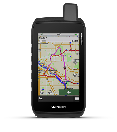
Expect big things. A large touchscreen puts them all at your fingertips.
![]()
![]()
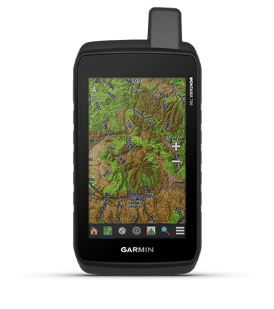
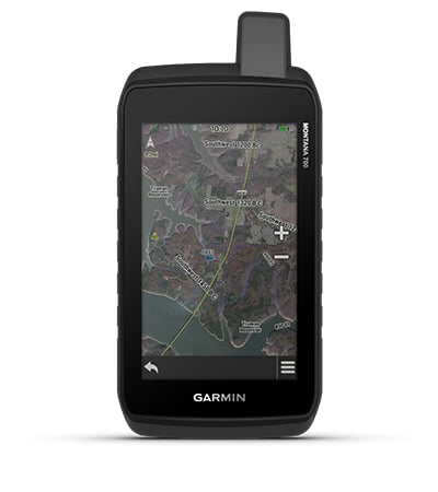
Routable topographic maps? Check. Now you’re free to take it off-road or on.
![]()
![]()
Built like a tank. Meets MIL-STD 810 for thermal, shock, water and vibration.
![]()
![]()
Get the clear perspective of BirdsEye Satellite Imagery right to your device.
![]()
![]()
Go far with no fear. ABC sensors and multiple GNSS networks have your back.
![]()
![]()
Power your adventures with 18+ hours of lithium-ion battery life in GPS mode.

Track your adventures on any terrain.
RUGGED BY DESIGN
This durable, water-resistant handheld is tested to U.S. military standards and features a glove-friendly 5” touchscreen that’s 50% larger than previous Montana models.
TOPOACTIVE MAPS
To navigate your adventures, use preloaded topographical maps for the U.S. and Canada. View terrain contours, elevations, coastlines, rivers, landmarks and more.
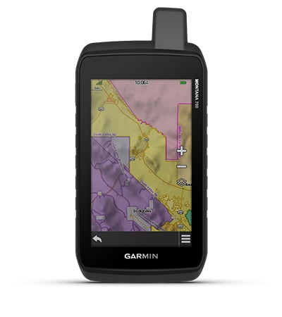
PUBLIC LAND BOUNDARIES
Optional display of federal public land boundaries on topographical maps helps you know that you’re venturing where you’re supposed to be.
SATELLITE VIEWS
Use direct-to-device downloads of BirdsEye Satellite Imagery (no annual subscription required) to see photo-realistic views and create waypoints based on landmarks.
ADDITIONAL MAPS
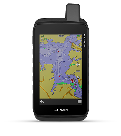
With 16 GB of onboard memory and a microSD™ card slot for expandable storage, you can download even more maps such as City Navigator for your drive or BlueChart g3 for the water.
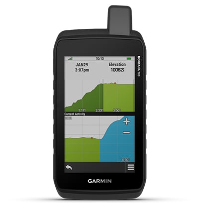
ABC SENSORS
Navigate your next trail with ABC sensors, including an altimeter for elevation data, barometer to monitor weather and 3-axis electronic compass.
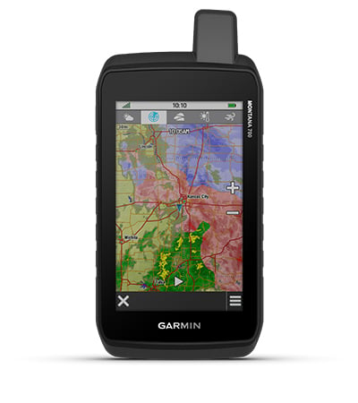
ACTIVE WEATHER
Use cellular connectivity1 to access up-to-date Active Weather forecasts through the Garmin Connect app.
![]()
![]()
DOG TRACKING
For hunters and trainers, this Montana syncs with compatible Astro or Alpha series handhelds (sold separately) to help track sporting dogs in the field.
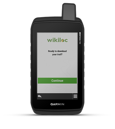
WIKILOC TRAILS
This preloaded app lets you easily download hiking, cycling and other Wikiloc trails shared by outdoor enthusiasts like you. Get a free 60-day Wikiloc Premium trial to try this and other exclusive features. Learn more.
Take it hiking. Take it hunting. Take it off-grid.
MULTI-GNSS SUPPORT
Access to GPS, GLONASS and GALILEO satellite networks enables Montana 700 to track in more challenging environments than GPS alone.
LOCATION SHARING
The LiveTrack feature lets you wirelessly connect1 your device with other compatible Garmin GPS users, so they can follow your tracks, routes, waypoints and adventures.
EXPEDITION MODE
Trek far and wide off-grid. Use Expedition mode, an ultralow-power GPS reference, to keep Montana tracking for a week or more between recharges.
BATTERY OPTIONS
An internal, rechargeable lithium-ion battery pack provides more than 18 hours of battery life in GPS mode. It can also be powered with traditional AA batteries.
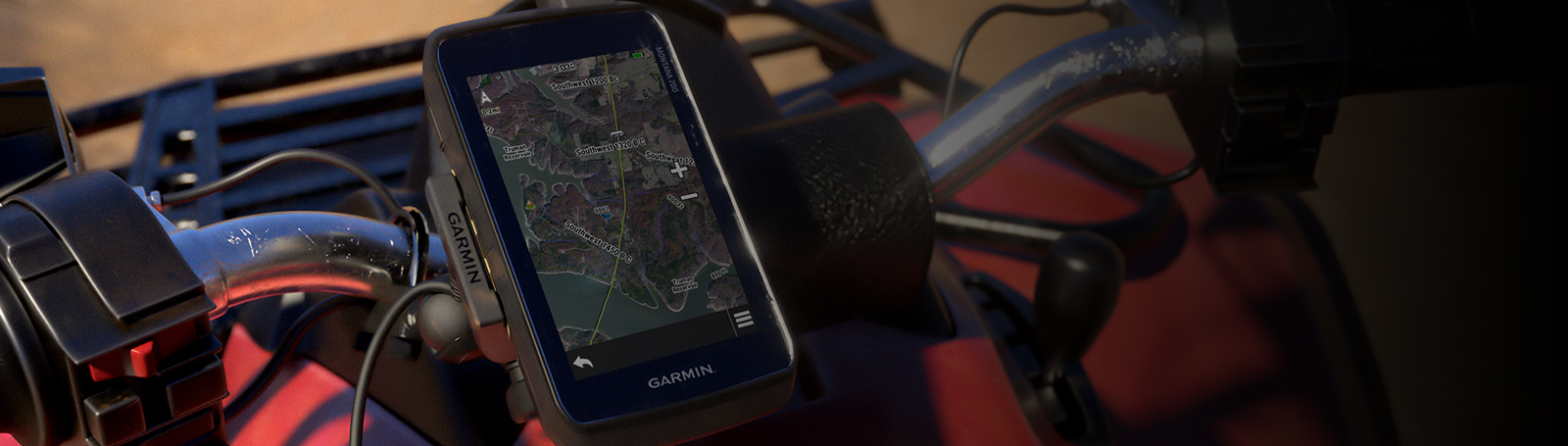
VEHICLE MOUNTS
A variety of Montana handheld-compatible mounts (sold separately) lets you adapt your navigator for use on ATVs, boats, cars, motorcycles, RVs or other vehicles.
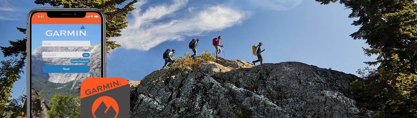
Garmin Explore App for off-grid navigation and more
Hanya pelanggan yang sudah login dan telah membeli produk ini yang dapat memberikan ulasan.
Produk Terkait


GPS Garmin 73
Baca selengkapnyaPerangkat Genggam GPS Navigator yang Mudah Digunakan Penanda GPS dengan sensitivitas tinggi yang dapat menyimpan 1000 waypoints dan 100 tracks Tandai lokasi favorit anda untuk kemudahan navigasi Garmin SailAssist??untuk GPS 73 dilengkapi dengan virtual starting line, heading line, timer countdown timers dan tack assist Fitur matahari terbit/matahari terbenam, perkiraan waktu tiba, dan kalkulasi data lain, …

Garmin GT20-TM
Baca selengkapnyaFor the shallow water anglers who wants traditional and CHIRP ClearVü scanning sonar, this transom or trolling motor mounted transducer consistently displays fish arches as well as clear pictures of objects, structure and fish that pass below your boat. The 20 ft transducer cable with built-in fast response temperature sensor has a power rating of …

GPS Garmin Montana 710
Baca selengkapnyaSTAY ON TRACK THROUGH ALL KINDS OF ADVENTURES With routable mapping for roads and trails, the Montana 710 handheld brings advanced outdoor features into a sturdy 5-inch format that’s ideal for navigation on foot, bike, kayak, ATV and more. LARGE 5-INCH GLOVE-FRIENDLY TOUCHSCREEN PRELOADED TOPOGRAPHIC MAPS WITH LANDMARKS MEETS MIL-STD 810 FOR THERMAL, SHOCK, WATER …

GPS Garmin GPSMAP 79s
Baca selengkapnyaCAST OFF CONFIDENTLY Tetap berada di jalur dan lacak lebih banyak petualangan dengan perangkat genggam yang tangguh dan bisa mengapung ini Tahan air, bisa mengapung, dan tahan kabut, sehingga perangkat ini cocok sekali di air — sama seperti Anda. Perangkat ini dapat menyimpan hingga 10.000 waypoint dan lebih banyak lagi, sehingga Anda tidak perlu melakukannya. …


Ulasan
Belum ada ulasan.