


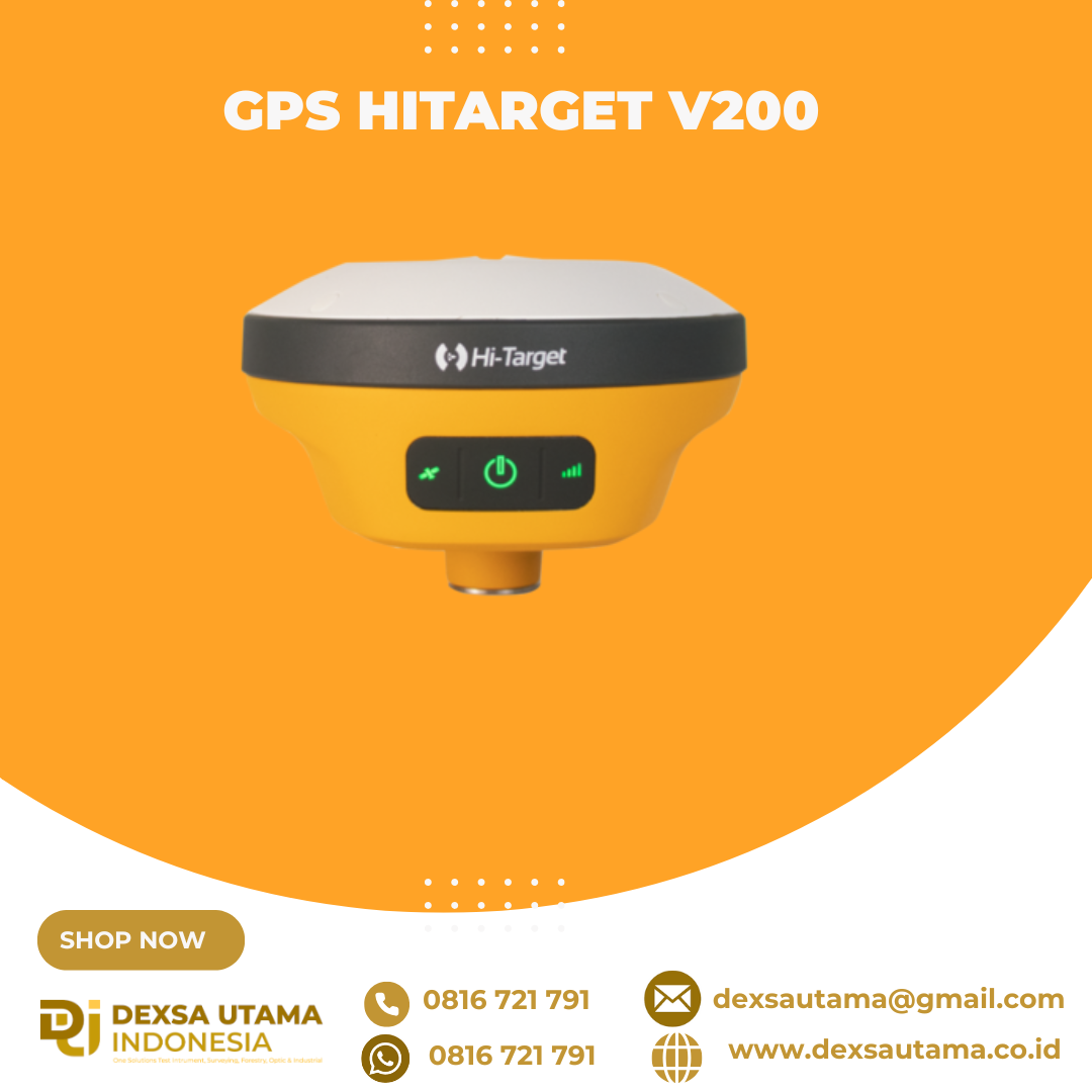
GPS Hitarget V200
penerima GNSS RTK (Global Navigation Satellite System Real-Time Kinematic) geodetik yang ringkas dan ringan, dirancang untuk survei dan pemetaan dengan akurasi tinggi. Dengan menggabungkan teknologi multi-konstelasi dan fitur kompensasi kemiringan, perangkat ini menawarkan solusi efisien dan portabel untuk pekerjaan lapangan di berbagai kondisi lingkungan
igher Accuracy and Precision
Equipped with the High-Performance Patch Antenna, enhances the low elevation angle tracking capabilities and keeps it maintaining a high gain for higher elevation satellites while tracking low-elevation satellites.
Spesifikasi
GNSS SIGNAL
- Channels: 1408
- GPS: L1 / L2 / L5 / L2C
- BDS: B1 / B2 / B3 / B1C / B2a
- GLONASS: L1/L2/L3
- Galileo: E1 / E5 / AltBOC / E5a / E5b / E6
- SBAS: L1 / L5
- QZSS: L1 / L2 / L5 / L6
- IRNSS: L5
POSITIONING PERFORMANCE
- High Precision static GNSS Surveying
- Horizontal : 2.5mm + 0.1ppm RMS
- Vertical: 3.5mm + 0.4ppm RMS
- Static and Fast Static
- Horizontal: 2.5mm + 0.5ppm RMS
- Vertical: 5mm + 0.5ppm RMS
- Post Processing Kinematic (PPK / Stop & Go)
- Horizontal: 8mm + 1ppm RMS
- Vertical: 15mm + 1ppm RMS
- Initialization time: Typically 10 min for base and 5 min for rover
- Initialization reliability: Typically > 99.9%
- Code Differential GNSS Positioning
- Horizontal: ±0.25m + 1ppm RMS
- Vertical: ±0.5m + 1 ppm RMS
- SBAS: 0.5m (H), 0.85m (V)
- Real Time Kinematic (RTK)
- Horizontal: 8mm+1ppm RMS
- Vertical: 15mm+1ppm RMS
- Initialization time: Typically <10s
- Initialization reliability: Typically > 99.9%
- Time to First Fix
- Cold Start: <45 s
- Hot Start: <30 s
- Signal re-acquisition: <2 s
- Hi-Fix
- Horizontal: RTK+10mm / minute RMS
- Vertical: RTK+20mm / minute RMS
- Tilt Survey Performance
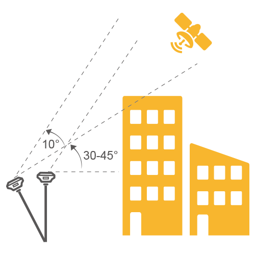
- Additional horizontal pole-tilt uncertainty typically less than 8mm +0.7mm / °tilt (2.5cm accuracy in the inclination of 30°)
- High Precision static GNSS Surveying
COMMUNICATION
- Communication
- Bluetooth: 4.2 / 2.1+EDR, 2.4GHz
- WiFi: Frequency 2.4GHz, Supports 802.11a/b/g/n
- Internal UHF Radio
- Frequency: 410-470MHz
- Channel: 116 (16 scalable)
- Transmitting power: 0.5W/ 1W / 2W adjustable
- Support multi-communication protocols:
- Hi-Target
- TRIMTALK450S
- TRIMMARK III
- TRANSEOT
- SATEL-3AS
- etc.
- Communication
PHYSICAL
- Internal Battery
- Internal 7.4V / 6800mAh lithium-ion rechargeable battery
- RTK Rover (network) for 12 hours
- Static: up to 15 hours
- External Power
- Power Consumption: 4.2W
- Dimension (W x H): 132mm x 67mm
- Charging: using standard smartphone chargers or external power banks
- Weight: ≤0.8kg (include battery)
- Data Storage: 8GB ROM internal storage
- Internal Battery
CONTROL PANEL
- LED Lamp:
- Satellite
- Signal
- Power
- Physical button: 1
- LED Lamp:
ENVIRONMENT
- Water / Dustproof: IP67
- Shock and vibration: Designed to survive a 2m natural fall onto concrete
- Humidity: 100%, condensing
- Operation Temperature: -30°C~+70°C
- Storage Temperature: -40°C~+80°C
I/O INTERFACE
- 1x USB port, type C
- 1x SMA antenna connector
DATA FORMATS
- Output rate: 1Hz-20Hz.
- Static data format: GNS, Rinex
- Network model: VRS, FKP, MAC; supports NTRIP protocol
- CMR& RTCM: CMR, RTCM 2.x, RTCM 3.0, RTCM 3.2
- Navigation outputs ASCII: NMEA-0183
Brosure
Video
Hanya pelanggan yang sudah login dan telah membeli produk ini yang dapat memberikan ulasan.
Produk Terkait


CHCNAV DL8 Radio External
Baca selengkapnyaThe DL8 UHF radio modem provides reliable base-to-rover GNSS RTK corrections over long distances. Designed for harsh environments, it supports up to 28 W of adjustable output power, ensuring robust communication even in challenging conditions. With customizable frequency channels and a rugged IP67-rated enclosure, the DL8 is an essential tool for surveyors requiring dependable and high-performance data links.
GPS Topcon HiPer VR
Baca selengkapnyaVersatile Performance Better things in smaller packages! The HiPer VR* is compact, light and packed with the most advanced GNSS technology in a design built to withstand the harshest field environments. Using Topcon’s advanced GNSS chipset with Universal Tracking Channels Technology, the HiPer VR automatically tracks every satellite signal above – now and into the future. All …
eSurvey eRTK25
Baca selengkapnyaLaser + CAD AR Dual-Tech Integration AR Stakeout: Overlay CAD designs onto real-world environments via AR, boosting on-site efficiency by 40%. Laser Precision: Achieve centimeter-level accuracy with non-contact measurements, ideal for extreme temperatures or tight spaces. High performance and stability: The eSurvey eRTK25 integrates laser ranging technology and AR vision stakeout, enabling robust centimeter-level positioning …






Ulasan
Belum ada ulasan.