


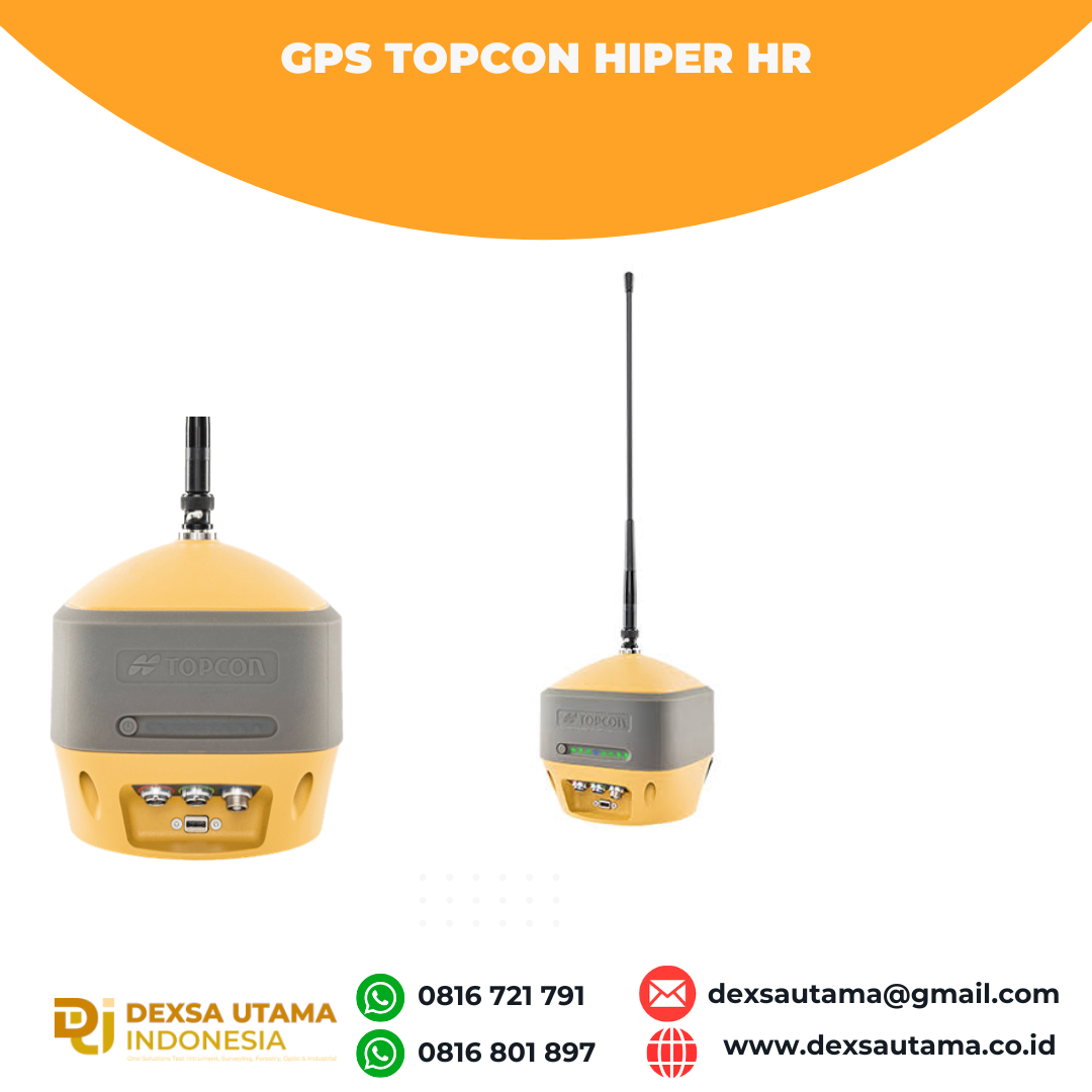

GPS Topcon Hiper HR

The HiPer HR GNSS receiver overcomes field challenges with a unique blend of technologies. If you’re under tree cover, or can’t get the pole plumb, or need to range widely from your base, or you need superb accuracy, or work in wet conditions, or all of the above, you’ll be free to do your best work.
As part of the Elite Survey Suite hybrid positioning solution, using network correction, mounted to a vehicle or grade checking with Millimeter GPS, or an almost countless number of applications, the HR combines the features to help you succeed.
- Next generation Fence Antenna for superior reception
- Rugged, waterproof IP67 environmental design
- Cellular, LongLink and Radio communications all integrated
- 452 Universal Tracking channels
- Unique 9-axis TILT™ compensation
- Internal Wi-Fi and multi-spectrum Bluetooth
- Removable, hot-swappable batteries
Topcon Integrated Leveling Technology (TILT™)
 | By combining a 9-axis inertial measurement unit (IMU), along with a digital compass, the HR can accurately compensate for up to 15º of tilt on the rod. Now you can measure all the way to a building edge without using an offset. Or stretch to get an otherwise out-of-reach point. Just as with many other Topcon technologies, TILT™ is designed to solve real-world challenges, so your work gets easier, faster, and better. |
Hanya pelanggan yang sudah login dan telah membeli produk ini yang dapat memberikan ulasan.
Produk Terkait


GPS GNSS Alpha Geo Matrix II AR + Laser
Baca selengkapnyaGNSS Alpha GEO Matrix II AR + Smart Laser Teknologi Canggih untuk Pengukuran yang Lebih Akurat dan Efisien AR – Stakeout Jadi Lebih Mudah dan Akurat GNSS Alpha Geo Matrix II Dengan fitur Augmented Reality (AR), Matrix II memungkinkan surveyor menandai titik langsung di lapangan tanpa perlu menggeser pole berulang kali. Cukup ikuti arah panah …
GPS Topcon HiPer VR
Baca selengkapnyaVersatile Performance Better things in smaller packages! The HiPer VR* is compact, light and packed with the most advanced GNSS technology in a design built to withstand the harshest field environments. Using Topcon’s advanced GNSS chipset with Universal Tracking Channels Technology, the HiPer VR automatically tracks every satellite signal above – now and into the future. All …

 0816 721 791
 dexsautama@gmail.com




Ulasan
Belum ada ulasan.