




CHCNAV HCE600
The HCE600 is a lightweight, professional Android data collector designed for field surveying and mapping. With a 5.5-inch DragonTrail™ display, it offers exceptional durability and clear visibility in sunlight. Packed with Bluetooth 5.0, dual-band Wi-Fi, and a 4G modem, it ensures seamless connectivity with GNSS receivers and RTK networks. Certified to IP67 and MIL-STD-810H standards, the HCE600 is built to withstand harsh environments, making it the ideal handheld controller for reliable data collection in any conditions


The HCE600 is a lightweight, compact, professional Android 10 data collector with an alphanumeric keypad specifically designed for surveying and mapping operations in the field. Its 5.5-inch DragonTrail™ display offers extreme durability, long-term performance, and incredible sunlight readability.
Packed with connectivity modules including Bluetooth 5.0, dual-band 2.4G and 5G Wi-Fi, 4G modem, and more, the HCE600 connects seamlessly and reliably to your favorite GNSS receivers and RTK network correction sources. Ultra-rugged, it withstands a 1.5-meter drop on concrete and meets stringent IP67 and MIL-STD-810H standards.
The HCE600 is the optimal handheld controller for working in harsh field environments and making your data collection more accessible and more efficient. The HCE600 comes with a 90-day trial version of the LandStar Surveying and Mapping App, trusted by over 100,000 professionals worldwide.
Brosure
Specifications
Hanya pelanggan yang sudah login dan telah membeli produk ini yang dapat memberikan ulasan.
Produk Terkait
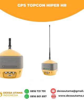

GPS Topcon Hiper HR
Baca selengkapnyaThe HiPer HR GNSS receiver overcomes field challenges with a unique blend of technologies. If you’re under tree cover, or can’t get the pole plumb, or need to range widely from your base, or you need superb accuracy, or work in wet conditions, or all of the above, you’ll be free to do your best work. …

CHCNAV DL8 Radio External
Baca selengkapnyaThe DL8 UHF radio modem provides reliable base-to-rover GNSS RTK corrections over long distances. Designed for harsh environments, it supports up to 28 W of adjustable output power, ensuring robust communication even in challenging conditions. With customizable frequency channels and a rugged IP67-rated enclosure, the DL8 is an essential tool for surveyors requiring dependable and high-performance data links.

ESurvey E600
Baca selengkapnyaThe new e-survey E600 GNSS Receiver is coming to change the scene in the high-end GNSS receiver market. With up to 800 true channels and surprising performance, it is destined to be the perfect ally of the topographer – and not only – in the pursuit of perfection. E600 supports all the new technologies (Tilt …

 0816 721 791
 dexsautama@gmail.com




Ulasan
Belum ada ulasan.