


GPS CHCNAV i76
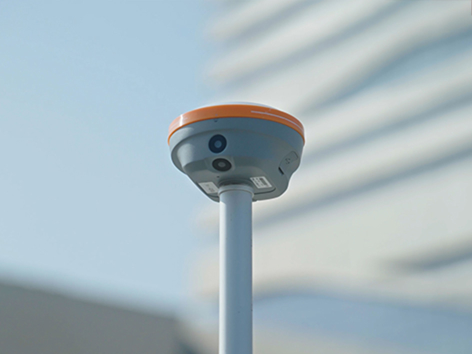
The i76 Palm Visual RTK is a lightweight receiver combining GNSS, IMU, and dual cameras. Weighing just 450g and IP68-rated, it maintains a 96% fixed rate even in areas with high solar activity. Its CAD AR visual stakeout enables precise path planning, while the 5th Gen Ultra-IMU ensures accuracy even at a 60° tilt. With over 17 hours of battery life, the i76 offers precision and adaptability for professionals seeking precision and adaptability.
Main Features
 Augmented Reality
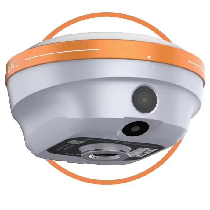
Dual 2 MP cameras with a 95° field of view.
 Superior GNSS
Reach reliable fixed RTK rate with advanced GNSS tracking.
 Ultra-IMU
5th generation IMU for high accuracy and tilt compensation.
 Lightweight
Extremely compact and weighing just 450g.


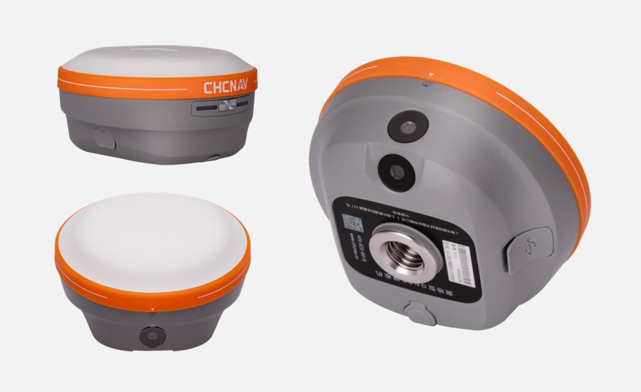
The i76 Palm Visual RTK is a compact, lightweight surveying tool engineered for precision and user-friendliness in challenging conditions. It features IP68 protection, 2-meter drop resistance, and a robust biomimetic design for enhanced durability. Weighing just 450g, the i76 is 40% lighter and 50% smaller than industry standards. It is equipped with integrated GNSS, IMU, 95° wide-angle dual cameras, a one-button operation, and synchronized LED to improve surveying efficiency significantly. The CAD+AR visual stakeout can enhance the overall project stakeout efficiency by 40% compared to traditional surveying methods.
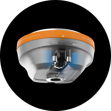
The i76’s 4th Gen air-medium GNSS antenna enhances stability across all GNSS constellations and frequencies, achieving an excellent RTK fixed rate with iStar 2.0 technology, which is particularly effective in regions with high solar activity. Its 5th Gen Ultra-IMU technology improves accuracy by 30%, even when surveying with a 60° range pole tilt. With a powerful battery supporting over 17 hours of continuous use, the i76 is ideal for professionals who value precision, adaptability, and innovation in their surveying work.
Specifications
Brosure
Hanya pelanggan yang sudah login dan telah membeli produk ini yang dapat memberikan ulasan.
Produk Terkait


CHCNAV DL8 Radio External
Baca selengkapnyaThe DL8 UHF radio modem provides reliable base-to-rover GNSS RTK corrections over long distances. Designed for harsh environments, it supports up to 28 W of adjustable output power, ensuring robust communication even in challenging conditions. With customizable frequency channels and a rugged IP67-rated enclosure, the DL8 is an essential tool for surveyors requiring dependable and high-performance data links.


Ulasan
Belum ada ulasan.