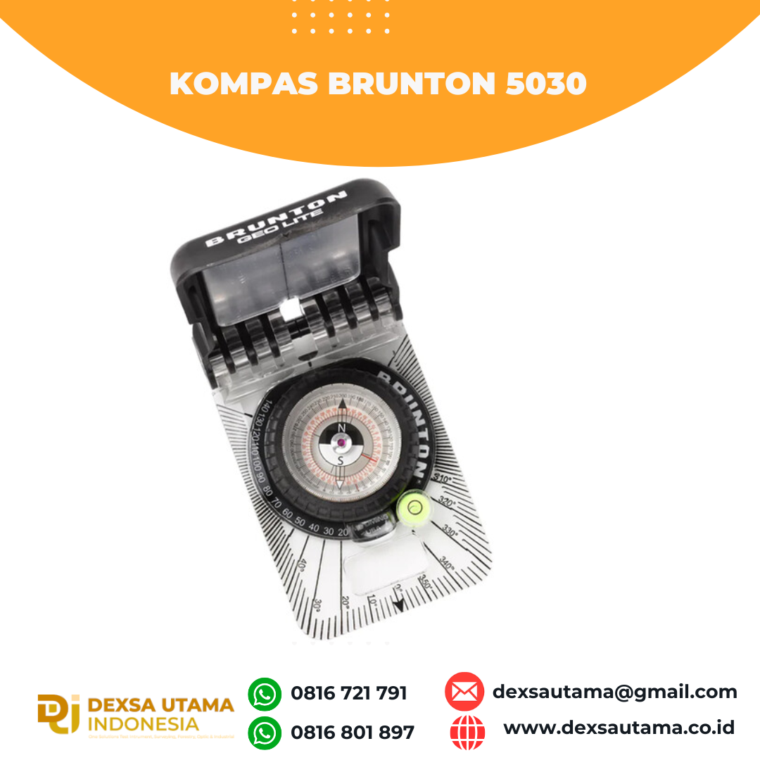
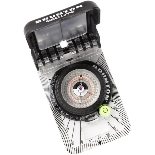
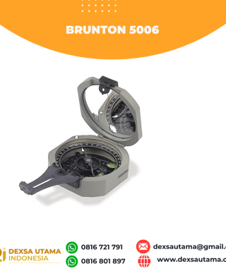
Category
- Uncategorized
- Abney Level
- Accessories GPS Geodetik
- Accessories Lain
- Accessories Survey
- Alat Curah Hujan
- Altimeter
- Anemometer
- Anemometer Kestrel
- Automatic Digital Level
- Automatic Level
- Baterai GPS RTK
- Baterai Total Station & Theodolite
- Borescope Endoscope
- Bushnell H2O
- Bushnell Lainnya
- Bushnell Powerview
- Bushnell Powerview 2
- Curvimeter
- Densiometer
- Detektor Petir
- Diagonal Eyepiece
- Digipas Digital Level
- Disto Meter
- Drone
- Dulang
- Echo Sounder
- Global Water
- GPS Furuno
- GPS Garmin
- GPS Geodetik
- GPS Trimble
- Hammer Test & Profometer
- Hand Lens
- Humidity / Temp
- Inclinometer
- Kabel Locator
- Kamera Trap
- Kompas
- Laser level / Crossline Laser
- LiDAR Laser Scanner
- Meteran
- Nikon Action EX
- Nikon Aculon
- Nikon Monarch
- Notebooks
- Palu Geologi
- Photometer
- Pita Survey/Flagging Tape
- Pocket Microscope
- Prisma Total Station
- Protractor Ruler
- Radar Gun
- Rangefinder
- Rotating Laser level
- Sampel Bag
- Software
- Soil Tester
- Susceptibility Meter
- Tachometer
- Telepon Satelit
- Temperature & Data Logger
- Tension Meter
- Teropong Malam/Night Vision
- Teropong Marine
- Theodolite & Laser Plummet
- Total Station
- Total Station Robotic
- USV
- Water Level Meters
- Weather Station

Kompas Brunton 5030
- Compact and Lightweight Design
- Equator Balanced
- Transit-Style Direct-Read Azimuth System
- Slender Needle for a More Accurate Read
- EverNorth Magnet Resists Demagnetization
- ±180° Declination Adjustment
- Integrated Protractor and Bubble Level
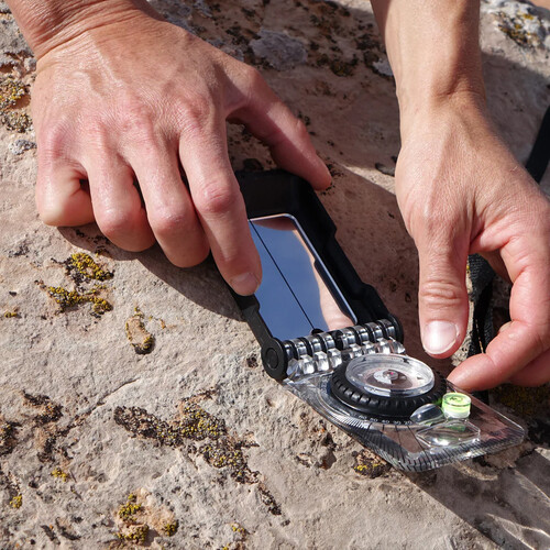
- Sighting Mirror for Accurate Bearings
- Tool-Free Declination Adjustment
Compass
- Balanced for use in equatorial latitudes
- Proprietary EverNorth magnet resists demagnetization over time
- Slender needle enables a more accurate read
- Sighting mirror allows for accurate bearings
- Romer scales included for easy integration with handheld GPS unit
- Declination adjustment: ±180°
- Tool-free declination adjustment
- Map magnifier makes seeing smaller details easier
Transit
- Transit-style direct read azimuth system
- Resolution of 2° for azimuth readings including strike, dip azimuth, directional bearings
- Graduation hinge clinometer of ±2.5° with 5° enables dip/dip azimuth measurements
- Fixed plumb-style clinometer is unaffected by declination adjustment
- Flat bottom for accurate strike and dip measurements at low angles
- Integrated protractor for plotting data on a field map
- Bubble level for accurate strike measurement
Construction
- Made in the USA in Riverton, Wyoming
- Compact 4 x 2.5 x 0.6″ dimensions
- Weighs 3.2 ounces
- Lid is made of recycled glass-filled nylon for increased durability
- Hot-stamped base plate for improved durability
Spesification
| Region |
Equatorial Zone
|
| Compass Style |
Azimuth (360°)
|
| Azimuth |
2° Graduations with ±1° Accuracy
|
| Clinometer |
5° Graduations with ±2.5° Accuracy
|
| Declination Adjustment |
Yes, ±180°
|
| Additional Functions |
Bubble Level/Map Magnifier
|
| Dimensions |
4.1 x 2.5 x 0.7″ / 10.4 x 6.3 x 1.8 cm (Closed)
7.4 x 2.5 x 0.7″ / 18.8 x 6.3 x 1.8 cm (Open) |
| Weight |
3 oz / 85 g (With Lanyard)
|
Hanya pelanggan yang sudah login dan telah membeli produk ini yang dapat memberikan ulasan.
Produk Terkait
-
Kompas Geologist Freiberg
Baca selengkapnya- compass circle • diameter: 45 mm • scale value: 2° (2 gon) • estimation: 0,5° (0,5 gon)
- azimuth circle • diameter. 22 mm • scale value: 5° (5 gon) • estimation: 1° (1 gon)
- clinometer • measuring range: +/- 90° (+/- 100 gon) • scale value: 2° (2 gon) • estimation: 0,5° (0,5 gon)
- contact edge • graduated length: 70 mm • scale value: 1 mm


Ulasan
Belum ada ulasan.