



Laser Scanner Lixel K1
Laser Scanner Lixel K1 – Scanner 3D Genggam yang Ringkas & Presisi
Lixel K1 adalah perangkat pemindaian dan pemodelan 3D Lidar genggam yang ringkas, ringan, dan mudah digunakan. Dengan berat hanya 1 kg, alat ini dirancang untuk kemudahan mobilitas dan efisiensi kerja.

Fitur Unggulan Laser Scanner Lixel K1
- Ringkas & Mudah Dibawa – Material aluminium alloy membuatnya ringan dan nyaman digunakan.
- LiDAR Multi-Garis & Pengumpulan Panoramik – Sensor 40-line LiDAR dengan 200.000 titik/detik, FOV 360°, serta akurasi ±1,2 cm dengan jangkauan hingga 40 meter.
- Model 3D Berwarna Real-Time – Dilengkapi modul visi panoramik 56MP, menghasilkan tampilan detail dan akurat.
- Bebas Sudut Pemindaian – Sensor IMU bawaan memungkinkan pemindaian dengan sudut kemiringan tertentu.
- Mudah Digunakan & Hemat Biaya – Dirancang agar pengguna pemula bisa langsung melakukan pemindaian dan pemodelan 3D dengan efisien.
Aplikasi Lidar Lixel K1
Digital Twins
Survey Teknik & Konstruksi
Film, Gaming, & Animasi
Scan to BIM
Pertanian & Kehutanan
Pelestarian Budaya & Pariwisata
Perangkat Lunak
 PC Software – Pemrosesan data lengkap: tampilan, pengeditan, pemodelan, dan post-processing.
 Mobile App – Memudahkan pemindaian, pratinjau hasil, dan pemantauan status perangkat secara real-time.
Scanner Lidar Lixel K1 adalah solusi 3D scanning profesional yang praktis, akurat, dan efisien, cocok untuk berbagai industri!
Sepsifikasi
| Scanning performance | Laser channels | 40 |
| Laser class | Class 1/905nm | |
| Relative accuracy | +1.2cm | |
| Absolute accuracy | ≤3cm | |
| Repeat accuracy | ≤2cm | |
| Horizontal accuracy | 0.015° | |
| Working range | 0.1m~40m @10%,70m@80% | |
| Scanning mode | Mobile | |
| Scanning speed | 200,000 points/second | |
| Resume scanning from break point | Supports | |
| Visual module | Camera FOV | Color panorama HDV 360°x360° |
| Camera resolution | 56 Mega Pixel | |
| Data & storage | Processing mode | Real-time calculating/Mixed calculating |
| Software kit | Lixel Studio (Windows), LixelGo (Android) | |
| Point cloud format | *.las | |
| Color point cloud | Supports | |
| Hardware performance | Power input | 14.4V |
| Power consumption | <20W | |
| Dimensions(main body) | 87mm(L)x65mm(W)x133.1mm(H) | |
| Weight | 1kg | |
| Data interface | Type-C USB3.1 Gen2 | |
| Storage capacity | TF card 256GB(Replaceble) | |
| Connection mode | WiFi/Bluetooth | |
| Operating temperature | -20℃~+50°C | |
| Protection level | IP54 | |
| IP54 | Navigational aluminum | |
| Power supply | Fast-lock battery/external power | |
| Operating time | 1.5 hrs | |
| Battery capacity | 28.8wh</td> | |
| 4 | ||
| Visual-aided positioning | Supports | |
| APP WiFi distance | 20m | |
| RTK mode | Supports |
Brosure
Hanya pelanggan yang sudah login dan telah membeli produk ini yang dapat memberikan ulasan.
Produk Terkait


LiDAR CHCNAV AlphaAir 450
Baca selengkapnyaThe AlphaAir 450 is designed for simplicity and precision, making advanced geospatial reality capture accessible to non-professional users and those new to the technology. At an affordable price, the AA450 combines ease-of-use with high-precision capabilities. This lightweight, durable solution integrates a high-performance laser scanner, a professional-grade 26 MP industrial camera, and a high-precision inertial navigation system to ensure superior data collection quality.

Laser Scanner CHCNAV RS10
Baca selengkapnyaThe RS10 integrates GNSS RTK, laser scanning, and visual SLAM technologies into one single platform. This fusion increases the efficiency and accuracy of both indoor and outdoor 3D scanning and surveying tasks. It gives surveyors the ability to work in areas with weak GNSS signals, providing unparalleled flexibility. Designed for surveying, BIM, forestry, power line inspection, underground mapping, and more, the RS10 embodies versatility, making it an essential tool for professionals looking to expand their surveying capabilities.

SatLab SL9 SLAM RTK
Baca selengkapnyaSatLab SL9 SLAM RTK combines high-precision GNSS positioning with cutting-edge SLAM technology, eliminating the spatial constraints of traditional RTK measurements. Whether in urban buildings, dense forests, or indoor environments, SL9 ensures reliable, precise measurements, redefining efficiency and versatility in fieldwork
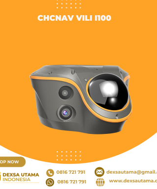
CHCNAV ViLi i100
Baca selengkapnyaThe ViLi i100 is CHCNAV’s flagship GNSS RTK receiver, combining advanced satellite filtering, enhanced SFix 2.0 positioning and innovative Vi-LiDAR technology. It provides reliable, centimetre-level accuracy even in challenging GNSS environments, allowing professionals to extend the boundaries of traditional GNSS surveying.





Ulasan
Belum ada ulasan.