



LiDAR CHCNAV AlphaAir 10
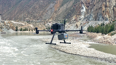
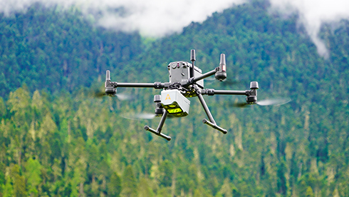
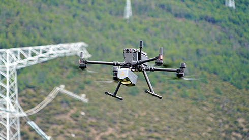
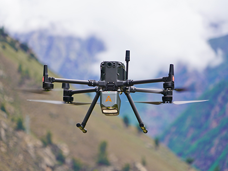
The AlphaAir 10 is a professional airborne LiDAR+RGB system designed to meet the demanding requirements of UAV LiDAR mapping and drone photogrammetry. This advanced solution integrates superior LiDAR technology with accurate GNSS positioning, IMU orientation, and a professional full frame orthophoto camera. Together with CHCNAV’s point cloud and image fusion modeling software, the AA10 delivers survey-grade accuracy, efficiency, and cost-effectiveness in 3D data acquisition and processing
Main Features
 High-Precision LiDAR
5 mm repeated range and 2-5 cm absolute accuracy.
 45 MP Camera
Integrated full-frame orthographic camera.
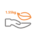 Lightweight
Only 1.55 kg for easy UAV integration.
High-Precision LiDAR Integration
Achieve unmatched accuracy with our high-precision LiDAR technology, offering 5 mm repeated range accuracy and 2-5 cm absolute precision. Enhance your mapping projects with reliable, detailed data even in complex environments.
Long-Range Scanning Capability
Extend your survey range with up to 800 m measurements and 500,000 points per second scanning. Cover large areas efficiently and with high detail, maximizing survey productivity.
Enhanced Vegetation Penetration
Utilize advanced multi-target capabilities with up to 8 target echoes, enabling effective penetration of dense vegetation. Create accurate DEMs and DSMs in challenging environments with improved ground surface acquisition.
High-Resolution Imaging
Capture detailed imagery with the integrated 45 MP orthographic camera. Generate high-resolution point clouds and orthomosaic outputs for superior 3D model reconstruction and realistic textures.
Efficient Workflow Integration
Streamline your 3D data acquisition with CoPre and CoProcess software, facilitating post-processing and feature extraction. Achieve high-quality results with an easy-to-use, efficient workflow from data collection to final output.
Lightweight and Versatile Design
Benefit from a compact, lightweight system (1.55 kg) that is easy to mount on various UAVs. Enjoy simplified installation with Alphaport’s one-click connection, enhancing operational flexibility.


Specifications
Brosure
Hanya pelanggan yang sudah login dan telah membeli produk ini yang dapat memberikan ulasan.
Produk Terkait


Laser Scanner CHCNAV RS10
Baca selengkapnyaThe RS10 integrates GNSS RTK, laser scanning, and visual SLAM technologies into one single platform. This fusion increases the efficiency and accuracy of both indoor and outdoor 3D scanning and surveying tasks. It gives surveyors the ability to work in areas with weak GNSS signals, providing unparalleled flexibility. Designed for surveying, BIM, forestry, power line inspection, underground mapping, and more, the RS10 embodies versatility, making it an essential tool for professionals looking to expand their surveying capabilities.

SatLab SL9 SLAM RTK
Baca selengkapnyaSatLab SL9 SLAM RTK combines high-precision GNSS positioning with cutting-edge SLAM technology, eliminating the spatial constraints of traditional RTK measurements. Whether in urban buildings, dense forests, or indoor environments, SL9 ensures reliable, precise measurements, redefining efficiency and versatility in fieldwork

LiDAR CHCNAV AlphaAir 15
Baca selengkapnyaThe AlphaAir 15 (AA15) is a lightweight, high-performance airborne LiDAR system designed for large-scale operations where high-density data capture is crucial. With a range of up to 1800 meters and the ability to produce 2 million pulses per second, the AA15 is ideal for mapping and geospatial applications, including corridor mapping, urban planning, and vegetation analysis. Its compact design allows for easy integration with UAVs, small aircraft, and helicopters.

LiDAR CHCNAV AlphaAir 450
Baca selengkapnyaThe AlphaAir 450 is designed for simplicity and precision, making advanced geospatial reality capture accessible to non-professional users and those new to the technology. At an affordable price, the AA450 combines ease-of-use with high-precision capabilities. This lightweight, durable solution integrates a high-performance laser scanner, a professional-grade 26 MP industrial camera, and a high-precision inertial navigation system to ensure superior data collection quality.







Ulasan
Belum ada ulasan.