Kategori: GPS Geodetik
Menampilkan 61–90 dari 95 hasilDiurutkan menurut yang terbaru


Reach M2/M+ camera hot shoe adapter
Baca selengkapnyaHot shoe adapter for Reach M2 and M+. Wires the flash sync pulse from camera to Reach for precise time stamping of each picture. Necessary for PPK workflow. Designed to work with any camera with hot shoe connector, tested to work with Sony, Canon, and Nikon. Not compatible with the original, Edison-based, Reach module.

Tallysman GNSS antenna for Reach M+
Baca selengkapnyaTallysman TW4721 is a compact, wideband Accutenna™ technology GNSS antenna that provides accurate reception for all upper L- band GPS, GLONASS, Beidou, and Galileo signals (L1, G1, B1, B1 BOC, B12, E1) and associated augmentation signals (WAAS, EGNOS and MSAS SBAS).

TOKNAV DL8635 RADIO EXTERNAL
Rp0 + PPN 11%Tambah ke keranjangDL8635 External Data Transmission Radio The DL8635 is an external high-power transceiver designed for the surveying market. It offers features such as long communication distance, low power consumption, intelligent and user-friendly design. It comes with a high-definition OLED display, supports menu operations, intelligent recognition of serial port baud rates, intelligent recognition of power-on status, interference …

TOKNAV PCR100U CONTROLER
Rp0 + PPN 11%Tambah ke keranjangFlagship RTK Measurement Control Terminal The PCR100U is a flagship RTK measurement control terminal designed specifically for the surveying industry. It boasts an impressive battery life of over 15 hours, a 5.5-inches sunlight-readable screen for easy outdoor viewing, and operates on the Android 11 system for smooth performance. It features a digital keyboard and offers …

GPS TOKNAV T10 PRO
Rp0 + PPN 11%Tambah ke keranjangCharacteristic Linux Intelligent System Qualcomm Cortex-A7 + Linux, the intelligent system platform, brings efficient computing and unlimited expansion of product functions to users. Multi Constellation With its 1408 channels, T10Pro provides an excellent on board real time navigation solution with high accuracy. All GNSS signals (GPS, GLONASS, BDS, GALILEO, QZSS, SBAS and IRNSS) are included. …

GPS EFIX F8
Baca selengkapnyaThe EFIX F8 seamlessly integrates cutting edge VISION, GNSS and IMU technologies to meet the needs of professional surveyors. It offers unparalleled accuracy and efficiency for surveying tasks.With the integration of dual cameras, the F8’s advanced vision system allows surveyors to effortlessly overcome obstacles and survey challenging terrain, including difficult-to-fix, hard-to-reach, and hazardous points. Real-time visual feedback enables precise stakeout without the complexity of offset methods, resulting in improved efficiency and accuracy.By leveraging the capabilities of the F8, surveyors can streamline their workflow, increase productivity and achieve exceptional results in every project they undertake.
GPS EFIX C8
Baca selengkapnyaThe EFIX C8 is a groundbreaking surveying RTK that seamlessly combines state-of-the-art vision, GNSS and IMU technologies. By integrating a powerful vision system, the C8 revolutionizes surveying workflows, streamlining operations, and delivering superior results in every surveying project. This integration empowers surveyors to tackle complex surveying tasks with unprecedented accuracy and ease. The real-time visual feedback provided by the vision system enables accurate stakeout, eliminating the need for complicated offset methods. Surveyors can efficiently measure previously inaccessible points and streamline their surveying workflow, increasing overall productivity. With the EFIX C8, surveyors can enhance their surveying capabilities and achieve superior results on every project they undertake.

GPS EFIX C5
Baca selengkapnyaC5 GNSS Receiver
100% MORE EFFICIENT TO DO SURVEYING AND STAKING-OUT1608 channels, full support of all GNSS constellations.Advanced Full Star technology, to maximize the use of all the satellite signals.4D IMU.RTK keeping technology, maintain fixed positioning when real-time corrections arelost.
Smaller body design
Support cloud service
GPS Sanding T9
Baca selengkapnyaMore information Distinguishable features MDS Internal radio adopts TRIMTALK protocol which enables T9 to work with other receives with same protocol. Power Operating power: min. [V] 7.4 Operating power: max. [V] 7.4 Typical consumption [W] 2 Internal power supply Removable 7.4V, 2500mAh Li-on battery External power supply 12-15V DC Operating time with internal power supply …

GPS Sanding T7
Rp0 + PPN 11%Tambah ke keranjangGPS Geodetic Sanding T7 GNSS Receiver dapat melacak sinyal dari semua konstelasi, termasuk sinyal B3 dari satelit BDS. Sanding T7 dilengkapi teknologi pengukuran inersia, yang memungkinkan pengguna melakukan survei kemiringan dengan sudut kemiringan maksimum 60°. Centering tidak wajib, sehingga surveyor dapat berada pada posisi yang aman saat melakukan pengukuran di jalan raya dan tidak perlu …

Controller Alpha GEO S50III Android
Baca selengkapnyaController Alpha GEO S60III : Solusi Handheld Tangguh untuk Surveyor Profesional Dalam dunia pengukuran dan pemetaan, keandalan perangkat adalah kunci utama untuk mendapatkan hasil yang presisi. S60III hadir sebagai data collector terbaru yang dirancang khusus untuk memenuhi kebutuhan surveyor dan profesional pemetaan. Dengan prosesor industri terbaru dari Qualcomm dan berbagai fitur unggulan, S60III siap memberikan …

GPS GNSS Alpha Geo L300
Baca selengkapnyaGNSS Alpha Geo L300 : Inovasi Teknologi untuk Pengukuran Presisi Dalam dunia pengukuran lahan dan konstruksi, keakuratan data sangatlah krusial. GNSS Alpha Geo L300 hadir sebagai solusi mutakhir bagi para surveyor dan kontraktor yang membutuhkan alat ukur dengan presisi tinggi, kemudahan operasional, dan fleksibilitas dalam berbagai kondisi kerja. Keunggulan GNSS Receiver Alpha Geo L300 1. …

GPS GNSS Alpha Geo L2
Baca selengkapnyaGNSS Alpha Geo L2 RTK Laser Handheld: Kecil, Ringan, dan Presisi Tinggi Dalam dunia survei lahan, teknologi terus berkembang untuk memberikan kemudahan, kecepatan, dan akurasi yang lebih tinggi. Salah satu perangkat terbaru yang menarik perhatian adalah GNSS Alpha Geo L2 RTK Laser Handheld. Alat ini menawarkan keunggulan dalam desain, teknologi pengukuran laser, serta kemampuan menangkap …

Kontroler Hitarget iHand55
Baca selengkapnyaThe iHand55 Handheld Controller is a professional field controller with a big vision. Adopting a full-keyboard design, iHand55 supports the fast charge. The updated screen is readable in direct sunlight. More features of the latest Hi-Survey Road Software contribute to achieving high intelligence. Keeping robust and reliable in fieldwork under any conditions, iHand55 is a perfect choice for your survey work

GPS Hitarget V30 Plus Base
Baca selengkapnyaHi-Target V30 Plus adalah
sistem Global Navigation Satellite System (GNSS) RTK (Real-Time Kinematic) geodetik, yang dirancang untuk survei dan pemetaan dengan presisi tinggi. Perangkat ini memiliki desain kokoh berkelas industri yang ringkas, dengan mesin GNSS multi-konstelasi untuk pemosisian yang stabil dan akurat bahkan di lingkungan yang sulit.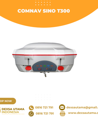
GPS Geodetik RTK Comnav Sino T300
Baca selengkapnyaSince its debut in 2013, the T300 has not only maintained its iconic design, but has also consistently evolved to stay at the forefront of GNSS technology.- GPS L1/L2/L5, BeiDou B1/B2/B3/B1C/B2a/B2b, GLONASS L1/L2/L3, Galileo E1/E5a/E5b/E6/AltBOC, QZSS L1/L2/L5, Navic L5, SBAS
- Compact Design
- Hot Swap Battery
- User-friendly Interface
- Support WIFI/UHF/4G
- Web server for easy configuration
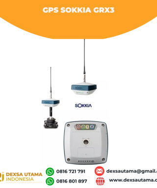
GPS Sokkia GRX3
Baca selengkapnyaNumber of Universal Tracking Channels 226 UTC technology Tracked Signals GPS L1 C/A, L1C, L2P(Y), L2C, L5 GLONASS L1 C/A, L1P, L2 C/A, L2P, L3C BeiDou B1, B2 Galileo E1,E5a, E5b, Alt-BOC SBAS L1 C/A, L5 WAAS/MSAS/EGNOS/GAGAN QZSS L1 C/A, L1C, L1-SAIF, L2C, L5 Static/Fast Static H: 3 mm + 0.4 ppm V: 5 mm …

GPS Topcon HiPer SR
Baca selengkapnyaSIMPLE AND SOPHISTICATED Daily setup routines are made easy through the HiPer SR’s LongLink intelligence feature. More than just a wireless Bluetooth connection, LongLink serves to automatically connect multiple HiPer SR rovers to your mobile base. Just power them on and let the system do the rest. Combine your Topcon HiPer SR receiver with a …
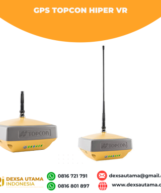
GPS Topcon HiPer VR
Baca selengkapnyaVersatile Performance Better things in smaller packages! The HiPer VR* is compact, light and packed with the most advanced GNSS technology in a design built to withstand the harshest field environments. Using Topcon’s advanced GNSS chipset with Universal Tracking Channels Technology, the HiPer VR automatically tracks every satellite signal above – now and into the future. All …
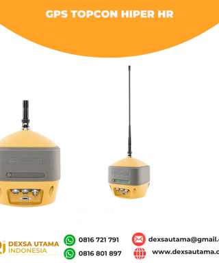
GPS Topcon Hiper HR
Baca selengkapnyaThe HiPer HR GNSS receiver overcomes field challenges with a unique blend of technologies. If you’re under tree cover, or can’t get the pole plumb, or need to range widely from your base, or you need superb accuracy, or work in wet conditions, or all of the above, you’ll be free to do your best work. …