

GPS Geodetik RTK Topcon HiPer HR
Harga Belum termasuk PPN
Garansi 12 Bulan

The HiPer HR GNSS receiver overcomes field challenges with a unique blend of technologies. If you’re under tree cover, or can’t get the pole plumb, or need to range widely from your base, or you need superb accuracy, or work in wet conditions, or all of the above, you’ll be free to do your best work.
As part of the Elite Survey Suite hybrid positioning solution, using network correction, mounted to a vehicle or grade checking with Millimeter GPS, or an almost countless number of applications, the HR combines the features to help you succeed.
- Next generation Fence Antenna for superior reception
- Rugged, waterproof IP67 environmental design
- Cellular, LongLink and Radio communications all integrated
- 452 Universal Tracking channels
- Unique 9-axis TILT™ compensation
- Internal Wi-Fi and multi-spectrum Bluetooth
- Removable, hot-swappable batteries
Topcon Integrated Leveling Technology (TILT™)
 | By combining a 9-axis inertial measurement unit (IMU), along with a digital compass, the HR can accurately compensate for up to 15º of tilt on the rod. Now you can measure all the way to a building edge without using an offset. Or stretch to get an otherwise out-of-reach point. Just as with many other Topcon technologies, TILT™ is designed to solve real-world challenges, so your work gets easier, faster, and better. |
| Berat | 40 kg |
|---|
Specifications
SS (915 MHz)
Wi-Fi
Bluetooth®
6to28VDC
2 x Internal batteries
3.7 V, 2900 mAh each
H: 3 mm + 0.3 ppm
V: 5 mm + 0.5 ppm
H: 3 mm + 0.1 ppm
V: 3.5 mm + 0.4 ppm
H: 5 mm + 0.5 ppm
V: 10 mm + 0.8 ppm
H: 1.3 mm/⁰Tilt;
Tilt ≤ 10°
H: 1.8 mm/⁰Tilt;
Tilt > 10°
Kelengkapan
1x Base
1x Rover
2x OAF, GLONASS L1 L2 Tracking
2x Antenna UHF 425-470 Male BNC
2x Hard Carry Case
1x Bipod
1x Data Kontroller FC-500
1x Bracket for Data Kontroller –
1x Pole Carbon
1x Software Post Procces
1x Tribrach with Adapter –
1x Tripod
Hanya pelanggan yang sudah login dan telah membeli produk ini yang dapat memberikan ulasan.
Produk Terkait


GPS Geodetik RTK Comnav Sino N2
Baca selengkapnyaSlim-line design makes the N2 one of the most compact GNSS receiver: only 48mm and 0.67kg including battery. Compared with a typical GNSS receiver, it is more than 35% thinner and 40% lighter, can be carried, used and operated more easily without fatigue. Lighter, Thinner, and Stronger – N2 is specifically designed for land survey, marine, precision agriculture, machine control, and GIS.- 1590 channels and 50+ satellites tracking capabilities
- Tracking all running and planned constellations, including GPS, BDS-2, BDS-3, GLONASS, Galileo, QZSS, IRNSS and SBAS
- Up to 15km work range with enhanced UHF
- Up to 120° tilt with 2.5 cm accuracy
- 20+ hrs continuous work with 10000mAh batteries
- Support NFC and Bluetooth connection
- IP67 dust- and waterproof for harsh environments

GPS EFIX C5
Baca selengkapnyaC5 GNSS Receiver
100% MORE EFFICIENT TO DO SURVEYING AND STAKING-OUT1608 channels, full support of all GNSS constellations.Advanced Full Star technology, to maximize the use of all the satellite signals.4D IMU.RTK keeping technology, maintain fixed positioning when real-time corrections arelost.
Smaller body design
Support cloud service
GPS Sanding T7
Rp0 + PPN 11%Tambah ke keranjangGPS Geodetic Sanding T7 GNSS Receiver dapat melacak sinyal dari semua konstelasi, termasuk sinyal B3 dari satelit BDS. Sanding T7 dilengkapi teknologi pengukuran inersia, yang memungkinkan pengguna melakukan survei kemiringan dengan sudut kemiringan maksimum 60°. Centering tidak wajib, sehingga surveyor dapat berada pada posisi yang aman saat melakukan pengukuran di jalan raya dan tidak perlu …

GPS SINGULAR XYZ X1
Baca selengkapnyaThe SingularXYZ X1 GNSS Receiver is a lightweight, ultra-compact RTK receiver designed for demanding field conditions. Offering full satellite tracking, tilt compensation, and a long-lasting battery, it delivers consistent high-precision results in any environment.

SatLab Eyr GNSS
Baca selengkapnyaEquipped with dual cameras, the Eyr features image measurement and visual stakeout, which not only provide a wide range of contact-free measurement solutions but also make stakeout operations intuitive and simple. The design of the RTK is aesthetic but practical, and the pocket-sized and lightweight body makes it portable and versatile.

GPS GINTEC G40+
Baca selengkapnyaG40Plus is the latest masterpiece of the Gintec team in 2024, a super RTK (Real-Time Kinematic) system that focuses on high-performance radio communication. G40Plus not only inherits all the advantages of the G40 base unit but also expands the power and range of the radio communication. It can cover a maximum distance of 20km, and in urban areas, it has been tested to reach nearly 14km. It boasts an exceptional battery life, with a continuous working time of up to 8-10 hours in the 5W power base station mode. It features an upgraded night vision starlight camera that can operate effectively in low-light conditions…
There are more features waiting for you to explore!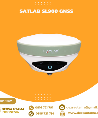
SatLab SL900 GNSS
Baca selengkapnyaThe SatLab GNSS receiver is a high-precision that performs even under the most demanding conditions. With this GNSS receiver, it is capable of delivering highly accurate GPS data in real-time to any device via a Bluetooth connection. Satellite correction service, compact and lightweight, this rtk GNSS is one of the most flexible solutions that promise positioning reliability.

Controller Alpha GEO S60III Android
Baca selengkapnyaController Alpha GEO S60III : Solusi Handheld Tangguh untuk Surveyor Profesional Dalam dunia pengukuran dan pemetaan, keandalan perangkat adalah kunci utama untuk mendapatkan hasil yang presisi. S60III hadir sebagai data collector terbaru yang dirancang khusus untuk memenuhi kebutuhan surveyor dan profesional pemetaan. Dengan prosesor industri terbaru dari Qualcomm dan berbagai fitur unggulan, S60III siap memberikan …

GPS Geodetik RTK Comnav Sino Mars Pro Laser
Baca selengkapnyaThe Mars Pro is an ultra-reliable GNSS receiver with a millimeter-level laser, enabling it to handle complex surveying tasks with unmatched precision, for example, in hard-to-reach, signal-obstructed, and dangerous fields. Mars Pro also features a sunlight-readable OLED color display for user-friendly, high-end operations. Breaking the usual constraints in land surveying, construction, and GIS, it is the go-to choice for professionals looking to elevate their work.- 1668 channels and 60+ satellites tracking capabilities
- Tracking all running and planned constellations, including GPS, BDS-2, BDS-3, GLONASS, Galileo, QZSS, IRNSS, and SBAS
- Up to 120° tilt with 2.5 cm accuracy
- IP67 dust- and waterproof for harsh environments
- Up to 20 hrs non-stop use
- Enabling broader use through extensive protocol support, including Transparent/TT450S/SATEL/Trimtakl3/CHC/South

CHCNAV HCE600
Baca selengkapnyaThe HCE600 is a lightweight, professional Android data collector designed for field surveying and mapping. With a 5.5-inch DragonTrail™ display, it offers exceptional durability and clear visibility in sunlight. Packed with Bluetooth 5.0, dual-band Wi-Fi, and a 4G modem, it ensures seamless connectivity with GNSS receivers and RTK networks. Certified to IP67 and MIL-STD-810H standards, the HCE600 is built to withstand harsh environments, making it the ideal handheld controller for reliable data collection in any conditions

GPS GNSS Alpha Geo L300
Baca selengkapnyaGNSS Alpha Geo L300 : Inovasi Teknologi untuk Pengukuran Presisi Dalam dunia pengukuran lahan dan konstruksi, keakuratan data sangatlah krusial. GNSS Alpha Geo L300 hadir sebagai solusi mutakhir bagi para surveyor dan kontraktor yang membutuhkan alat ukur dengan presisi tinggi, kemudahan operasional, dan fleksibilitas dalam berbagai kondisi kerja. Keunggulan GNSS Receiver Alpha Geo L300 1. …

TOKNAV PCR100U CONTROLER
Rp0 + PPN 11%Tambah ke keranjangFlagship RTK Measurement Control Terminal The PCR100U is a flagship RTK measurement control terminal designed specifically for the surveying industry. It boasts an impressive battery life of over 15 hours, a 5.5-inches sunlight-readable screen for easy outdoor viewing, and operates on the Android 11 system for smooth performance. It features a digital keyboard and offers …

Kontroler Hitarget iHand55
Baca selengkapnyaThe iHand55 Handheld Controller is a professional field controller with a big vision. Adopting a full-keyboard design, iHand55 supports the fast charge. The updated screen is readable in direct sunlight. More features of the latest Hi-Survey Road Software contribute to achieving high intelligence. Keeping robust and reliable in fieldwork under any conditions, iHand55 is a perfect choice for your survey work

GPS GNSS Alpha Geo L2
Baca selengkapnyaGNSS Alpha Geo L2 RTK Laser Handheld: Kecil, Ringan, dan Presisi Tinggi Dalam dunia survei lahan, teknologi terus berkembang untuk memberikan kemudahan, kecepatan, dan akurasi yang lebih tinggi. Salah satu perangkat terbaru yang menarik perhatian adalah GNSS Alpha Geo L2 RTK Laser Handheld. Alat ini menawarkan keunggulan dalam desain, teknologi pengukuran laser, serta kemampuan menangkap …

GPS CHCNAV i89
Baca selengkapnyaThe i89 is a compact yet powerful surveying tool with a 1408-channel GNSS module that enhances RTK performance in challenging conditions. Its advanced ionospheric modeling ensures reliable RTK fixes, even during high solar activity. With 16.5 hours of battery life and a lightweight 750 g design, the i89 delivers efficiency and ease for daily surveying tasks.

GPS GINTEC G20
Baca selengkapnyaSystem
Bluetooth V2.1+EDR / V4.0 dual mode
WIFI 802.11 b/g/n
Radio External:5W/35W Internal:0.5W/1W(can be adjusted)
Frequency:410~470MHZ
Protocol:TrimTalk,TrimMark3,SOUTH,PCC-EOT
Network LTE FDD: B1/B3/B5/B8 LTE TDD: B38/B39/B40/B41 TD-SCDMA: B34/B39 CDMA: BC0 WCDMA: B1/B8 GSM: 900/1800MHz
GPS EFIX F8
Baca selengkapnyaThe EFIX F8 seamlessly integrates cutting edge VISION, GNSS and IMU technologies to meet the needs of professional surveyors. It offers unparalleled accuracy and efficiency for surveying tasks.With the integration of dual cameras, the F8’s advanced vision system allows surveyors to effortlessly overcome obstacles and survey challenging terrain, including difficult-to-fix, hard-to-reach, and hazardous points. Real-time visual feedback enables precise stakeout without the complexity of offset methods, resulting in improved efficiency and accuracy.By leveraging the capabilities of the F8, surveyors can streamline their workflow, increase productivity and achieve exceptional results in every project they undertake.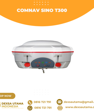
GPS Geodetik RTK Comnav Sino T300
Baca selengkapnyaSince its debut in 2013, the T300 has not only maintained its iconic design, but has also consistently evolved to stay at the forefront of GNSS technology.- GPS L1/L2/L5, BeiDou B1/B2/B3/B1C/B2a/B2b, GLONASS L1/L2/L3, Galileo E1/E5a/E5b/E6/AltBOC, QZSS L1/L2/L5, Navic L5, SBAS
- Compact Design
- Hot Swap Battery
- User-friendly Interface
- Support WIFI/UHF/4G
- Web server for easy configuration

Kcosit Windows 10 With Magnet Field Sokkia
Rp0 + PPN 11%Tambah ke keranjangIP67 Waterproof Shockproof Dustproof Windows 10 IOT Enterprise Intel CPU Quad-Core Cherry Trail Z8350 6″ 1280X720 Pixel IPS 4GB RAM+64GB ROM Dual Camera 5.0MP Back+ 2.0MP Front Battery Capacity: 5000mAH Built-in 3G, Wifi ,GPS, Bluetooth Sim Card Quantity: Single SIM

GPS Hitarget V30 Plus Rover
Baca selengkapnyaHi-Target V30 Plus adalah
sistem Global Navigation Satellite System (GNSS) RTK (Real-Time Kinematic) geodetik, yang dirancang untuk survei dan pemetaan dengan presisi tinggi. Perangkat ini memiliki desain kokoh berkelas industri yang ringkas, dengan mesin GNSS multi-konstelasi untuk pemosisian yang stabil dan akurat bahkan di lingkungan yang sulit.
GPS EFIX C8
Baca selengkapnyaThe EFIX C8 is a groundbreaking surveying RTK that seamlessly combines state-of-the-art vision, GNSS and IMU technologies. By integrating a powerful vision system, the C8 revolutionizes surveying workflows, streamlining operations, and delivering superior results in every surveying project. This integration empowers surveyors to tackle complex surveying tasks with unprecedented accuracy and ease. The real-time visual feedback provided by the vision system enables accurate stakeout, eliminating the need for complicated offset methods. Surveyors can efficiently measure previously inaccessible points and streamline their surveying workflow, increasing overall productivity. With the EFIX C8, surveyors can enhance their surveying capabilities and achieve superior results on every project they undertake.

GPS GNSS Alpha GEO NETBOX2
Baca selengkapnyaNetBOX2: GNSS Receiver Canggih untuk Surveyor Profesional GNSS Alpha GEO NETBOX2 – Buat rekan-rekan surveyor yang mencari GNSS receiver tangguh dengan teknologi terbaru, NetBOX2 dari α-GEO bisa jadi pilihan terbaik. Perangkat ini hadir dengan berbagai fitur canggih yang mendukung pekerjaan pengukuran lahan dengan lebih efisien dan akurat. Yuk, kita bahas fitur-fitur unggulannya! 1. Chipset GNSS …

GPS Sanding T9
Baca selengkapnyaMore information Distinguishable features MDS Internal radio adopts TRIMTALK protocol which enables T9 to work with other receives with same protocol. Power Operating power: min. [V] 7.4 Operating power: max. [V] 7.4 Typical consumption [W] 2 Internal power supply Removable 7.4V, 2500mAh Li-on battery External power supply 12-15V DC Operating time with internal power supply …


Invoice & Faktur Pajak

Dexsa Utama akan menerbitkan Kwitansi, Invoice, Faktur Pajak , Surat Jalan dan dikirimkan bersama Barang Pesanan.
Transaksi 100% Aman
Dexsa Utama menghadirkan pilihan metode pembayaran yang aman dan nyaman Melalui Rekening Perusahaan
Garansi & Jaminan Keaslian
Dexsa Utama menjamin produk yang kami jual 100% original berkualitas & Bergaransi


Ulasan
Belum ada ulasan.